Area Overview for B24 8TA
Photos of B24 8TA


Area Information
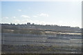
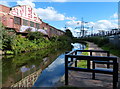
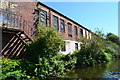
B24 8TA is a small, densely populated postcode area in Birmingham’s Gravelly Hill ward, covering 7,260 m² and home to 1,687 residents. Its high population density of 232,363 people per km² reflects a compact, urban setting typical of inner-city Birmingham. The area sits within a historically developed neighbourhood, once part of the Erdington constituency before administrative changes in 2018. Gravelly Hill itself is an inner-city ward with a mix of Victorian and pre-war housing, alongside newer developments. Proximity to Aston University and good transport links make it appealing to students and commuters. Daily life here is shaped by its proximity to retail hubs, rail networks, and educational institutions, though the area’s small size means amenities are tightly clustered. The community is largely composed of adults aged 30–64, with a median age of 47, suggesting a mature, stable population. While the area lacks natural reserves or protected landscapes, its urban density offers convenience over open space.
- Area Type
- Postcode
- Area Size
- 7260 m²
- Population
- 1687
- Population Density
- 2461 people/km²
B24 8TA is a small area with a housing stock dominated by houses, reflecting a predominantly owner-occupied community where 51% of residents own their homes. This contrasts with areas where rental properties dominate, suggesting a mix of long-term residents and occasional buyers. The limited size of the postcode means the housing market is tightly focused, with properties likely to be in close proximity to local amenities and transport links. Given the area’s history of Victorian and pre-war housing, older properties may be prevalent, though no data on modern developments is available. For buyers, this small area’s proximity to Aston University and rail stations could be a draw, but the lack of detailed property listings or price ranges means potential buyers must consider nearby postcode areas for broader options. The market’s character is shaped by its urban setting, balancing affordability with the challenges of high population density.
House Prices in B24 8TA
No properties found in this postcode.
Energy Efficiency in B24 8TA
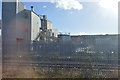
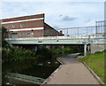
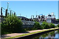
Residents of B24 8TA have access to a range of nearby amenities within practical reach. Retail options include Costco Birmingham, Asda Armada, and Tesco Erdington, offering everyday shopping and dining choices. The area’s rail network—Gravelly Hill, Aston, and Erdington stations—provides swift access to Birmingham’s central business districts and beyond. Metro stops at Bull Street, St Chads, and St Paul’s further enhance local mobility, linking to the city’s wider transport system. While the area lacks detailed information on parks or leisure facilities, its proximity to Aston University suggests a vibrant student presence, potentially contributing to a dynamic local culture. The combination of retail, transport, and educational hubs creates a convenient urban lifestyle, though the small postcode size means amenities are tightly clustered, requiring efficient use of space.
Amenities
Schools
| Rank | School | Type | Entry gender | Ages |
|---|
Explore more schools in this area
Go to Schools tabDemographics
The population of B24 8TA is 1,687, with a median age of 47 and the majority of residents aged 30–64. This suggests a community of established professionals and families, rather than students or retirees. Home ownership is at 51%, slightly below the national average, indicating a mix of owner-occupied and rental properties. The area is predominantly composed of houses, with no data on flats or apartments. The predominant ethnic group is White, though specific diversity metrics are not provided. The high population density—232,363 people per km²—implies a compact, possibly overcrowded living environment. While this density supports local amenities and transport links, it may also contribute to pressure on public services. The absence of detailed deprivation data means it is unclear how this density affects access to healthcare, education, or leisure facilities.
Household Size
Accommodation Type
Tenure
Ethnic Group
Religion
Household Composition
Age
Household Deprivation
NS-SEC
Explore more demographic insights in this area
Go to Demographics tabPlanning
Planning Constraints
- Flood RiskPremium
- Ramsar Wetland SitesPremium
- Area of Outstanding Natural BeautyPremium
- Protected Nature ReservePremium
- Protected WoodlandPremium