Area Overview for B24 8PU
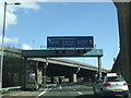
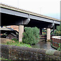
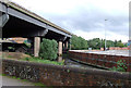
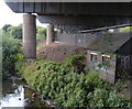
Photos of B24 8PU


Area Information
Living in B24 8PU means being part of a small, tightly knit residential cluster in the heart of Birmingham. The postcode area, which sits within the broader Gravelly Hill ward, has a population of 1,854, reflecting its compact size. Historically, this area has been shaped by Victorian and pre-war housing, with newer developments adding modern apartments. Its proximity to Aston University makes it a draw for students, though the community is predominantly composed of adults aged 30–64, with a median age of 47. The area’s character blends traditional urban living with accessible transport links. Residents benefit from nearby rail and metro stations, including Gravelly Hill and Aston, which connect to Birmingham city centre and beyond. While the ward itself is part of a larger urban fabric, B24 8PU’s distinctiveness lies in its balance of established housing stock and practical amenities, making it a viable option for those seeking a mix of convenience and stability.
- Area Type
- Postcode
- Area Size
- Not available
- Population
- 1854
- Population Density
- 4135 people/km²
The property market in B24 8PU is characterised by a 39% home ownership rate, indicating that more than half of residents rent their homes. This suggests a rental-dominated market, which may reflect the area’s appeal to students and transient populations, particularly given its proximity to Aston University. The accommodation type is predominantly houses, rather than flats or apartments, which is typical of older urban areas with Victorian and pre-war housing stock. This mix of housing types means buyers should expect a limited range of properties, with fewer modern developments compared to newer suburbs. The small size of the postcode area also means that the immediate surroundings, such as nearby wards like Stockland Green or Erdington, may offer more variety. For buyers, the focus on houses rather than apartments could appeal to those seeking traditional homes, though the rental market’s dominance may affect property value trends and availability.
House Prices in B24 8PU
No properties found in this postcode.
Energy Efficiency in B24 8PU
Residents of B24 8PU have access to a range of amenities within practical reach. The area is served by five retail outlets, including major stores like Asda Armada, Costco Birmingham, and Tesco Erdington, ensuring convenience for shopping and daily needs. Transport links are extensive, with five rail stations and five metro stops providing easy access to Birmingham’s broader network. The presence of stations such as Gravelly Hill and Aston, along with metro stops like St Chads, enhances connectivity to the city centre and beyond. While specific parks or leisure facilities are not detailed, the proximity to transport hubs and retail options suggests a lifestyle focused on urban accessibility. The mix of shops, transport, and educational institutions—particularly Aston University—creates a dynamic environment, blending practicality with opportunities for study and work. This makes the area appealing to those prioritising convenience and connectivity.
Amenities
Schools
| Rank | School | Type | Entry gender | Ages |
|---|
Explore more schools in this area
Go to Schools tabDemographics
The community in B24 8PU is predominantly composed of adults aged 30–64, with a median age of 47. This suggests a mature, settled population, likely with established careers and families. Home ownership rates stand at 39%, indicating a mix of owner-occupied properties and rental units. The area’s accommodation is primarily houses, reflecting a traditional housing stock rather than flats or apartments. The predominant ethnic group is White, though no specific diversity metrics are provided. The age profile and ownership figures suggest a community that values stability, with a focus on long-term residency. However, the relatively low home ownership rate implies a significant portion of residents may be renters, which could influence local dynamics and housing market pressures. The absence of detailed deprivation data means broader socioeconomic context remains unexplored, but the demographic profile points to a balanced, middle-aged population with access to urban amenities.
Household Size
Accommodation Type
Tenure
Ethnic Group
Religion
Household Composition
Age
Household Deprivation
NS-SEC
Explore more demographic insights in this area
Go to Demographics tabPlanning
Planning Constraints
- Flood RiskPremium
- Ramsar Wetland SitesPremium
- Area of Outstanding Natural BeautyPremium
- Protected Nature ReservePremium
- Protected WoodlandPremium