Area Overview for B24 8NT
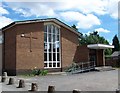
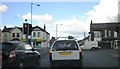
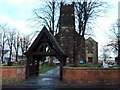
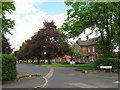
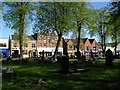
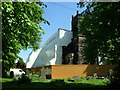
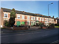
Photos of B24 8NT


Area Information
Living in B24 8NT means inhabiting a compact, densely populated postcode within Gravelly Hill, an inner-city ward of Birmingham. This area, covering just 1,130 m², is home to 1,738 residents, creating a high population density of 1.5 million people per km². Situated 4 miles north-east of Birmingham city centre, it borders Stockland Green, Erdington, and Aston, blending historic urban fabric with modern developments. The area’s character is defined by its proximity to Aston University, attracting students and professionals seeking accessible transport links. Daily life here is shaped by its compact size, with residents relying on nearby amenities and public transport. While the high density fosters a close-knit community, the area’s small footprint means its identity is tightly woven with surrounding neighbourhoods, offering a mix of Victorian housing and newer apartment blocks. B24 8NT is a microcosm of Birmingham’s inner-city dynamics, where urban convenience meets the challenges of limited space.
- Area Type
- Postcode
- Area Size
- 1130 m²
- Population
- 1738
- Population Density
- 6611 people/km²
The property market in B24 8NT is characterised by a low home ownership rate of 35%, suggesting a rental market dominates. Flats are the primary accommodation type, aligning with the area’s small size and historical development as a residential cluster. This reflects a mix of older Victorian housing and more recent apartment blocks, typical of inner-city Birmingham. The limited space within the postcode means the housing stock is concentrated, with little scope for expansion. For buyers, this suggests competition for available properties, particularly flats, and a need to consider proximity to nearby areas for additional options. The area’s compact nature also means that property values may be influenced by transport links and access to amenities, such as the nearby rail stations and Aston University. Given the rental focus, buyers should evaluate long-term stability and whether the area’s characteristics align with their lifestyle needs.
House Prices in B24 8NT
No properties found in this postcode.
Energy Efficiency in B24 8NT
Residents of B24 8NT have access to a range of nearby amenities that cater to daily needs and leisure. Retail options include major stores such as Tesco Erdington, Farmfoods Erdington, and Iceland Erdington, providing convenience for grocery shopping. The area’s rail and metro stations—Gravelly Hill, Erdington, Chester Road, St Chads, Bull Street, and St Paul’s—offer easy access to Birmingham’s broader transport network, facilitating travel to work, education, or social events. While parks and green spaces are not explicitly listed in the data, the area’s proximity to historical and modern Birmingham suggests opportunities for outdoor activities nearby. The compact nature of the postcode means amenities are closely clustered, enhancing walkability and reducing reliance on cars. This density supports a vibrant, service-rich environment, though the lack of specific details on leisure facilities means further local exploration is advised to fully understand the area’s offerings.
Amenities
Schools
Residents of B24 8NT have access to three notable educational institutions within practical reach. St Mary and St John Junior and Infant School is a primary school, offering early education for younger children. St John Earlswood and St John’s Children’s Resource Centre are listed as other types of educational or community facilities, though specific details on their roles are not provided. The presence of a primary school suggests families with young children can find immediate access to schooling, while the additional centres may provide support services or alternative educational pathways. However, without Ofsted ratings or further information on their curricula, prospective residents should conduct further research to assess the quality and suitability of these institutions for their needs. The mix of school types indicates a range of options, but clarity on their specific functions would be necessary for families prioritising educational standards.
| Rank | School | Type | Entry gender | Ages |
|---|
Explore more schools in this area
Go to Schools tabDemographics
The population of B24 8NT has a median age of 47, with the majority of residents falling in the 30-64 age range. Home ownership is relatively low at 35%, indicating a rental-dominated market. The predominant accommodation type is flats, reflecting the area’s compact nature and historical housing stock. The predominant ethnic group is White, though specific diversity metrics are not provided. The high population density—1.5 million people per km²—suggests a tightly packed community, which can influence local services and social interactions. With 35% of households owning their homes, renters may find the area more transient, while the age profile suggests a stable core of middle-aged residents. The lack of detailed deprivation data means quality of life factors like access to services or employment opportunities are not quantified here, but the area’s proximity to Birmingham’s transport networks and amenities likely supports a functional daily life.
Household Size
Accommodation Type
Tenure
Ethnic Group
Religion
Household Composition
Age
Household Deprivation
NS-SEC
Explore more demographic insights in this area
Go to Demographics tabPlanning
Planning Constraints
- Flood RiskPremium
- Ramsar Wetland SitesPremium
- Area of Outstanding Natural BeautyPremium
- Protected Nature ReservePremium
- Protected WoodlandPremium