Area Overview for B24 8NG
Photos of B24 8NG


Area Information
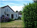
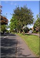
Living in B24 8NG means being part of a small, tightly knit residential cluster within Gravelly Hill, an inner-city ward of Birmingham. The postcode area has a population of 1,854, reflecting its compact nature. Historically, Gravelly Hill was a distinct ward before administrative changes in 2018, and it remains a mix of Victorian and pre-war housing, with newer developments adding diversity. The area’s proximity to Aston University makes it popular with students, though its character is defined by mature, established homes. Daily life here balances urban convenience with a quieter, more residential feel. With no major natural or protected sites nearby, the focus is on local amenities and transport links. The ward’s boundaries include areas like Erdington and Stockland Green, but B24 8NG itself is a self-contained microcosm of Birmingham’s evolving urban fabric. Its small size means residents often know their neighbours, and the community reflects the broader demographic of Birmingham’s inner suburbs.
- Area Type
- Postcode
- Area Size
- Not available
- Population
- 1854
- Population Density
- 4135 people/km²
The property market in B24 8NG is characterised by a 39% home ownership rate, which is lower than the national average, indicating a rental-dominated market. The area’s accommodation type is primarily houses, which are less common in inner-city zones and may appeal to buyers seeking larger, more traditional properties. Given the small size of the postcode area, the housing stock is limited, and buyers may need to consider nearby areas for more options. The presence of houses rather than apartments suggests a focus on family homes or long-term residents. However, the low home ownership rate means competition for available properties, particularly for those seeking owner-occupied homes. The mix of older and newer housing stock offers variety but may require buyers to assess the condition and potential for renovation.
House Prices in B24 8NG
No properties found in this postcode.
Energy Efficiency in B24 8NG
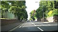
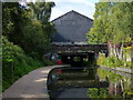
Residents of B24 8NG have access to a range of local amenities within practical reach. Retail options include Asda Armada, Costco Birmingham, and Tesco Erdington, offering shopping convenience for everyday needs. The area’s rail network connects to Gravelly Hill, Aston, and Witton stations, providing easy access to Birmingham’s broader transport system. Metro stops like Bull Street and St Chads further enhance connectivity. While the area lacks large parks or leisure facilities, its proximity to Aston University means students and staff have access to campus amenities. The mix of retail, transport, and educational hubs creates a functional lifestyle, balancing urban convenience with a residential atmosphere. The presence of multiple retail and transport options ensures that daily errands and commuting are efficient, though the area’s small size means residents may need to travel slightly further for specialist services.
Amenities
Schools
| Rank | School | Type | Entry gender | Ages |
|---|
Explore more schools in this area
Go to Schools tabDemographics
The population of B24 8NG has a median age of 47, with the majority of residents aged 30–64. This suggests a community of working-age adults, many of whom may be homeowners or long-term renters. Home ownership here is relatively low at 39%, indicating that a significant portion of the population rents their homes. The predominant accommodation type is houses, which contrasts with the higher proportion of flats in other parts of Birmingham. The predominant ethnic group is White, reflecting broader trends in the area. With no specific data on deprivation, the 39% home ownership rate implies a rental market that may influence housing affordability. The age profile suggests a stable, mature community, though the lack of younger residents could affect local schools and amenities.
Household Size
Accommodation Type
Tenure
Ethnic Group
Religion
Household Composition
Age
Household Deprivation
NS-SEC
Explore more demographic insights in this area
Go to Demographics tabPlanning
Planning Constraints
- Flood RiskPremium
- Ramsar Wetland SitesPremium
- Area of Outstanding Natural BeautyPremium
- Protected Nature ReservePremium
- Protected WoodlandPremium