Area Overview for B24 8ER
Photos of B24 8ER
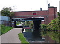
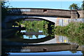
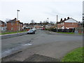
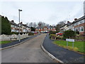
47 photos from this area
Area Information
Key information about the B24 8ER including its size, population, and administrative classification.
- Area Type
- Postcode
- Area Size
- 5284 m²
- Population
- 1914
- Population Density
- 7681 people/km²
House Prices in B24 8ER
8
Properties
£172,728
Average Sold Price
£146,821
Lowest Price
£235,000
Highest Price
Showing 8 properties
| Address | Type | Beds | Baths | Last Sale Price | Last Sale Date | |
|---|---|---|---|---|---|---|
| 25 The Laurels, Birmingham, B24 8ER | Semi-detached | 3 | 2 | £235,000 | Jun 2025 | |
| 33 The Laurels, Birmingham, B24 8ER | Semi-detached | 3 | - | £200,000 | Oct 2020 | |
| 23 The Laurels, Birmingham, B24 8ER | Semi-detached | 3 | - | £155,000 | Aug 2017 | |
| 21 The Laurels, Birmingham, B24 8ER | Terraced | 3 | 1 | £165,000 | Jan 2017 | |
| 27 The Laurels, Birmingham, B24 8ER | Semi-detached | 3 | - | £165,000 | Oct 2016 | |
| 29 The Laurels, Birmingham, B24 8ER | house | 3 | - | £160,000 | Sep 2014 | |
| 19 The Laurels, Birmingham, B24 8ER | Semi-detached | 3 | 2 | £155,000 | May 2013 | |
| 31 The Laurels, Birmingham, B24 8ER | Semi-detached | 3 | 2 | £146,821 | Feb 2012 |
Energy Efficiency in B24 8ER
Amenities
Schools
| Rank | School | Type | Entry gender | Ages |
|---|
Explore more schools in this area
Go to Schools tabDemographics
Household Size
Family (3-5 people)
most common
Accommodation Type
Houses
most common
Tenure
48
majority
Ethnic Group
White
most common
Religion
N/A
most common
Household Composition
N/A
most common
Age
47
median
Adults (30-64 years)
most common
Household Deprivation
N/A
with no deprivation
NS-SEC
14
in Lower managerial occupations
Explore more demographic insights in this area
Go to Demographics tabPlanning
Planning Constraints
- Flood RiskPremium
- Ramsar Wetland SitesPremium
- Area of Outstanding Natural BeautyPremium
- Protected Nature ReservePremium
- Protected WoodlandPremium