Area Overview for B24 8DD
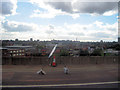
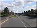
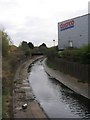
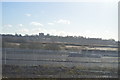
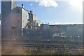
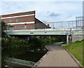
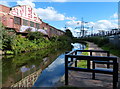
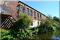
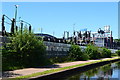
Photos of B24 8DD


Area Information
Living in B24 8DD, a small residential cluster in Birmingham’s Gravelly Hill ward, offers a blend of historical character and modern convenience. The postcode area, with a population of 1,687, sits within an inner-city ward known for its Victorian and pre-war housing stock, alongside newer developments. Its proximity to Aston University and strong transport links to nearby stations like Gravelly Hill and Erdington Railway Station make it appealing to students and commuters. Historically shaped by 19th-century canals and inter-war expansion, the area retains a distinct urban feel while benefiting from retail hubs such as Costco Birmingham and Asda Armada. Despite its compact size, B24 8DD is positioned near key Birmingham districts, offering a balance of residential tranquillity and city accessibility. The ward’s population of around 10,501 suggests a broader community, though the specific postcode area remains a tightly knit cluster. For those seeking a mix of heritage and practicality, B24 8DD provides a focused snapshot of Birmingham’s evolving urban landscape.
- Area Type
- Postcode
- Area Size
- Not available
- Population
- 1687
- Population Density
- 2461 people/km²
The property market in B24 8DD is defined by a 51% home ownership rate, indicating that nearly half of properties are owner-occupied, while the remainder are likely rentals. The accommodation type is predominantly houses, which contrasts with areas dominated by apartments or flats. This suggests a focus on family-friendly housing, with larger properties suited to established households. Given the small size of the postcode area, the housing stock is limited to a specific cluster, meaning buyers may need to consider nearby wards for broader options. The presence of both older and newer housing stock, as noted in the area’s character, hints at a mix of traditional and modern properties. For buyers, this implies a market where properties are likely to be in stable demand, particularly among those seeking a settled, residential environment with access to local amenities and transport links.
House Prices in B24 8DD
Showing 2 properties
| Address | Type | Beds | Baths | Last Sale Price | Last Sale Date | |
|---|---|---|---|---|---|---|
| Erdington Cng Station, Land At 80, Gravelly Industrial Park, Standard Way, Birmingham, B24 8DD | Industrial | - | - | - | - | |
| Cadent Gas, 80, Gravelly Industrial Park, Standard Way, Birmingham, B24 8DD | Industrial | - | - | - | - |
Energy Efficiency in B24 8DD
Residents of B24 8DD have access to a range of amenities within practical reach, including retail hubs like Costco Birmingham, Asda Armada, and Tesco Erdington, ensuring everyday shopping needs are met. The area’s transport links to Gravelly Hill, Aston, and Erdington Railway Stations, alongside metro stops such as Bull Street and St Chads, provide seamless access to Birmingham’s cultural and commercial centres. While specific parks or leisure facilities are not detailed, the area’s proximity to Aston University suggests a vibrant student presence, contributing to a dynamic local atmosphere. The mix of historic housing and modern developments, combined with retail and transport convenience, creates a lifestyle that balances tradition with accessibility. For those prioritising practicality, B24 8DD offers a compact yet well-connected environment, ideal for those seeking a blend of urban living and community-oriented amenities.
Amenities
Schools
| Rank | School | Type | Entry gender | Ages |
|---|
Explore more schools in this area
Go to Schools tabDemographics
The community in B24 8DD is predominantly composed of adults aged 30–64, with a median age of 47. This suggests a mature population, likely comprising families and professionals. Home ownership rates stand at 51%, indicating a mix of owner-occupied and rental properties. The area is characterised by houses rather than flats, reflecting a more traditional housing stock. The predominant ethnic group is White, though no further breakdown of diversity is provided. With a population of 1,687, the area is small enough to foster a close-knit environment but situated within a larger ward of 10,501 residents. The age profile and home ownership figures suggest a stable, long-term resident base rather than a transient population. This demographic profile aligns with the area’s historical development as a residential hub, offering a steady, community-oriented lifestyle.
Household Size
Accommodation Type
Tenure
Ethnic Group
Religion
Household Composition
Age
Household Deprivation
NS-SEC
Explore more demographic insights in this area
Go to Demographics tabPlanning
Planning Constraints
- Flood RiskPremium
- Ramsar Wetland SitesPremium
- Area of Outstanding Natural BeautyPremium
- Protected Nature ReservePremium
- Protected WoodlandPremium