Area Overview for B24 8BP
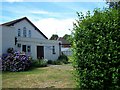
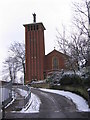
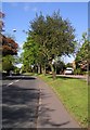
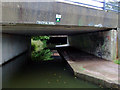
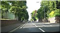
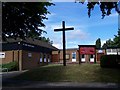
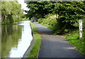
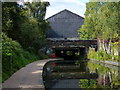
Photos of B24 8BP


Area Information
Living in B24 8BP means being part of a small, tightly knit residential cluster in the heart of Birmingham. With a population of 1,586, this postcode area is compact yet connected to the broader Gravelly Hill ward, which lies approximately 4 miles north-east of Birmingham city centre. The area blends historic Victorian and pre-war housing with newer developments, reflecting its role as a hub for both long-term residents and students. Its proximity to Aston University, coupled with reliable transport links, makes it appealing to those seeking a balance between urban convenience and quieter living. The community is defined by its mature demographic, with a median age of 47, and a strong presence of owner-occupied homes. Daily life here is shaped by local amenities, including retail outlets and public transport options, while the area’s compact size ensures a sense of familiarity and accessibility. Though small, B24 8BP sits within a broader network of nearby wards, offering residents a mix of established character and practical modernity.
- Area Type
- Postcode
- Area Size
- Not available
- Population
- 1586
- Population Density
- 5264 people/km²
The property market in B24 8BP is dominated by owner-occupied homes, with 66% of residents living in properties they own. This suggests a market where long-term investment is prioritised over short-term rental opportunities. The accommodation type is predominantly houses, which aligns with the area’s historical development and its appeal to families seeking space and stability. Given the small size of the postcode area, the housing stock is likely limited, meaning buyers may need to consider nearby wards for a broader selection. The mix of older Victorian and pre-war homes with newer developments indicates a blend of traditional character and modern convenience. For buyers, this means a focus on established properties with potential for long-term value, though the limited scale of the area may require flexibility in location. The high home ownership rate also suggests a community with a strong sense of place, where properties are likely to be well-maintained and reflect the area’s distinct identity.
House Prices in B24 8BP
No properties found in this postcode.
Energy Efficiency in B24 8BP
Residents of B24 8BP have access to a range of nearby amenities that cater to daily needs and leisure. Retail options include Asda Armada, Tesco Erdington, and Farmfoods Erdington, providing essential shopping and grocery services within easy reach. The area’s transport links extend to three metro stations—St Chads, Bull Street, and St Paul’s—offering quick access to Birmingham’s urban core and surrounding areas. While the postcode’s compact size means the immediate vicinity is limited, the broader Gravelly Hill ward offers a mix of urban and suburban character. This includes historic housing stock and newer developments, creating a blend of traditional charm and modern convenience. The presence of retail outlets and transport hubs ensures that residents can meet both practical and social needs without long commutes, contributing to a lifestyle that balances accessibility with a sense of community.
Amenities
Schools
The nearest school to B24 8BP is Erdington Hall Primary School, which serves the area with a primary education offering. The school holds a ‘good’ Ofsted rating, indicating a solid educational standard for younger students. As a primary school, it plays a key role in the local community, providing a foundation for families with young children. The absence of secondary schools in the immediate vicinity means parents may need to consider commuting to nearby wards or further afield for secondary education. However, the presence of a well-rated primary school is a significant draw for families, as it reduces the need for long-distance travel for early education. The school’s rating suggests a focus on consistent teaching quality and student outcomes, which can be a deciding factor for homebuyers prioritising educational opportunities.
| Rank | School | Type | Entry gender | Ages |
|---|
Explore more schools in this area
Go to Schools tabDemographics
The population of B24 8BP is 1,586, with a median age of 47, indicating a community skewed towards adults aged 30–64. This age range suggests a stable, mature population, likely with established careers and family structures. Home ownership rates are high at 66%, reflecting a preference for long-term residency over rental properties. The predominant accommodation type is houses, which aligns with the area’s historic housing stock and contributes to a sense of permanence. The largest ethnic group in the area is the Asian community, though specific proportions are not detailed. This demographic profile implies a community with strong roots and a focus on stability, where families may be more likely to invest in property. The absence of specific deprivation data means the area’s quality of life can be inferred from its infrastructure, such as good broadband connectivity and accessible transport, which support both daily living and economic activity.
Household Size
Accommodation Type
Tenure
Ethnic Group
Religion
Household Composition
Age
Household Deprivation
NS-SEC
Explore more demographic insights in this area
Go to Demographics tabPlanning
Planning Constraints
- Flood RiskPremium
- Ramsar Wetland SitesPremium
- Area of Outstanding Natural BeautyPremium
- Protected Nature ReservePremium
- Protected WoodlandPremium