Area Overview for B24 8AW
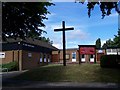
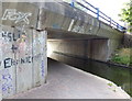
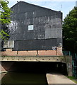
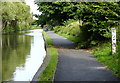
Photos of B24 8AW


Area Information
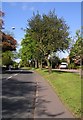
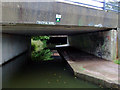
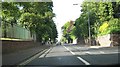
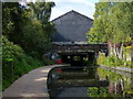
B24 8AW represents a specific postcode area covering a small residential cluster within the larger Gravelly Hill ward of Birmingham City Council. This location sits approximately four miles north-east of Birmingham city centre, positioned between Erdington, Stockland Green, and Aston. While the specific postcode serves around 1,586 people, the surrounding Gravelly Hill ward holds a substantial population of roughly 10,501. The area historically benefited from early industrial expansion when the Birmingham and Warwick Junction Canal opened in the 19th century, shaping the local infrastructure. Although administrative changes in 2018 merged the ward with Stockland Green, it retains its identity as a distinct inner-city neighbourhood. Residents here navigate a landscape defined by Victorian and pre-war housing stock, supplemented by newer apartment developments. The ward previously formed part of the Erdington Constituency before becoming part of a consolidated ward structure. Life in this area blends historic urban character with modern residential diversity, making it a practical choice for those seeking proximity to city amenities while living outside the immediate central sprawl.
- Area Type
- Postcode
- Area Size
- Not available
- Population
- 1586
- Population Density
- 5264 people/km²
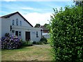
Homes in B24 8AW are predominantly houses, reflecting the historical growth of this inner-city ward during the industrial era. This housing stock consists mainly of Victorian and pre-war properties, creating a uniform architectural heritage across the small cluster. Recent developments have introduced modern apartments, adding diversity to the traditional suburban feel. With 66% of residents owning their homes, this postcode area functions as a primarily owner-occupied community rather than a rental haven. This high ownership rate typically correlates with lower transient turnover and a community focused on long-term settlement. Buyers considering this location should expect a market characterised by established family or professional households seeking permanence. The scarcity of data on rental yields or specific transaction volumes means the narrative remains focused on the physical stock and ownership demographics. Houses dominate the landscape, offering established gardens and mature plots where many owners have invested over generations. This structure supports a stable neighbourhood where the property market moves at a measured pace compared to high-density rental hubs.
House Prices in B24 8AW
No properties found in this postcode.
Energy Efficiency in B24 8AW
Residents of B24 8AW have access to a practical range of amenities within immediate reach, catering to daily household needs. For shopping, you can visit Asda Armada, Tesco Erdington, or Farmfoods Erdington, which cover a variety of grocery requirements from supermarkets to bargain buys. Getting around the wider city is straightforward via three major railway stations nearby: Gravelly Hill Railway Station, Erdington Railway Station, and Aston Railway Station. These rail links provide rapid access to the city centre and surrounding suburbs. For those preferring bus travel, services operating at St Chads, Bull Street, and St Paul's offer flexible public transport options connecting the neighbourhood to other key parts of Birmingham. This mix of retail giants and strategic transport hubs ensures that life in B24 8AW remains convenient without needing extensive commuter journeys for essential errands. The locality balances quiet residential zones with the necessary commercial infrastructure to support a self-sufficient lifestyle.
Amenities
Schools
Erdington Hall Primary School stands as the nearest educational facility for residents of B24 8AW. This primary institution holds a Good rating, confirmed by Ofsted, providing assurance of quality education for local children. The school serves as the sole academic option explicitly listed for this immediate postcode cluster, suggesting a reliance on this specific provision for early years education. Families within B24 8AW likely rely on this single primary option alongside secondary choices further afield not detailed in the current data. The presence of a Good-rated primary school indicates that the local authority has delivered a standard of education meeting national expectations. You will not find comprehensive secondary education datasets for this specific small cluster, focusing the narrative on the certainty provided by Erdington Hall. This specific rating allows parents to evaluate the immediate educational environment with confidence, despite the limited scope of primary versus secondary data available for this micro-region.
| Rank | School | Type | Entry gender | Ages |
|---|
Explore more schools in this area
Go to Schools tabDemographics
The community within B24 8AW skews towards middle-aged adults, with a median age of 47 years. The most common age range comprises adults between 30 and 64 years old, indicating a neighbourhood populated by established residents rather than young families or students. Considerable proportion of households have settled down, evidenced by a 66% home ownership rate. This figure places the area firmly within the owner-occupier sector, contrasting sharply with high-street rental markets. The predominant ethnic group within the postcode is those identifying as Asian, reflecting the diverse cultural composition common to inner-city Birmingham wards. Accommodation types are primarily houses, aligning with the historical suburban development patterns of the region. The population profile suggests stability, with long-term residents likely influencing the pace and character of the local environment. You will find a community defined by this demographic maturity, where many residents have likely lived in their properties for decades. The low presence of children in the general population data further points towards an area where working professionals and retired individuals coexist.
Household Size
Accommodation Type
Tenure
Ethnic Group
Religion
Household Composition
Age
Household Deprivation
NS-SEC
Explore more demographic insights in this area
Go to Demographics tabPlanning
Planning Constraints
- Flood RiskPremium
- Ramsar Wetland SitesPremium
- Area of Outstanding Natural BeautyPremium
- Protected Nature ReservePremium
- Protected WoodlandPremium