Area Overview for B24 0WD
Photos of B24 0WD
Area Information
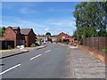
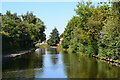
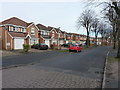
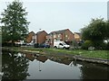
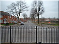
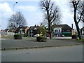
Living in B24 0WD means residing in a small, tightly knit residential cluster within the Pype Hayes area of Erdington, Birmingham. With a population of 1,490, this postcode is part of a historically significant district shaped by 19th-century sewage works and 20th-century housing developments. The area’s character is defined by its mix of semi-detached inter-war homes and later housing stock, including council properties and private residences. Pype Hayes Hall, a Grade II listed Jacobean mansion, anchors the area, with its grounds forming Pype Hayes Park—a public space for recreation. The postcode lies along the ancient Welsh Road, now Chester Road, linking it to nearby districts. Daily life here balances suburban tranquillity with proximity to transport networks and retail amenities, making it a practical choice for families and commuters. Its compact size means residents are close to schools, rail stations, and local shops, though the area’s identity remains rooted in its historical legacy and post-war regeneration.
- Area Type
- Postcode
- Area Size
- Not available
- Population
- 1490
- Population Density
- 5999 people/km²
The property market in B24 0WD is dominated by houses, with 67% of homes owner-occupied. This reflects a mix of private residences, council properties, and housing association units, creating a diverse but stable housing stock. The area’s semi-detached inter-war homes and later developments cater to a range of buyers, from first-time purchasers to those seeking established properties. The presence of both older and newer housing stock means there are options for different budgets and preferences. However, the small size of the postcode means the immediate surroundings are critical for buyers seeking additional properties. The market is likely influenced by the area’s proximity to transport links and amenities, though the lack of high-rise or high-density housing suggests a focus on suburban living rather than urban investment.
House Prices in B24 0WD
No properties found in this postcode.
Energy Efficiency in B24 0WD
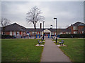
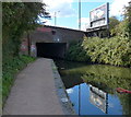
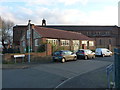
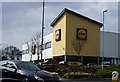
Life in B24 0WD offers a blend of convenience and suburban comfort. Within practical reach are five retail outlets, including Lidl Tyburn, Aldi Chester, and Farmfoods Erdington, ensuring everyday shopping needs are met. The area’s rail network includes Erdington Railway Station and Chester Road Railway Station, while three metro stops—Bull Street, St Chads, and St Paul’s—provide links to Birmingham’s urban core. Pype Hayes Park, adjacent to the historic Pype Hayes Hall, offers green space for recreation. The presence of schools in the area, though not named, suggests family-friendly infrastructure. The mix of retail, transport, and public open space creates a practical, accessible lifestyle, balancing local amenities with the ease of commuting to larger urban hubs.
Amenities
Schools
| Rank | School | Type | Entry gender | Ages |
|---|
Explore more schools in this area
Go to Schools tabDemographics
The population of B24 0WD has a median age of 47, with the majority of residents aged 30–64. This suggests a mature, stable community with a strong presence of working-age adults. Home ownership is high at 67%, reflecting a predominantly owner-occupied area with a mix of private, council, and housing association properties. The accommodation type is primarily houses, indicating a low-density, suburban layout. The predominant ethnic group is White, though no specific diversity metrics are provided. The age profile and home ownership rate suggest a community focused on long-term residency, with fewer transient populations. The absence of data on deprivation means the area’s socioeconomic challenges are not explicitly detailed, but the high home ownership and stable age range imply a relatively secure quality of life for most residents.
Household Size
Accommodation Type
Tenure
Ethnic Group
Religion
Household Composition
Age
Household Deprivation
NS-SEC
Explore more demographic insights in this area
Go to Demographics tabPlanning
Planning Constraints
- Flood RiskPremium
- Ramsar Wetland SitesPremium
- Area of Outstanding Natural BeautyPremium
- Protected Nature ReservePremium
- Protected WoodlandPremium