Area Overview for B24 0SF
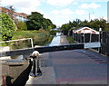
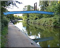
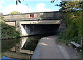
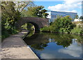
Photos of B24 0SF


Area Information
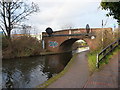
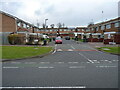
Living in B24 0SF, part of the Pype Hayes area in Erdington, Birmingham, offers a suburban lifestyle within a small residential cluster. The postcode covers around 2,112 residents, with a mix of housing styles ranging from inter-war semi-detached homes to post-1960s developments. The area’s history is rooted in its 17th-century Pype Hayes Hall, now a Grade II listed building and the focal point of Pype Hayes Park, which provides public recreational space. While the estate saw significant regeneration in the 1990s, its character remains defined by a blend of private, council, and housing association properties. Residents benefit from proximity to Chester Road, a historic route, and the surrounding infrastructure of modern Birmingham. The area’s compact size means amenities are within practical reach, though it retains a quieter, residential feel compared to the city’s central districts. For those seeking a balance between suburban tranquility and urban accessibility, B24 0SF offers a distinct footprint in Erdington’s east.
- Area Type
- Postcode
- Area Size
- Not available
- Population
- 2112
- Population Density
- 4157 people/km²
The property market in B24 0SF is characterised by a 44% home ownership rate, suggesting a balance between private ownership and rental properties. The area is predominantly composed of houses, with semi-detached homes from the inter-war period forming a significant portion of the housing stock. Later developments, including 1960s tower blocks, were partially demolished due to structural issues, leaving a mix of older and post-regeneration properties. This mix means buyers may find a range of options, from traditional homes to more modern builds. However, the small size of the postcode area limits the diversity of properties available. For those seeking a stable, owner-occupied market, B24 0SF offers a suburban alternative to Birmingham’s denser districts, though the limited scale of the area may restrict opportunities for larger or newer developments.
House Prices in B24 0SF
No properties found in this postcode.
Energy Efficiency in B24 0SF
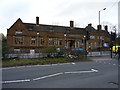
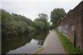
Residents of B24 0SF have access to a range of amenities within practical reach. Retail options include Aldi Chester, Farmfoods Erdington, and Sainsburys Castle, providing everyday shopping convenience. Public transport links are extensive, with five railway stations and three metro stops nearby, ensuring easy access to Birmingham’s urban core and beyond. Recreational spaces are represented by Pype Hayes Park, a public area derived from the grounds of the historic Pype Hayes Hall. This park offers green space for leisure and outdoor activities, enhancing the suburban lifestyle. The mix of retail, transport, and open space contributes to a balanced daily life, combining practicality with small-town amenities. While the area’s compact size limits the variety of venues, its proximity to Chester Road and Erdington ensures residents are never far from essential services.
Amenities
Schools
The nearest school to B24 0SF is Gunter Primary School, which provides education for younger children and holds an Ofsted rating of ‘good’. This school is a key local institution, offering a foundation for families with young children. The absence of secondary schools in the immediate vicinity means parents may need to consider nearby districts for secondary education. The presence of a primary school with a positive rating suggests a focus on early education quality, though the broader school ecosystem for older students is not detailed in the data. For families prioritising strong primary education, Gunter Primary School is a reliable option, but planning for secondary schooling would require additional research into surrounding areas.
| Rank | School | Type | Entry gender | Ages |
|---|
Explore more schools in this area
Go to Schools tabDemographics
The population of B24 0SF is 2,112, with a median age of 47 and the majority of residents aged between 30 and 64. This suggests a mature, stable community, likely with a strong presence of families and professionals. Home ownership stands at 44%, indicating a mix of owner-occupied properties and rental stock. The area is predominantly composed of houses, reflecting a suburban housing model rather than high-density flats. The predominant ethnic group is White, though specific data on diversity beyond this is not provided. The age profile implies a community with established roots, potentially influencing local services and social dynamics. With no data on deprivation levels, it is reasonable to infer that the area’s quality of life aligns with average standards for similar suburban postcode clusters in the West Midlands.
Household Size
Accommodation Type
Tenure
Ethnic Group
Religion
Household Composition
Age
Household Deprivation
NS-SEC
Explore more demographic insights in this area
Go to Demographics tabPlanning
Planning Constraints
- Flood RiskPremium
- Ramsar Wetland SitesPremium
- Area of Outstanding Natural BeautyPremium
- Protected Nature ReservePremium
- Protected WoodlandPremium