Area Overview for B24 0RE
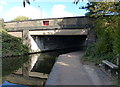
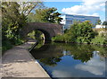
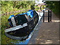
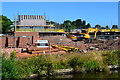
Photos of B24 0RE
Area Information
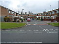
B24 0RE is a small residential cluster in England, home to 1,521 people living at a density of 1,300 per square kilometre. This area, part of Castle Vale in Birmingham, sits on land once occupied by Castle Bromwich Aerodrome, a site with a history dating back to the 17th century. The estate, built from 1964 onward, was once a symbol of postwar housing challenges but has undergone significant regeneration since the 1990s. Today, it reflects a mix of older housing stock and community-focused developments. Residents here are predominantly adults aged 30–64, with a median age of 47, suggesting a mature, settled population. Living in B24 0RE means navigating a compact, high-density environment with proximity to transport networks and retail hubs. The area’s character is shaped by its past and ongoing efforts to balance practical living with community amenities, making it a place where history and modernity intersect.
- Area Type
- Postcode
- Area Size
- Not available
- Population
- 1521
- Population Density
- 1300 people/km²
The property market in B24 0RE is shaped by its small size and the types of homes available. With 42% home ownership, the area is not dominated by owner-occupied properties, suggesting a significant rental market. The accommodation type is primarily houses, which are more common than flats or apartments. This mix of housing stock reflects the estate’s origins as a postwar development, with many homes built in the 1960s and 1970s. Buyers in B24 0RE should consider the limited number of properties, as the area’s compact footprint means fewer options compared to larger neighbourhoods. The presence of houses may appeal to those seeking more space, but the high density of the area means proximity to neighbours is inevitable. For those seeking investment, the rental market’s strength could be a factor, though property values may be influenced by the area’s historical challenges and ongoing regeneration efforts.
House Prices in B24 0RE
No properties found in this postcode.
Energy Efficiency in B24 0RE
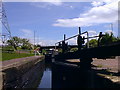
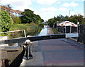
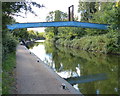
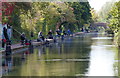
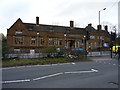
Living in B24 0RE offers access to a range of amenities within practical reach. Retail options include Sainsburys Castle, Aldi Chester, and Farmfoods Erdington, ensuring daily essentials are easily accessible. The area’s transport links are complemented by nearby rail and metro stations, such as Erdington Railway Station and Bull Street, facilitating travel to Birmingham’s business districts or cultural hubs. For leisure, the estate features a 15-kilometre network of footpaths, part of Project Wagtail, which encourages walking and outdoor activity. The health village around Tangmere Drive includes a primary care centre, underscoring the area’s focus on community well-being. The Sanctuary, a community events venue, hosts gatherings and activities, fostering local engagement. While the area’s history includes challenges, the presence of these amenities suggests a lifestyle that balances practicality with opportunities for social interaction and recreation.
Amenities
Schools
| Rank | School | Type | Entry gender | Ages |
|---|
Explore more schools in this area
Go to Schools tabDemographics
The community in B24 0RE is defined by its demographics: 42% of residents own their homes, while the majority live in rented properties. The predominant accommodation type is houses, reflecting a mix of family homes and smaller units. The median age of 47, with most residents aged 30–64, suggests a population focused on stability, with fewer young families or retirees. The predominant ethnic group is White, indicating a homogenous demographic profile. This age range and home ownership rate suggest a community with established routines and a focus on long-term residency. However, the relatively low home ownership rate may indicate a reliance on rental markets or shared housing. The area’s compact size and high density mean that amenities and services are closely packed, catering to daily needs without requiring long commutes.
Household Size
Accommodation Type
Tenure
Ethnic Group
Religion
Household Composition
Age
Household Deprivation
NS-SEC
Explore more demographic insights in this area
Go to Demographics tabPlanning
Planning Constraints
- Flood RiskPremium
- Ramsar Wetland SitesPremium
- Area of Outstanding Natural BeautyPremium
- Protected Nature ReservePremium
- Protected WoodlandPremium