Area Overview for B24 0RB
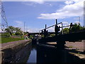
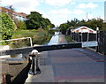
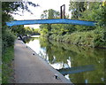
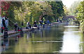
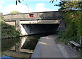
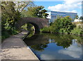
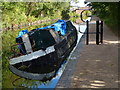
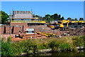
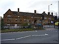
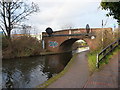
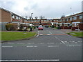
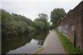
Photos of B24 0RB
Area Information
B24 0RB lies in the Pype Hayes area of Erdington, Birmingham, a small residential cluster defined by its compact size of 7,332 square metres and a dense population of 2112 people. This postcode covers a mix of housing styles, from inter-war semi-detached homes to post-1960s developments, reflecting its history as a council estate. The area’s name traces back to Henry de Pipe, a 17th-century landowner, with its layout shaped by the ancient Welsh Road (now Chester Road). Daily life here balances suburban quiet with proximity to urban amenities. The community is anchored by Pype Hayes Park, a public space derived from the grounds of the historic Pype Hayes Hall, a Grade II listed Jacobean mansion. While the area has faced regeneration challenges, including the 1992 redevelopment of defective housing, it remains a compact, walkable neighbourhood with a strong local identity. Residents benefit from nearby rail and metro links, making it accessible to Birmingham’s broader network, while the population density suggests a tightly knit, active community.
- Area Type
- Postcode
- Area Size
- 7332 m²
- Population
- 2112
- Population Density
- 4157 people/km²
The property market in B24 0RB is characterised by a 44% home ownership rate, indicating that nearly half of residents rent their homes. The accommodation type is predominantly houses, with a mix of private, council, and housing association properties. This contrasts with areas dominated by flats or apartments, offering more space and privacy per household. The housing stock includes semi-detached homes from the inter-war period and later developments, reflecting the area’s post-1920s expansion. While 85% of properties are private, the high population density suggests a balance between owner-occupied and rental units. For buyers, this means a focus on houses rather than apartments, with potential for both investment and long-term living. The compact size of the area means competition for properties is likely, particularly for homes near key amenities like schools and transport links. The regeneration efforts of the 1990s may have improved property standards, though buyers should consider the age of specific homes when assessing maintenance needs.
House Prices in B24 0RB
No properties found in this postcode.
Energy Efficiency in B24 0RB
Living in B24 0RB offers access to a range of nearby amenities, including five retail outlets such as Farmfoods Erdington, Aldi Chester, and Sainsburys Castle. These shops provide convenience for daily errands, from groceries to household essentials. The area’s transport links—five rail stations and three metro stops—enhance mobility, connecting residents to Birmingham’s broader retail, cultural, and employment hubs. Pype Hayes Park, a public space derived from the grounds of Pype Hayes Hall, offers recreational opportunities, adding green space to the urban environment. The mix of retail, transport, and open space creates a lifestyle that balances suburban tranquillity with urban accessibility. Residents can enjoy local shopping and dining while benefiting from swift travel to Birmingham’s amenities. The compact nature of the area ensures that essential services are within practical reach, supporting a self-contained yet connected community.
Amenities
Schools
The primary school nearest to B24 0RB is Gunter Primary School, which holds an Ofsted rating of ‘good’. This institution serves the local community, offering education for younger children within walking distance of many homes. While no secondary schools are listed in the data, the presence of a well-rated primary school suggests that families have a reliable foundation for early education. The school’s rating indicates that it meets or exceeds national standards in teaching quality and student outcomes. However, parents seeking secondary education may need to look beyond the immediate area, as the data does not specify nearby secondary schools. The availability of a single primary school highlights the importance of local infrastructure in supporting family life, though it also underscores the need for broader educational planning for growing households.
| Rank | School | Type | Entry gender | Ages |
|---|
Explore more schools in this area
Go to Schools tabDemographics
The population of B24 0RB is 2112, with a median age of 47 and a majority of adults aged 30–64. This suggests a mature, stable community with a focus on family living. Home ownership sits at 44%, indicating a mix of owner-occupied properties and rental stock. The area is predominantly composed of houses, reflecting a traditional suburban layout rather than high-rise or terraced housing. The predominant ethnic group is White, though specific diversity metrics are not provided. The population density of 288,063 people per square kilometre is exceptionally high for a residential area, implying compact living and shared spaces. This density may influence local services and infrastructure, with amenities designed for a close-knit community. The age profile suggests a demographic that values established housing and proximity to schools, though the lack of specific data on deprivation means quality of life factors beyond ownership and age remain unquantified.
Household Size
Accommodation Type
Tenure
Ethnic Group
Religion
Household Composition
Age
Household Deprivation
NS-SEC
Explore more demographic insights in this area
Go to Demographics tabPlanning
Planning Constraints
- Flood RiskPremium
- Ramsar Wetland SitesPremium
- Area of Outstanding Natural BeautyPremium
- Protected Nature ReservePremium
- Protected WoodlandPremium