Area Overview for B23 7YD
Photos of B23 7YD
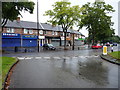
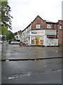
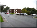
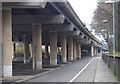
80 photos from this area
Area Information
Key information about the B23 7YD including its size, population, and administrative classification.
- Area Type
- Postcode
- Area Size
- 3790 m²
- Population
- 1899
- Population Density
- 5567 people/km²
House Prices in B23 7YD
15
Properties
£104,227
Average Sold Price
£21,000
Lowest Price
£167,000
Highest Price
Showing 15 properties
| Address | Type | Beds | Baths | Last Sale Price | Last Sale Date | |
|---|---|---|---|---|---|---|
| 34 North Park Road, Birmingham, B23 7YD | house | - | - | £155,000 | Jan 2022 | |
| 44 North Park Road, Birmingham, B23 7YD | house | - | - | £167,000 | Nov 2021 | |
| 32 North Park Road, Birmingham, B23 7YD | Semi-detached | 1 | 1 | £138,000 | Feb 2018 | |
| 24 North Park Road, Birmingham, B23 7YD | Terraced | 3 | 1 | £108,500 | Apr 2015 | |
| 38 North Park Road, Birmingham, B23 7YD | Terraced | 3 | - | £124,000 | Oct 2014 | |
| 22 North Park Road, Birmingham, B23 7YD | house | 3 | - | £125,000 | Jan 2014 | |
| 50 North Park Road, Birmingham, B23 7YD | Terraced | 3 | - | £85,000 | Dec 2012 | |
| 40 North Park Road, Birmingham, B23 7YD | Semi-detached | - | - | £126,000 | Apr 2006 | |
| 30 North Park Road, Birmingham, B23 7YD | house | - | - | £54,000 | Aug 2000 | |
| 46 North Park Road, Birmingham, B23 7YD | Terraced | - | - | £21,000 | Feb 2000 |
Page 1 of 2
Energy Efficiency in B23 7YD
Amenities
Schools
| Rank | School | Type | Entry gender | Ages |
|---|
Explore more schools in this area
Go to Schools tabDemographics
Household Size
One person
most common
Accommodation Type
Houses
most common
Tenure
59
majority
Ethnic Group
White
most common
Religion
N/A
most common
Household Composition
N/A
most common
Age
47
median
Adults (30-64 years)
most common
Household Deprivation
N/A
with no deprivation
NS-SEC
26
in Lower managerial occupations
Explore more demographic insights in this area
Go to Demographics tabPlanning
Planning Constraints
- Flood RiskPremium
- Ramsar Wetland SitesPremium
- Area of Outstanding Natural BeautyPremium
- Protected Nature ReservePremium
- Protected WoodlandPremium