Area Overview for B23 7WL
Photos of B23 7WL
Area Information
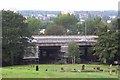
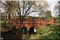
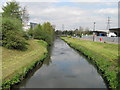
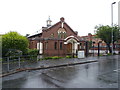
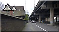
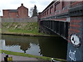
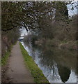
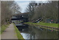
B23 7WL is a small residential postcode area in England, part of the Erdington district in Birmingham. With a population of 1,919, it reflects a compact, suburban character typical of northern Birmingham. The area is defined by its proximity to key local amenities and green spaces, including Brookvale Park and Witton Lakes, which offer recreational opportunities for residents. Daily life here is shaped by a mix of suburban tranquillity and urban connectivity, with easy access to rail and metro stations. The community is predominantly composed of adults aged 30–64, with a median age of 47, suggesting a mature, settled population. While the area’s housing stock is largely composed of owner-occupied homes, the presence of nearby retail outlets and transport links indicates a balance between residential stability and practical convenience. However, the area is not without challenges, including reports of antisocial behaviour and rising crime rates. For those seeking a suburban lifestyle with access to city infrastructure, B23 7WL offers a blend of proximity and local distinctiveness, though potential buyers should weigh its advantages against known concerns.
- Area Type
- Postcode
- Area Size
- Not available
- Population
- 1919
- Population Density
- 4522 people/km²
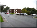
The property market in B23 7WL is characterised by a 50% home ownership rate, with houses forming the predominant accommodation type. This suggests a focus on owner-occupied properties rather than rental housing, though the exact proportion of rental units is unspecified. The presence of houses indicates a suburban or semi-detached housing stock, which may appeal to families or those seeking more space than apartments. Given the area’s small size, the housing market is likely limited in scale, with limited scope for new developments. Buyers should consider that 50% of residents own their homes, which may influence property values and availability. The area’s proximity to transport links and amenities could make it attractive to those prioritising convenience, but the lack of detailed data on property prices or trends means potential buyers must conduct further local research. The mix of houses and the moderate home ownership rate also suggest a balance between stability and flexibility for those entering or leaving the market.
House Prices in B23 7WL
No properties found in this postcode.
Energy Efficiency in B23 7WL
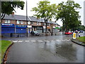
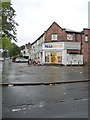
Living in B23 7WL offers access to a range of amenities within practical reach. The area is served by five retail outlets, including Spar, Co-op Marsh, and Tesco Aston, providing everyday shopping convenience. Nearby parks such as Brookvale Park and Witton Lakes offer green spaces for recreation, with active community groups enhancing their appeal. The presence of rail and metro stations ensures easy access to Birmingham’s city centre and beyond, while the digital connectivity supports modern lifestyles. However, the area’s character is shaped by its suburban setting, with a focus on local services rather than large-scale retail or leisure facilities. The mix of shops, transport, and open spaces creates a balance between convenience and a quieter, community-oriented environment. For those prioritising proximity to essential services and transport, B23 7WL provides a practical, though not extravagant, lifestyle. The absence of detailed data on dining or entertainment options means further local investigation is needed to fully assess the area’s social offerings.
Amenities
Schools
Residents of B23 7WL have access to a range of educational institutions, including Stockland Green School, which operates as both a primary school and an academy with an Ofsted rating of ‘good’. The Pines Special School caters to students with specific educational needs, while Josiah Mason College provides sixth-form education. This combination of primary, special needs, and post-16 provision ensures a comprehensive educational ecosystem for families. The presence of a school with a ‘good’ rating indicates a reliable standard of education, though the absence of data on pupil outcomes or Ofsted inspections for other schools limits deeper analysis. For parents, the diversity of school types may be a significant factor, offering options for different learning requirements. However, the lack of information on school performance metrics or catchment areas means prospective buyers should verify details independently. Overall, the area supports a range of educational needs but may require further scrutiny to assess the quality of all institutions.
| Rank | School | Type | Entry gender | Ages |
|---|---|---|---|---|
| 1 | Stockland Green School | primary | N/A | N/A |
| 2 | The Pines Special School | special | N/A | N/A |
| 3 | Josiah Mason College | sixth-form | N/A | N/A |
| 4 | Stockland Green School | academy | N/A | N/A |
Explore more schools in this area
Go to Schools tabDemographics
The population of B23 7WL is 1,919, with a median age of 47 and the majority of residents falling within the 30–64 age range. This suggests a community of established adults, likely with long-term ties to the area. Home ownership is at 50%, indicating a mix of owner-occupied properties and rental housing. The predominant accommodation type is houses, reflecting a suburban rather than high-density residential profile. The predominant ethnic group is White, though specific data on diversity is not provided. The area’s demographic profile aligns with a mature, stable population, but the absence of detailed diversity statistics means broader cultural or generational dynamics remain unexplored. The median age also implies a community with potential needs for healthcare, education, and retirement services. Given the 50% home ownership rate, the area may attract both long-term residents and those seeking a semi-rural alternative to city centres, though the lack of data on deprivation or income levels limits deeper analysis of quality of life factors.
Household Size
Accommodation Type
Tenure
Ethnic Group
Religion
Household Composition
Age
Household Deprivation
NS-SEC
Explore more demographic insights in this area
Go to Demographics tabPlanning
Planning Constraints
- Flood RiskPremium
- Ramsar Wetland SitesPremium
- Area of Outstanding Natural BeautyPremium
- Protected Nature ReservePremium
- Protected WoodlandPremium
- Crime RiskPremium