Area Overview for B23 7UZ
Photos of B23 7UZ
Area Information
Living in B23 7UZ means inhabiting a compact residential cluster in the Erdington district of Birmingham. With a population of 2,037, this area is part of the Stockland Green ward, a suburban zone characterised by a mix of established housing and proximity to the city centre. The median age of 47 suggests a community of middle-aged residents, many of whom are likely long-term locals. Daily life here balances suburban tranquillity with easy access to Birmingham’s urban amenities. The area is served by multiple rail and metro stations, including Witton and Perry Barr, which link residents to central Birmingham in under 30 minutes. Nearby open spaces like Brookvale Park and Witton Lakes offer greenery within walking distance, while local shops and supermarkets ensure convenience. Though small, B23 7UZ reflects the broader dynamics of north Birmingham, where suburban living meets the pulse of a major city.
- Area Type
- Postcode
- Area Size
- Not available
- Population
- 2037
- Population Density
- 7624 people/km²
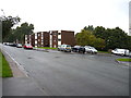
The property market in B23 7UZ is defined by a 56% home ownership rate, with houses forming the dominant accommodation type. This suggests a community where many residents own their homes, though the small population of 2,037 means the housing stock is limited in scale. The prevalence of houses, rather than flats, points to a suburban character with likely semi-detached or terraced properties. For buyers, this area’s compact size means limited immediate options, but proximity to Birmingham’s transport networks and amenities could offset this. The lack of specific data on rental demand or property values means the market remains opaque, though the low crime risk and access to schools may enhance appeal for families seeking stability in a semi-urban setting.
House Prices in B23 7UZ
No properties found in this postcode.
Energy Efficiency in B23 7UZ
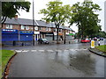
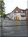
Residents of B23 7UZ enjoy a range of amenities within practical reach. Local retail options include Spar, Co-op Marsh, and Aldi Kingstanding, offering everyday shopping needs. The area’s proximity to Brookvale Park, Witton Lakes, and Bleak Hill Park—each with active community groups—provides green spaces for recreation and relaxation. Public transport links, including rail and metro stations, ensure easy access to Birmingham’s cultural and commercial hubs. The combination of local shops, open spaces, and transport infrastructure creates a lifestyle that balances convenience with suburban calm. While the area’s small size limits diversity in amenities, its strategic location and connectivity make it a practical choice for those prioritising accessibility over sprawling retail or leisure options.
Amenities
Schools
Residents of B23 7UZ have access to two local schools: Marsh Hill Nursery School, which provides early-years education, and Marsh Hill Primary School, rated ‘good’ by Ofsted. The presence of both a nursery and primary school within the area suggests a family-friendly environment where children can attend local institutions without long commutes. The primary school’s ‘good’ rating indicates a baseline standard of education, though the absence of secondary school data means families may need to look further afield for secondary education. This mix of school types supports a community where early education is prioritised, though parents should consider additional resources for older children.
| Rank | School | Type | Entry gender | Ages |
|---|
Explore more schools in this area
Go to Schools tabDemographics
The community in B23 7UZ is predominantly composed of adults aged 30–64, with a median age of 47. Home ownership stands at 56%, indicating a mix of owner-occupied properties and rentals. The accommodation type is primarily houses, reflecting a residential area with fewer flats. The predominant ethnic group is White, though specific diversity metrics are not detailed. The area’s population density—4,487 people per km²—suggests a compact, built-up environment. While the data does not quantify deprivation levels, the low crime risk score of 76 (on a 0–100 scale, where lower is better) implies a relatively stable quality of life. However, the area research notes concerns about antisocial behaviour and rising crime, which may reflect local challenges not fully captured by the provided statistics.
Household Size
Accommodation Type
Tenure
Ethnic Group
Religion
Household Composition
Age
Household Deprivation
NS-SEC
Explore more demographic insights in this area
Go to Demographics tabPlanning
Planning Constraints
- Flood RiskPremium
- Ramsar Wetland SitesPremium
- Area of Outstanding Natural BeautyPremium
- Protected Nature ReservePremium
- Protected WoodlandPremium