Area Overview for B23 7SW
Photos of B23 7SW
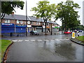
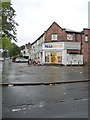
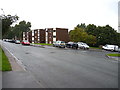
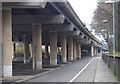
80 photos from this area
Area Information
Key information about the B23 7SW including its size, population, and administrative classification.
- Area Type
- Postcode
- Area Size
- 4681 m²
- Population
- 1899
- Population Density
- 5567 people/km²
House Prices in B23 7SW
16
Properties
£154,577
Average Sold Price
£71,500
Lowest Price
£273,000
Highest Price
Showing 16 properties
| Address | Type | Beds | Baths | Last Sale Price | Last Sale Date | |
|---|---|---|---|---|---|---|
| 14 Byron Avenue, Birmingham, B23 7SW | Detached | 3 | 1 | £273,000 | Mar 2025 | |
| 30 Byron Avenue, Birmingham, B23 7SW | Semi-detached | 2 | 1 | £205,000 | Jun 2024 | |
| 31 Byron Avenue, Birmingham, B23 7SW | Terraced | 2 | 1 | £190,000 | Jun 2023 | |
| 8 Byron Avenue, Birmingham, B23 7SW | house | 3 | 2 | £260,000 | Mar 2020 | |
| 29 Byron Avenue, Birmingham, B23 7SW | Terraced | 2 | 1 | £140,000 | Dec 2019 | |
| 35 Byron Avenue, Birmingham, B23 7SW | Terraced | 2 | 1 | £141,500 | Sep 2019 | |
| 16 Byron Avenue, Birmingham, B23 7SW | Detached | 3 | 1 | £195,000 | Jul 2018 | |
| 23 Byron Avenue, Birmingham, B23 7SW | Semi-detached | 2 | 1 | £111,000 | Dec 2014 | |
| 10 Byron Avenue, Birmingham, B23 7SW | house | 3 | - | £125,000 | Jun 2011 | |
| 33 Byron Avenue, Birmingham, B23 7SW | Terraced | - | - | £105,000 | Sep 2005 |
Page 1 of 2
Energy Efficiency in B23 7SW
Amenities
Schools
| Rank | School | Type | Entry gender | Ages |
|---|
Explore more schools in this area
Go to Schools tabDemographics
Household Size
One person
most common
Accommodation Type
Houses
most common
Tenure
59
majority
Ethnic Group
White
most common
Religion
N/A
most common
Household Composition
N/A
most common
Age
47
median
Adults (30-64 years)
most common
Household Deprivation
N/A
with no deprivation
NS-SEC
26
in Lower managerial occupations
Explore more demographic insights in this area
Go to Demographics tabPlanning
Planning Constraints
- Flood RiskPremium
- Ramsar Wetland SitesPremium
- Area of Outstanding Natural BeautyPremium
- Protected Nature ReservePremium
- Protected WoodlandPremium