Area Overview for B23 7SS
Photos of B23 7SS
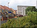
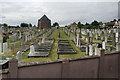
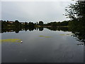
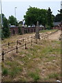
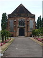
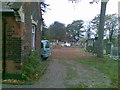
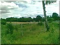
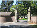
46 photos from this area
Area Information
Key information about the B23 7SS including its size, population, and administrative classification.
- Area Type
- Postcode
- Area Size
- 6439 m²
- Population
- 2037
- Population Density
- 7624 people/km²
House Prices in B23 7SS
20
Properties
£118,107
Average Sold Price
£43,000
Lowest Price
£210,000
Highest Price
Showing 20 properties
| Address | Type | Beds | Baths | Last Sale Price | Last Sale Date | |
|---|---|---|---|---|---|---|
| 5 Walmer Grove, Birmingham, B23 7SS | Terraced | 3 | 1 | £166,000 | Jun 2025 | |
| 4 Walmer Grove, Birmingham, B23 7SS | house | - | - | £149,000 | Jul 2024 | |
| 10 Walmer Grove, Birmingham, B23 7SS | house | - | - | £210,000 | Oct 2021 | |
| 17 Walmer Grove, Birmingham, B23 7SS | house | 3 | 1 | £180,000 | Aug 2021 | |
| 15 Walmer Grove, Birmingham, B23 7SS | house | - | - | £145,000 | Apr 2020 | |
| 3 Walmer Grove, Birmingham, B23 7SS | Terraced | 3 | 1 | £130,000 | Jan 2019 | |
| 11 Walmer Grove, Birmingham, B23 7SS | house | - | - | £96,500 | Jan 2013 | |
| 16 Walmer Grove, Birmingham, B23 7SS | house | 3 | 1 | £78,500 | Jun 2011 | |
| 9 Walmer Grove, Birmingham, B23 7SS | house | - | - | £87,000 | Mar 2009 | |
| 19 Walmer Grove, Birmingham, B23 7SS | house | 3 | 1 | £117,500 | Mar 2007 |
Page 1 of 2
Energy Efficiency in B23 7SS
Amenities
Schools
| Rank | School | Type | Entry gender | Ages |
|---|
Explore more schools in this area
Go to Schools tabDemographics
Household Size
Family (3-5 people)
most common
Accommodation Type
Houses
most common
Tenure
56
majority
Ethnic Group
White
most common
Religion
N/A
most common
Household Composition
N/A
most common
Age
47
median
Adults (30-64 years)
most common
Household Deprivation
N/A
with no deprivation
NS-SEC
15
in Lower managerial occupations
Explore more demographic insights in this area
Go to Demographics tabPlanning
Planning Constraints
- Flood RiskPremium
- Ramsar Wetland SitesPremium
- Area of Outstanding Natural BeautyPremium
- Protected Nature ReservePremium
- Protected WoodlandPremium