Area Overview for B23 7RT
Photos of B23 7RT
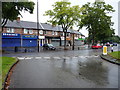
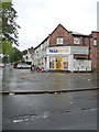
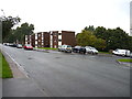
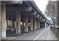
80 photos from this area
Area Information
Key information about the B23 7RT including its size, population, and administrative classification.
- Area Type
- Postcode
- Area Size
- 6399 m²
- Population
- 2037
- Population Density
- 7624 people/km²
House Prices in B23 7RT
9
Properties
£124,317
Average Sold Price
£69,950
Lowest Price
£183,000
Highest Price
Showing 9 properties
| Address | Type | Beds | Baths | Last Sale Price | Last Sale Date | |
|---|---|---|---|---|---|---|
| 276 Brookvale Road, Stockland Green, Birmingham, B23 7RT | Semi-detached | 3 | 1 | £183,000 | Mar 2019 | |
| 280 Brookvale Road, Stockland Green, Birmingham, B23 7RT | house | - | - | £120,000 | Jul 2009 | |
| 278 Brookvale Road, Stockland Green, Birmingham, B23 7RT | house | 3 | - | £69,950 | Jul 2001 | |
| 282 Brookvale Road, Stockland Green, Birmingham, B23 7RT | house | - | - | - | - | |
| 274 Brookvale Road, Stockland Green, Birmingham, B23 7RT | Terraced | - | - | - | - | |
| 296A Brookvale Road, Stockland Green, Birmingham, B23 7RT | Flat | - | - | - | - | |
| 294 Brookvale Road, Stockland Green, Birmingham, B23 7RT | house | - | - | - | - | |
| Flat Over, 270 Brookvale Road, Stockland Green, Birmingham, B23 7RT | Flat | - | - | - | - | |
| First Floor Flat, 298 Brookvale Road, Stockland Green, Birmingham, B23 7RT | Flat | 2 | 1 | - | - |
Energy Efficiency in B23 7RT
Amenities
Schools
| Rank | School | Type | Entry gender | Ages |
|---|
Explore more schools in this area
Go to Schools tabDemographics
Household Size
Family (3-5 people)
most common
Accommodation Type
Houses
most common
Tenure
56
majority
Ethnic Group
White
most common
Religion
N/A
most common
Household Composition
N/A
most common
Age
47
median
Adults (30-64 years)
most common
Household Deprivation
N/A
with no deprivation
NS-SEC
15
in Lower managerial occupations
Explore more demographic insights in this area
Go to Demographics tabPlanning
Planning Constraints
- Flood RiskPremium
- Ramsar Wetland SitesPremium
- Area of Outstanding Natural BeautyPremium
- Protected Nature ReservePremium
- Protected WoodlandPremium