Area Overview for B23 7RF
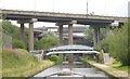
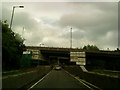
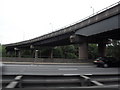
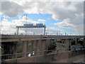
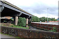
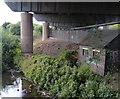
Photos of B23 7RF


Area Information
B23 7RF is a small, tightly knit residential postcode area in England, situated within the broader Erdington district of Birmingham. With a population of 1,788, it reflects a suburban character typical of north Birmingham, where housing is predominantly composed of individual homes rather than apartments. The area’s compact size means it is a self-contained community, though its proximity to Birmingham’s city centre offers easy access to urban amenities. Daily life here is shaped by a mature demographic, with residents averaging 47 years old and many in the 30–64 age bracket. This suggests a stable, family-oriented environment, though the area’s small footprint means local services and green spaces are limited to what is immediately accessible. The presence of nearby railway stations, such as Gravelly Hill and Aston, and retail outlets like Asda Armada and Co-op Marsh, indicates a practical balance between suburban tranquillity and urban connectivity. However, the area’s high crime risk score—0 out of 100—casts a shadow over its appeal, requiring residents to weigh convenience against safety concerns.
- Area Type
- Postcode
- Area Size
- Not available
- Population
- 1788
- Population Density
- 8018 people/km²
The property market in B23 7RF is characterised by a 48% home ownership rate, suggesting that less than half of the area’s housing stock is owner-occupied. This implies a significant portion of properties are rented, potentially making the area more attractive to tenants than buyers seeking long-term investment. The accommodation type is predominantly houses, which are typically family homes, though the small size of the postcode means the housing stock is limited in scale. This could mean that buyers must look beyond the immediate area for larger or more varied options. The combination of lower home ownership and a focus on single-family homes suggests a market that may appeal to those prioritising rental flexibility over property ownership, though the area’s compact nature may limit scope for expansion or development.
House Prices in B23 7RF
No properties found in this postcode.
Energy Efficiency in B23 7RF
Daily life in B23 7RF is shaped by its proximity to essential amenities, including five nearby railway stations and retail outlets such as Asda Armada, Spar, and Co-op Marsh. These provide practical access to shopping, food, and transport options. While the area itself is small, its connection to nearby open spaces like Brookvale Park and Witton Lakes—mentioned in research—offers recreational opportunities within reach. The presence of metro stations like St Paul’s and Bull Street adds to the area’s accessibility for commuting or leisure. However, the limited local amenities mean residents may need to travel further for more specialised services. The suburban character of the area, combined with its transport links, creates a balance between convenience and a quieter lifestyle, though the lack of extensive local facilities may be a consideration for those prioritising self-contained living.
Amenities
Schools
| Rank | School | Type | Entry gender | Ages |
|---|
Explore more schools in this area
Go to Schools tabDemographics
The community in B23 7RF is predominantly composed of adults aged 30–64, with a median age of 47. This suggests a population that is largely settled, with fewer young families or retirees compared to other areas. Home ownership stands at 48%, slightly below the national average, indicating a mix of owner-occupied homes and rental properties. The accommodation type is primarily houses, reflecting a suburban layout rather than high-density living. The predominant ethnic group is White, though no specific data on diversity or deprivation levels is provided. This demographic profile implies a community that is relatively stable, with a focus on long-term residency. However, the lower home ownership rate may indicate a reliance on rental housing, which could affect the area’s economic dynamics and housing market stability.
Household Size
Accommodation Type
Tenure
Ethnic Group
Religion
Household Composition
Age
Household Deprivation
NS-SEC
Explore more demographic insights in this area
Go to Demographics tabPlanning
Planning Constraints
- Flood RiskPremium
- Ramsar Wetland SitesPremium
- Area of Outstanding Natural BeautyPremium
- Protected Nature ReservePremium
- Protected WoodlandPremium