Area Overview for B23 7PL
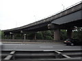
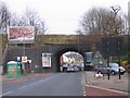
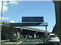
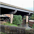
Photos of B23 7PL


Area Information
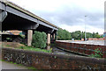
Living in B23 7PL means being part of a small, tightly knit residential cluster in Gravelly Hill, Birmingham. This postcode area, with a population of 1,812, sits within an inner-city ward known for its mix of historic and modern housing. The area’s character is shaped by its proximity to Aston University, attracting students and professionals, while its Victorian and pre-war homes offer a sense of traditional urban living. Residents benefit from nearby rail links, including Gravelly Hill and Aston stations, which connect to Birmingham city centre and beyond. The postcode’s compact size means amenities are within practical reach, from retail outlets like Asda Armada to local transport hubs. While the area is not expansive, its strategic location balances urban convenience with a quieter residential feel. The demographic profile—primarily adults aged 30–64—suggests a community focused on stability, with a median age of 47. For those seeking a blend of accessibility and character, B23 7PL offers a distinct slice of Birmingham’s evolving urban landscape.
- Area Type
- Postcode
- Area Size
- Not available
- Population
- 1812
- Population Density
- 7202 people/km²
The property market in B23 7PL is defined by a 49% home ownership rate, suggesting a balance between owner-occupied and rental properties. The area’s accommodation is predominantly houses, reflecting its historical development of Victorian and pre-war housing. This mix includes both traditional homes and newer developments, though the exact proportion of modern apartments is unclear. Given the small size of the postcode area, the housing stock is limited, making it a niche market for buyers seeking specific properties. The proximity to Aston University and transport links may attract students or professionals looking for short-term or investment properties. However, the low home ownership rate indicates a significant portion of the housing is rented, potentially offering opportunities for landlords. Buyers should consider the area’s compact nature and the need to evaluate properties in context of nearby amenities and transport connectivity.
House Prices in B23 7PL
No properties found in this postcode.
Energy Efficiency in B23 7PL
Residents of B23 7PL have access to a range of nearby amenities, including retail outlets like Asda Armada, Costco Birmingham, and Tesco Erdington, which cater to daily shopping needs. The area’s transport links—railway stations such as Gravelly Hill and Aston, and metro stops like St Chads—ensure easy movement within the city and beyond. While the data does not specify parks or leisure facilities, the proximity to Aston University suggests a vibrant academic and cultural environment. The mix of retail, transport, and educational hubs contributes to a convenient lifestyle, balancing practicality with urban connectivity. The presence of multiple railway and metro stations also supports a dynamic social scene, enabling residents to engage with Birmingham’s broader offerings. This combination of accessibility and local amenities makes B23 7PL a practical choice for those prioritising convenience and mobility.
Amenities
Schools
The nearest school to B23 7PL is Spring Hill High School, a special school with a ‘good’ Ofsted rating. This institution caters to students with specific educational needs, offering tailored support and resources. The presence of a special school in the area suggests a focus on inclusive education, though no other schools are listed in the data. Families seeking mainstream education may need to look beyond the immediate vicinity, as the area lacks primary or secondary schools with broader student populations. The quality of Spring Hill High School, however, ensures that residents with children requiring specialist provision have access to a well-regarded institution. This dynamic may appeal to those prioritising accessibility to niche educational services over a wider range of school options.
| Rank | School | Type | Entry gender | Ages |
|---|
Explore more schools in this area
Go to Schools tabDemographics
The population of B23 7PL is 1,812, with a median age of 47, reflecting a community dominated by adults aged 30–64. Home ownership here is relatively low at 49%, indicating a mix of owner-occupied and rental properties. The area’s accommodation is primarily houses, aligning with the ward’s historical development of Victorian and pre-war housing stock. The predominant ethnic group is White, though specific data on diversity beyond this is not provided. This age profile suggests a settled, mature population, likely with established careers and family ties. The lower home ownership rate may reflect a reliance on rental markets or shared living arrangements. While no deprivation data is explicitly stated, the presence of 49% homeownership and a median age above the national average could imply a community with varying economic profiles. The absence of detailed diversity metrics means the full range of social dynamics remains partially unexplored.
Household Size
Accommodation Type
Tenure
Ethnic Group
Religion
Household Composition
Age
Household Deprivation
NS-SEC
Explore more demographic insights in this area
Go to Demographics tabPlanning
Planning Constraints
- Flood RiskPremium
- Ramsar Wetland SitesPremium
- Area of Outstanding Natural BeautyPremium
- Protected Nature ReservePremium
- Protected WoodlandPremium