Area Overview for B23 7NW
Photos of B23 7NW


Area Information
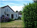
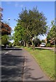
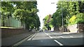
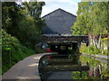
Living in B23 7NW, a small residential cluster within Gravelly Hill, Birmingham, offers a blend of urban convenience and historical character. The area is part of an inner-city ward with a population of 1,829, reflecting a compact, tightly-knit community. Gravelly Hill itself is bounded by surrounding districts like Erdington and Aston, and its proximity to Birmingham city centre—approximately 4 miles away—makes it accessible for commuters. The area’s history is rooted in 19th-century industrial expansion, with Victorian and pre-war housing stock still present alongside modern developments. This mix appeals to a range of residents, particularly students from Aston University, who benefit from strong transport links to the campus. Daily life here is shaped by proximity to retail hubs, educational institutions, and public transport, though the small postcode area means the community is both intimate and limited in scale. The character of B23 7NW is defined by its mix of older homes and newer apartments, creating a diverse yet cohesive urban environment.
- Area Type
- Postcode
- Area Size
- Not available
- Population
- 1829
- Population Density
- 6301 people/km²
The property market in B23 7NW is characterised by a low home ownership rate of 22%, suggesting that the area functions more as a rental market than an owner-occupied one. The predominant accommodation type is flats, a reflection of the area’s urban density and limited space for larger homes. This housing stock is likely a mix of older Victorian and pre-war properties, alongside newer developments, given the ward’s history of both historical and modern construction. For buyers, this small postcode area presents challenges: the limited number of homes and high rental demand may make property acquisition difficult. However, the proximity to Aston University and good transport links could attract investors targeting students or young professionals. The area’s compact size means that properties are often part of larger residential clusters, offering potential for community interaction but limited individual privacy. Buyers should consider the area’s suitability for those prioritising location over long-term ownership.
House Prices in B23 7NW
No properties found in this postcode.
Energy Efficiency in B23 7NW
The lifestyle in B23 7NW is shaped by its proximity to practical amenities, including five retail venues such as Asda Armada, Tesco Erdington, and Farmfoods Erdington. These stores provide everyday essentials, making the area convenient for residents who prefer to shop locally. The presence of five rail and metro stations, including Gravelly Hill and St Chads, ensures easy access to public transport, supporting both daily commutes and weekend excursions. While the data does not mention parks or leisure facilities explicitly, the area’s historical and urban character suggests a balance between residential and commercial spaces. The mix of retail, transport, and educational institutions creates a functional environment, ideal for those prioritising accessibility over expansive green spaces. Residents benefit from a compact, service-rich environment, though the limited size of the postcode area means larger recreational options may require travel to nearby districts.
Amenities
Schools
Residents of B23 7NW have access to a range of educational institutions, including state and independent schools. Jaffray School and Ss Mary & John Catholic Primary School are both primary schools, with the latter holding a ‘good’ Ofsted rating, indicating a reliable standard of education. Sunrise School is an independent institution, offering an alternative for families seeking private schooling. Virtual College, categorised as ‘other,’ may provide further or vocational education. This mix of school types ensures families can choose between state-funded options and independent institutions, though the absence of secondary schools in the data suggests parents may need to look beyond the immediate area for comprehensive education. The presence of a ‘good’-rated primary school is a positive indicator for families prioritising early education, though the overall school landscape remains focused on primary and specialist provision.
| Rank | School | Type | Entry gender | Ages |
|---|
Explore more schools in this area
Go to Schools tabDemographics
The community in B23 7NW is predominantly composed of adults aged 30–64, with a median age of 47. This suggests a mature population, likely with established careers and families. Home ownership is low at 22%, indicating that most residents are renters, which may reflect the area’s appeal to transient groups such as students or professionals seeking short-term housing. The accommodation type is primarily flats, a common feature in urban areas with limited space. The predominant ethnic group is White, though specific data on diversity beyond this is not provided. The relatively low population—1,829—suggests a quiet, less densely populated environment compared to larger urban centres. While no deprivation data is explicitly stated, the low home ownership and focus on rental properties could imply a reliance on local services and amenities. This demographic profile shapes a community that is stable but not highly dynamic, with residents likely prioritising convenience and proximity to key services.
Household Size
Accommodation Type
Tenure
Ethnic Group
Religion
Household Composition
Age
Household Deprivation
NS-SEC
Explore more demographic insights in this area
Go to Demographics tabPlanning
Planning Constraints
- Flood RiskPremium
- Ramsar Wetland SitesPremium
- Area of Outstanding Natural BeautyPremium
- Protected Nature ReservePremium
- Protected WoodlandPremium