Area Overview for B23 7NA
Photos of B23 7NA
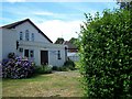
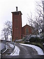
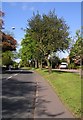
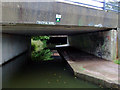

41 photos from this area
Area Information
Key information about the B23 7NA including its size, population, and administrative classification.
- Area Type
- Postcode
- Area Size
- 7306 m²
- Population
- 1829
- Population Density
- 6301 people/km²
House Prices in B23 7NA
28
Properties
£193,958
Average Sold Price
£65,500
Lowest Price
£485,000
Highest Price
Showing 28 properties
| Address | Type | Beds | Baths | Last Sale Price | Last Sale Date | |
|---|---|---|---|---|---|---|
| 10 Hunton Hill, Birmingham, B23 7NA | Detached | 8 | 8 | £485,000 | Mar 2020 | |
| 22 Hunton Hill, Birmingham, B23 7NA | Flat | 4 | 1 | £210,000 | Oct 2017 | |
| 24 Hunton Hill, Birmingham, B23 7NA | house | - | - | £135,000 | Nov 2016 | |
| 6A Hunton Hill, Birmingham, B23 7NA | house | - | - | £185,000 | Nov 2016 | |
| 20 Hunton Hill, Birmingham, B23 7NA | Terraced | 1 | 2 | £150,000 | Mar 2016 | |
| 12 Hunton Hill, Birmingham, B23 7NA | Terraced | 4 | 1 | £175,000 | Sep 2015 | |
| 15 Hunton Hill, Birmingham, B23 7NA | Terraced | 7 | - | £230,000 | Jul 2015 | |
| 13 Hunton Hill, Birmingham, B23 7NA | Semi-detached | - | - | £165,000 | Apr 2005 | |
| 14 Hunton Hill, Birmingham, B23 7NA | Terraced | 5 | - | £187,000 | Nov 2004 | |
| 4 Hunton Hill, Birmingham, B23 7NA | Flat | 1 | 1 | £218,000 | Sep 2003 |
Page 1 of 3
Energy Efficiency in B23 7NA
Amenities
Schools
| Rank | School | Type | Entry gender | Ages |
|---|
Explore more schools in this area
Go to Schools tabDemographics
Household Size
One person
most common
Accommodation Type
Flats
most common
Tenure
22
majority
Ethnic Group
White
most common
Religion
N/A
most common
Household Composition
N/A
most common
Age
47
median
Adults (30-64 years)
most common
Household Deprivation
N/A
with no deprivation
NS-SEC
17
in Lower managerial occupations
Explore more demographic insights in this area
Go to Demographics tabPlanning
Planning Constraints
- Flood RiskPremium
- Ramsar Wetland SitesPremium
- Area of Outstanding Natural BeautyPremium
- Protected Nature ReservePremium
- Protected WoodlandPremium