Area Overview for B23 7EF
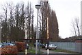
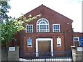
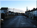
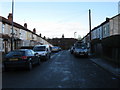
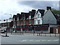
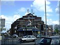
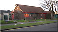
Photos of B23 7EF

Area Information
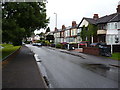
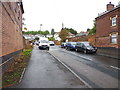
B23 7EF is a small residential postcode area in England, located within the Erdington district of Birmingham. With a population of 1,919, it is a compact suburban cluster positioned to the south-west of Erdington and north-east of Birmingham’s city centre. The area is part of a larger council ward known as Stockland Green, which has a higher population density and is characterised by a mix of built-up housing and suburban infrastructure. Daily life here is shaped by proximity to Birmingham’s urban core, with radial transport links offering quick access to the city’s amenities. The area is notable for its blend of residential housing and local amenities, though it faces challenges such as rising crime rates and concerns over antisocial behaviour. Despite these issues, the postcode remains a practical choice for those seeking proximity to Birmingham’s economic and cultural hubs, with a community profile skewed towards middle-aged adults. Its small size means the immediate surroundings offer a limited range of properties, but the area’s connectivity to rail and road networks makes it a viable option for commuters and families alike.
- Area Type
- Postcode
- Area Size
- Not available
- Population
- 1919
- Population Density
- 4522 people/km²
B23 7EF is a small area with a housing stock primarily composed of houses, which is unusual for a suburban postcode in Birmingham. With 50% of properties owner-occupied, the area reflects a mix of long-term residents and renters. The dominance of houses over flats or apartments suggests a more traditional, low-density residential layout, which may appeal to families seeking space. However, the limited size of the postcode means the property market here is constrained, with few options for buyers. The immediate surroundings, including nearby Erdington, likely offer a broader range of properties, but B23 7EF itself is unlikely to be a hotspot for investment or development. For buyers, this area may be more suitable for those prioritising proximity to Birmingham’s transport links over property diversity. The housing stock’s age and condition, however, are not detailed in the data, leaving potential buyers to assess these factors independently.
House Prices in B23 7EF
No properties found in this postcode.
Energy Efficiency in B23 7EF
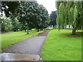
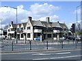
Residents of B23 7EF have access to a range of amenities within walking or short driving distance. Retail options include Spar, Co-op Marsh, and Tesco Erdington, providing everyday shopping convenience. The area’s rail and metro stations connect to Birmingham’s broader network, facilitating access to the city’s cultural, commercial, and leisure hubs. Nearby open spaces such as Brookvale Park, Witton Lakes, and Bleak Hill Park offer recreational opportunities, though the data does not specify their condition or accessibility. The presence of active Friends Groups at Brookvale and Witton suggests community engagement in maintaining these spaces. However, the area’s character is shaped by its suburban layout, with a focus on practicality over luxury amenities. While the data highlights retail and transport, it lacks details on dining, entertainment, or specialist services, which may require further local investigation.
Amenities
Schools
Residents of B23 7EF have access to a range of educational institutions, including Stockland Green School, which operates as both a primary school and an academy with a Good Ofsted rating. The Pines Special School caters to students with special educational needs, while Josiah Mason College provides sixth-form education. This mix of school types ensures that families have options for primary, special needs, and post-16 education within the area. The presence of a rated academy suggests a focus on academic standards, though the absence of secondary schools within the postcode itself means students may need to travel to nearby areas for secondary education. The diversity of school types reflects the community’s needs, but the data does not specify student performance or parental satisfaction, leaving gaps in understanding the full educational landscape.
| Rank | School | Type | Entry gender | Ages |
|---|---|---|---|---|
| 1 | Stockland Green School | primary | N/A | N/A |
| 2 | The Pines Special School | special | N/A | N/A |
| 3 | Josiah Mason College | sixth-form | N/A | N/A |
| 4 | Stockland Green School | academy | N/A | N/A |
Explore more schools in this area
Go to Schools tabDemographics
The population of B23 7EF is predominantly composed of adults aged 30–64, with a median age of 47. This suggests a mature, established community, though the area lacks data on younger demographics or children. Home ownership stands at 50%, indicating a balanced mix of owner-occupied and rental properties. The accommodation type is primarily houses, which is uncommon in urban areas, suggesting a more spread-out residential layout. The predominant ethnic group is White, with no specific data on other ethnicities provided. The absence of detailed diversity statistics means the community’s composition remains largely unexplored in the data. The age profile and housing stock imply a stable, middle-aged population, though the lack of younger residents may affect local services and schools. The 50% home ownership rate also suggests that a significant portion of the area’s housing stock is rented, potentially influencing the local rental market dynamics.
Household Size
Accommodation Type
Tenure
Ethnic Group
Religion
Household Composition
Age
Household Deprivation
NS-SEC
Explore more demographic insights in this area
Go to Demographics tabPlanning
Planning Constraints
- Flood RiskPremium
- Ramsar Wetland SitesPremium
- Area of Outstanding Natural BeautyPremium
- Protected Nature ReservePremium
- Protected WoodlandPremium
- Crime RiskPremium