Area Overview for B23 6XT
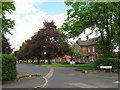
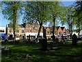
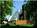
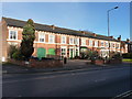
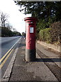
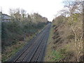
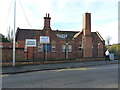
Photos of B23 6XT

Area Information
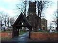
Living in B23 6XT means inhabiting a small, tightly knit residential cluster in Erdington, a historic suburb of Birmingham. With a population of 2,017, this area retains traces of its medieval origins, including its proximity to the River Tame and the Roman road now known as Chester Road. The district’s core is defined by Erdington High Street, a retail hub that once ranked as Birmingham’s third-largest shopping district. Today, the area blends suburban tranquillity with easy access to the city’s infrastructure, including rail links and major roads. The postcode covers parts of Six Ways and Wylde Green, areas that saw significant growth during the Victorian era with the arrival of railways and trams. Modern residents benefit from a mix of historical landmarks, such as Rookery Park and Brookvale Park Lake, alongside contemporary amenities. The community feels rooted in its past yet connected to the present, offering a balance of heritage and practicality for those seeking a settled lifestyle in Birmingham’s outskirts.
- Area Type
- Postcode
- Area Size
- Not available
- Population
- 2017
- Population Density
- 5738 people/km²
The property market in B23 6XT is characterised by a focus on owner-occupied homes, with 47% of residents owning their properties. The accommodation type is predominantly houses, which is typical for suburban areas on the outskirts of Birmingham. This suggests a market that may appeal to families seeking more space than city centre apartments but with the convenience of proximity to urban amenities. Given the small size of the postcode area, the housing stock is likely limited, making it a niche market for buyers prioritising specific locations. The presence of houses may also indicate a slower turnover compared to rental-focused areas, though the exact dynamics of the local property scene are not detailed. Buyers should consider the area’s proximity to transport links and retail hubs when evaluating its appeal.
House Prices in B23 6XT
No properties found in this postcode.
Energy Efficiency in B23 6XT
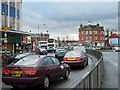
Residents of B23 6XT have access to a range of amenities within practical reach. The retail sector includes major supermarkets such as Farmfoods Erdington, Iceland Erdington, and Tesco Erdington, ensuring everyday shopping needs are met. Transport options are diverse, with rail stations like Erdington Railway Station and metro stops such as St Chads providing connectivity to the wider region. Parks and open spaces, including Rookery Park and Brookvale Park Lake, offer recreational opportunities. The area’s historical character is preserved in sites like Erdington High Street and the former Sir Josiah Mason Orphanage, now known as Goodison Gardens. These features combine to create a lifestyle that balances convenience with a touch of heritage, appealing to those who value both modern amenities and historical context.
Amenities
Schools
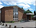
The nearest schools to B23 6XT include Queensbury School, which is designated as a special school. While only one school is explicitly named in the data, the listing includes two entries for Queensbury School, suggesting it may serve multiple age groups or have distinct departments. Special schools cater to students with specific educational needs, which could be a key consideration for families with children requiring tailored support. The absence of other school types in the data means the area’s educational options are limited to this category. For families seeking a broader range of school types, including primary or secondary institutions, further research beyond the immediate vicinity would be necessary.
| Rank | School | Type | Entry gender | Ages |
|---|
Explore more schools in this area
Go to Schools tabDemographics
The demographic profile of B23 6XT reflects a mature, stable population. The median age is 47, with the most common age range being adults aged 30–64. This suggests a community with established careers and families, likely contributing to a sense of continuity. Home ownership rates stand at 47%, indicating a mix of owner-occupied properties and rental stock. The predominant accommodation type is houses, which may reflect the area’s suburban character and lower density compared to central Birmingham. The predominant ethnic group is White, aligning with broader trends in the West Midlands. While no specific deprivation data is provided, the age profile and housing stock suggest a population with relatively stable employment and access to services. However, the lack of detailed diversity metrics means the full range of community experiences remains less defined.
Household Size
Accommodation Type
Tenure
Ethnic Group
Religion
Household Composition
Age
Household Deprivation
NS-SEC
Explore more demographic insights in this area
Go to Demographics tabPlanning
Planning Constraints
- Flood RiskPremium
- Ramsar Wetland SitesPremium
- Area of Outstanding Natural BeautyPremium
- Protected Nature ReservePremium
- Protected WoodlandPremium