Area Overview for B23 6XJ
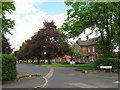
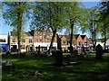
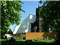
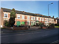
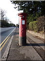
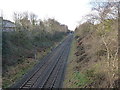
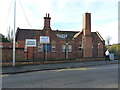
Photos of B23 6XJ

Area Information
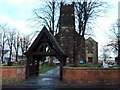
B23 6XJ is a small residential postcode in England, encompassing a compact cluster of homes within the broader Erdington area. With a population of 2,017, it reflects the character of a suburban district that has evolved from its historic roots near the River Tame. The area’s proximity to Birmingham’s urban core offers a blend of local identity and accessibility. Erdington itself, centred around the postcode B23 3AA, developed as a village along ancient Roman roads and grew into a suburban hub in the 19th century. Today, B23 6XJ sits within this fabric, offering residents a mix of traditional and modern living. The area is served by key infrastructure, including retail outlets like Farmfoods Erdington and Tesco Erdington, as well as rail and metro connections. Its compact size means daily life is shaped by nearby amenities, from schools to parks, while historical landmarks like St Barnabas Church and Rookery Park add to its distinctiveness. For those seeking a community with a balance of convenience and heritage, B23 6XJ provides a focused, manageable environment.
- Area Type
- Postcode
- Area Size
- Not available
- Population
- 2017
- Population Density
- 5738 people/km²
B23 6XJ is characterised by a housing stock dominated by houses, with 47% of properties owner-occupied. This suggests a community where homeownership is common, though the remaining 53% may be rented, potentially attracting a mix of tenants and investors. The presence of houses rather than flats or apartments indicates a preference for single-family living, which could appeal to families or individuals seeking space and privacy. However, the small size of the area means the housing market is limited in scale, with few options for buyers seeking a wide range of properties. Proximity to Birmingham’s urban centre may make B23 6XJ an attractive option for those seeking suburban living with easy access to city amenities. Buyers should consider the local infrastructure and the area’s historical development when evaluating property value potential, as the market may be influenced by both traditional appeal and modern demand.
House Prices in B23 6XJ
No properties found in this postcode.
Energy Efficiency in B23 6XJ
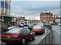
Living in B23 6XJ offers access to a range of local amenities within practical reach. Retail options include Farmfoods Erdington, Iceland Erdington, and Tesco Erdington, providing everyday shopping convenience. The area’s transport links, including five rail stations and metro stops, connect residents to broader networks for commuting or leisure. Parks and open spaces are also present, with Rookery Park serving as a former district office turned public space. Historical sites like St Barnabas Church and the former Sir Josiah Mason Orphanage add cultural depth. For dining, the proximity to Erdington High Street—Birmingham’s third-largest retail district—suggests a variety of eating options. The blend of retail, transport, and green spaces creates a lifestyle that balances practicality with community engagement, making daily life in B23 6XJ both functional and rooted in local heritage.
Amenities
Schools
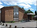
The nearest schools to B23 6XJ are both Queensbury School, which is designated as a special school. While no Ofsted ratings are provided, the presence of two institutions with the same name suggests a focused educational provision for specific needs. The area’s school mix indicates that families requiring specialist education for children with additional needs may find resources here. However, the absence of data on mainstream schools or their performance means the full educational landscape remains unclear. For prospective buyers, this highlights the importance of verifying additional schooling options beyond the immediate vicinity. The concentration of special schools may reflect local demand but does not necessarily indicate a comprehensive range of educational choices for all family requirements.
| Rank | School | Type | Entry gender | Ages |
|---|
Explore more schools in this area
Go to Schools tabDemographics
The population of B23 6XJ is 2,017, with a median age of 47, indicating a mature demographic skewed toward adults aged 30–64. Home ownership in the area stands at 47%, suggesting a mix of owner-occupied and rental properties. The predominant accommodation type is houses, reflecting a residential character that contrasts with high-density urban areas. The majority of residents identify as White, aligning with broader trends in the region. This age profile implies a community with established households, potentially prioritising stability and long-term residency. The absence of detailed data on deprivation or diversity metrics means the area’s socio-economic nuances remain less defined, but the presence of local amenities and infrastructure suggests a baseline level of service. For buyers, the demographic profile indicates a market likely oriented toward families or professionals seeking a settled environment rather than transient populations.
Household Size
Accommodation Type
Tenure
Ethnic Group
Religion
Household Composition
Age
Household Deprivation
NS-SEC
Explore more demographic insights in this area
Go to Demographics tabPlanning
Planning Constraints
- Flood RiskPremium
- Ramsar Wetland SitesPremium
- Area of Outstanding Natural BeautyPremium
- Protected Nature ReservePremium
- Protected WoodlandPremium