Area Overview for B23 6UQ
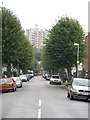
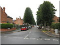
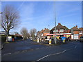
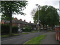
Photos of B23 6UQ
Area Information
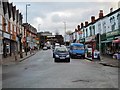
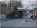
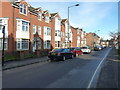
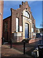
Living in B23 6UQ means being part of a compact residential cluster within the Erdington area of Birmingham, a suburb with historical roots as a village near the River Tame. The postcode covers a small but distinct community of 1,820 residents, centred around Erdington High Street, which remains a key retail hub. The area’s character blends suburban tranquillity with proximity to Birmingham’s urban infrastructure. Historically, Erdington developed as a farming village in the 9th century, later expanding with Victorian-era railways and trams. Today, it retains features like Rookery Park, once the district’s administrative heart, and the former Highcroft Hospital site. Residents benefit from nearby transport links, including five rail stations such as Erdington and Chester Road, and a mix of retail outlets like Co-op High and Lidl. The area’s compact size means daily life is walkable, with schools, shops, and green spaces within practical reach. However, the community’s demographics—predominantly adults aged 30–64—suggest a mature, stable population with established ties to the area.
- Area Type
- Postcode
- Area Size
- Not available
- Population
- 1820
- Population Density
- 4444 people/km²
The property market in B23 6UQ is characterised by a low home ownership rate of 25%, indicating that the majority of properties are rented rather than owner-occupied. This suggests a rental market that may appeal to tenants seeking stability in a suburban setting. The accommodation type is primarily houses, which is atypical for inner-city areas, hinting at a mix of larger homes and detached properties. For buyers, this dynamic means competition for owner-occupied homes may be limited, with more opportunities in the rental sector. The small area’s compact size means property availability is constrained, but the presence of houses could attract buyers prioritising space or family-friendly layouts. However, the low ownership rate may reflect broader economic factors, such as affordability or investment trends in the region.
House Prices in B23 6UQ
No properties found in this postcode.
Energy Efficiency in B23 6UQ
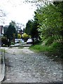
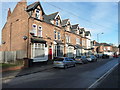
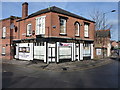
Residents of B23 6UQ enjoy a blend of suburban convenience and historical character. Nearby amenities include retail outlets such as Co-op High and Lidl, as well as the Erdington High Street, a third-largest retail district in Birmingham. Parks and open spaces like Rookery Park and Brookvale Park Lake provide recreational opportunities, while the area’s history includes landmarks like the former Sir Josiah Mason Orphanage site, now Goodison Gardens. The presence of multiple rail and metro stations ensures easy access to Birmingham’s cultural and commercial centres. The compact nature of the postcode means daily errands, dining, and leisure activities are within walking or short-vehicle distance. However, the area lacks major leisure venues or entertainment hubs, relying on nearby Birmingham for larger-scale amenities. The mix of green spaces, retail, and transport options creates a balanced lifestyle for residents.
Amenities
Schools
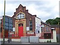
Residents of B23 6UQ have access to a range of educational institutions, including Osborne Nursery School, which provides early years education, and Osborne Primary School, rated ‘good’ by Ofsted. For secondary education, Highclare School and Imedia School—both independent—offer alternative options, with Imedia School holding an ‘outstanding’ Ofsted rating. The presence of both state and independent schools gives families flexibility, though the area’s primary schools are the most accessible. The mix of school types ensures a variety of educational philosophies, from state-funded public education to fee-paying independent institutions. However, the absence of a secondary state school may require commuting for students beyond primary level. The quality ratings suggest that local schools are generally reliable, though parents seeking top-tier education may need to consider nearby options.
| Rank | School | Type | Entry gender | Ages |
|---|
Explore more schools in this area
Go to Schools tabDemographics
The population of B23 6UQ is 1,820, with a median age of 47, indicating a community skewed towards middle-aged adults. The most common age range is 30–64 years, reflecting a mature demographic profile. Home ownership in the area is low at 25%, suggesting a rental market dominates. The primary accommodation type is houses, which is unusual for urban areas, implying a mix of single-family homes and larger properties. The predominant ethnic group is White, though no specific diversity statistics are provided. This age profile and ownership rate suggest a community of long-term residents, possibly with a higher proportion of retirees or professionals in stable employment. The low home ownership rate may indicate affordability challenges or a preference for renting, which could influence local property dynamics.
Household Size
Accommodation Type
Tenure
Ethnic Group
Religion
Household Composition
Age
Household Deprivation
NS-SEC
Explore more demographic insights in this area
Go to Demographics tabPlanning
Planning Constraints
- Flood RiskPremium
- Ramsar Wetland SitesPremium
- Area of Outstanding Natural BeautyPremium
- Protected Nature ReservePremium
- Protected WoodlandPremium