Area Overview for B23 6UD
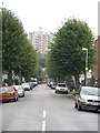
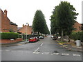
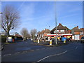
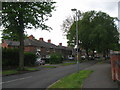
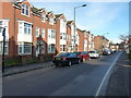
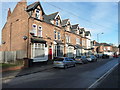
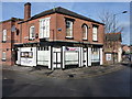
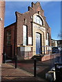
Photos of B23 6UD
Area Information
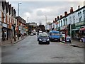
Living in B23 6UD means being part of a small, tightly knit residential cluster in the heart of Erdington, Birmingham. With a population of 1,820, this area balances suburban tranquillity with proximity to the city’s infrastructure. Historically rooted as a village near the River Tame, Erdington’s character is shaped by its medieval origins and Victorian expansion. The area’s core is defined by Erdington High Street, a major retail hub, and features like Rookery Park, which once housed the district’s administrative offices. Daily life here is marked by a mix of older housing stock and modern developments, such as Sorrel House in Pype Hayes. Residents benefit from nearby transport links, including five railway stations and multiple metro stops, while the area’s low flood risk and absence of protected natural sites suggest a practical, low-constraint environment. However, the community’s maturity—median age 47—reflects a stable, established demographic, with a focus on family-oriented living and access to both state and independent education.
- Area Type
- Postcode
- Area Size
- Not available
- Population
- 1820
- Population Density
- 4444 people/km²
The property market in B23 6UD is characterised by a 25% home ownership rate, suggesting that most residents rent rather than own their homes. The accommodation type is predominantly houses, which is typical of suburban areas with lower density than city centres. This mix of rental and owner-occupied properties creates a dynamic where buyers may find opportunities in both the private and rental sectors. The small size of the area means housing stock is limited, potentially increasing competition for available properties. For buyers, the focus on houses rather than flats may appeal to those seeking larger living spaces, though the low home ownership rate could indicate limited scope for investment in property equity. The area’s proximity to transport links and amenities may enhance its attractiveness for those prioritising convenience over speculative growth.
House Prices in B23 6UD
No properties found in this postcode.
Energy Efficiency in B23 6UD
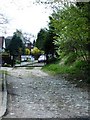
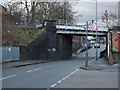
The lifestyle in B23 6UD is enriched by a variety of amenities within practical reach. Retail options include Co-op High, Heron Erdington, and Lidl BIR Erdington 2, offering everyday shopping needs. The area’s parks and open spaces, such as Rookery Park and Brookvale Park Lake, provide recreational opportunities, while historical sites like Erdington High Street and the former Sir Josiah Mason Orphanage site add cultural depth. The presence of multiple railway and metro stations, including Erdington Railway Station and St Paul’s, ensures easy access to Birmingham’s urban centres. This blend of practicality and historical character creates a balanced environment where residents can enjoy both suburban comfort and city connectivity.
Amenities
Schools
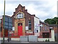
Residents of B23 6UD have access to a range of educational institutions, including Osborne Nursery School and Osborne Primary School, the latter of which holds a ‘good’ Ofsted rating. For independent education, Highclare School and Imedia School—rated ‘outstanding’ by Ofsted—offer alternative options. The presence of both state and independent schools provides families with choices tailored to their preferences, whether prioritising public education or fee-based institutions. The mix of school types reflects Erdington’s broader role as a residential area with diverse educational provision. While no data on school catchment areas is provided, the availability of high-rated institutions suggests the area is appealing to families seeking quality education for their children.
| Rank | School | Type | Entry gender | Ages |
|---|
Explore more schools in this area
Go to Schools tabDemographics
The community in B23 6UD is predominantly composed of adults aged 30–64, with a median age of 47. Home ownership stands at 25%, indicating a majority of residents rent their homes. The area’s accommodation is largely houses, reflecting a traditional suburban layout. The predominant ethnic group is White, though specific data on diversity beyond this is not provided. This demographic profile suggests a mature, settled population with established careers and family ties. The relatively low home ownership rate may indicate a mix of long-term renters and those in transitional housing phases. The absence of detailed deprivation data means quality of life considerations remain unquantified, but the age range and housing type imply a community prioritising stability over rapid change.
Household Size
Accommodation Type
Tenure
Ethnic Group
Religion
Household Composition
Age
Household Deprivation
NS-SEC
Explore more demographic insights in this area
Go to Demographics tabPlanning
Planning Constraints
- Flood RiskPremium
- Ramsar Wetland SitesPremium
- Area of Outstanding Natural BeautyPremium
- Protected Nature ReservePremium
- Protected WoodlandPremium