Area Overview for B23 6SX
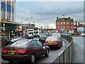
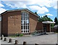
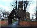
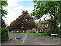
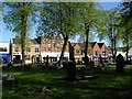
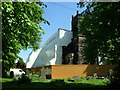
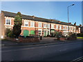
Photos of B23 6SX

Area Information
B23 6SX represents a specific residential cluster within the historic Erdington ward in the West Midlands. This postcode sits at the heart of an area that originally developed as a village near the River Tame and the Roman road now known as Chester Road. The district expanded rapidly during the Victorian era with the arrival of railways and trams, eventually joining Birmingham in 1911 following local government reforms in 1894. Today, the area encompasses much of the traditional Erdington suburb, including parts of Six Ways and Wylde Green. You will find yourself in a district borough unitary ward that forms the core of the Birmingham Erdington parliamentary constituency. The broader location retains its heritage from the post-Norman Conquest period, where land for farming, a mill, and meadows once characterised the landscape before evolving into one of Birmingham's most established suburbs. The current population stands at 2,017 residents for this specific postcode area, reflecting a concentrated community focused on this small cluster of addresses. Historic landmarks still define the neighbourhood, from Salford Bridge, first mentioned in the 1200s, to the former Rookery Park, which was once the site of district offices. Living in B23 6SX means residing in a location that balances significant historical heritage with modern suburban life. The area originated along the Birmingham-Fazeley Canal from 1783 and has remained central to the region's development for centuries.
- Area Type
- Postcode
- Area Size
- Not available
- Population
- 2017
- Population Density
- 5738 people/km²
Homes in B23 6SX form a predominantly owner-occupied sector with a clear housing stock composition. The market reflects a specific tenure split where exactly 47 per cent of households own their properties. The remaining 53 per cent represents either private rentals or social housing, though the specific breakdown is not detailed in the census data. Local housing stock consists primarily of houses, fitting the pattern of development seen in other areas of Erdington that grew from village foundations into suburban sprawl. This focus on houses rather than apartments or flats aligns with the area's history of expansion following the arrival of trams and railways in the Victorian and Edwardian eras. When buying a home in this postcode, you are entering a market characterised by established family residences rather than new developments or high-density blocks. The property types in B23 6SX mirror the broader Erdington ward, which was moved from Sutton Coldfield in 1974 to form its current boundaries. Potential buyers should expect traditional suburban layouts consistent with the area's growth from the mid-1700s population of approximately 700 to the 2,000 residents recorded by 1832. The concentration of houses suggests that single-family ownership remains the standard form of accommodation in this specific cluster. This tenure mix provides stability for sellers and long-term value for buyers looking at homes in the Erdington vicinity.
House Prices in B23 6SX
No properties found in this postcode.
Energy Efficiency in B23 6SX
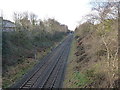
Residents of B23 6SX enjoy immediate access to a range of amenities within practical reach of their daily commutes. Retail options are concentrated with five key locations, including Farmfoods Erdington, Iceland Erdington, and Tesco Erdington. These supermarkets serve as the primary shopping destinations for groceries and household essentials. Transport connectivity remains a strength with five distinct railway stations nearby, namely Erdington Railway Station, Gravelly Hill Railway Station, and Chester Road Railway Station. These stations provide direct links to the city and surrounding suburbs. Beyond rail, you can access Birmingham city centre via nearby metro stops at St Chads, St Paul's, and Bull Street. Other notable features of the local landscape include Erdington High Street, recognised as the third largest retail district in Birmingham, and the historic Salford Bridge over the River Tame. Parks and open spaces are available in the form of Rookery Park and Brookvale Park Lake, the latter of which was formerly a reservoir. The presence of Erdington Library and St Barnabas Church adds cultural and community depth to the neighbourhood. Living in B23 6SX places you minutes from significant retail hubs, transport interchange points, and historical landmarks that define the Erdington identity.
Amenities
Schools
Schools near B23 6SX are limited to specific special education provisions within the immediate vicinity. The only institution listed in the local register is Queensbury School, which operates as a special school. You will find two entries for this facility in the available records, indicating its presence as a key provider of special educational needs support for the ward. The absence of standard primary or secondary schools in the direct data for this postcode suggests that families in B23 6SX may rely on facilities outside the immediate postcode boundary for mainstream education. Living in this area means accessing a dedicated special education environment alongside other local provisions not fully detailed in the dataset. The presence of a special school highlights the area's commitment to inclusive educational supports. While mainstream state schools in Erdington High Street or nearby Six Ways serve the wider community, the specific data points only to Queensbury School for this immediate cluster. Homebuyers considering schools near B23 6SX must look beyond the immediate postcode to the broader Birmingham catchment area for comprehensive educational options. The mix of school types here is narrow, focusing on special needs rather than the full spectrum of primary or secondary education found in larger educational hubs.
| Rank | School | Type | Entry gender | Ages |
|---|
Explore more schools in this area
Go to Schools tabDemographics
The community living in B23 6SX is defined by a predominantly adult population with a median age of 47 years. Most residents fall within the 30 to 64-year age range, creating a demographic profile focused on established households rather than young families or retirees. Nearly half of the population, at exactly 47 per cent, owns their homes outright or with a mortgage, indicating a significant level of long-term settlement. The remaining residents are likely renting, contributing to a mixed but largely stable tenure pattern. Accommodation in this postcode consists primarily of houses, aligning with the area's evolution from a village settlement into a suburban residential zone. The predominant ethnic group is White, which shapes the cultural fabric of the local community. This demographic concentration suggests a neighbourhood where long-established families have maintained continuity since the Victorian expansion and the incorporation into Birmingham. With a median age of 47, you are joining an area where most neighbours have built long-term roots here. The lack of younger children or elderly residents as the primary groups means the local atmosphere reflects the interests and stability of middle-aged householders. Understanding who lives here helps you anticipate the character of the streets and local interactions in B23 6SX. The data confirms a steady, mature population that has grown from the village origins described in historical records.
Household Size
Accommodation Type
Tenure
Ethnic Group
Religion
Household Composition
Age
Household Deprivation
NS-SEC
Explore more demographic insights in this area
Go to Demographics tabPlanning
Planning Constraints
- Flood RiskPremium
- Ramsar Wetland SitesPremium
- Area of Outstanding Natural BeautyPremium
- Protected Nature ReservePremium
- Protected WoodlandPremium