Area Overview for B23 6ST
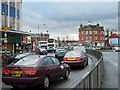
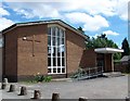
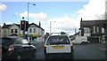
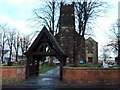
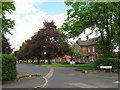
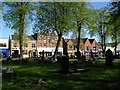
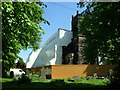
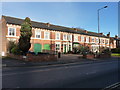
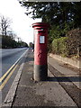
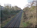
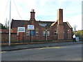
Photos of B23 6ST

Area Information
B23 6ST is a small, tightly defined postcode area within Birmingham’s Erdington district, home to around 2,017 residents. Situated in the West Midlands, it is part of a historic village that evolved into a suburban hub, centred on Erdington High Street. The area retains traces of its medieval origins, including the River Tame and Chester Road, a former Roman route. Today, it blends older residential stock with newer developments, such as the modern homes in Pype Hayes. The community is compact, with a focus on local amenities and transport links. While it is not a high-density area, its proximity to Birmingham’s core offers access to urban opportunities. The postcode’s small size means residents often live within walking distance of shops, schools, and rail services, creating a self-contained but connected environment. The area’s character is shaped by its history as a farming village, with landmarks like Rookery Park and Brookvale Park Lake offering green spaces. For those seeking a mix of heritage and convenience, B23 6ST presents a distinctive blend of suburban tranquillity and urban accessibility.
- Area Type
- Postcode
- Area Size
- Not available
- Population
- 2017
- Population Density
- 5738 people/km²
B23 6ST is predominantly a house-based area, with 100% of properties classified as houses rather than flats or apartments. This suggests a suburban character, with larger homes and gardens, though the small postcode size means the housing stock is limited. Home ownership rates of 47% indicate that nearly half of properties are rented, pointing to a mix of owner-occupied and rental markets. The area’s compact nature means buyers may need to consider nearby postcodes for a broader selection of properties. The presence of newer developments like Sorrel House in Pype Hayes hints at some modern housing options, but the overall market remains constrained by the area’s small footprint. For buyers, this means competition for available homes and potential reliance on nearby areas for additional choices. The focus on houses also implies higher maintenance costs and space requirements compared to urban apartments.
House Prices in B23 6ST
No properties found in this postcode.
Energy Efficiency in B23 6ST
The lifestyle in B23 6ST is shaped by its proximity to retail, transport, and green spaces. Within walking distance are major supermarkets like Farmfoods Erdington, Iceland Erdington, and Tesco Erdington, offering everyday shopping needs. The area’s rail and metro stations—Erdington Railway Station, Gravelly Hill Railway Station, and Chester Road Railway Station—provide seamless links to Birmingham and beyond. For leisure, Rookery Park and Brookvale Park Lake offer open spaces for walking, picnics, or relaxation. The historical character of the area is reflected in landmarks like Erdington High Street, the former Sir Josiah Mason Orphanage site, and the Birmingham Fazeley Canal. These elements create a balance between modern convenience and local heritage. The compact nature of the postcode means amenities are closely clustered, reducing the need for long commutes. This combination of practicality and historical interest makes daily life in B23 6ST both functional and engaging.
Amenities
Schools
The nearest schools to B23 6ST include Queensbury School, which is designated as a special school. This type of institution caters to students with specific educational needs, offering tailored support and resources. The presence of two entries for Queensbury School suggests it may serve multiple age groups or have distinct departments within the same building. While no Ofsted ratings are provided, the availability of a special school indicates the area’s commitment to inclusive education. For families requiring specialist provision, this school is a key resource. However, the absence of mainstream primary or secondary schools in the data means the area may rely on nearby postcodes for broader educational options. Parents should verify the school’s capacity and proximity to their homes when considering the area.
| Rank | School | Type | Entry gender | Ages |
|---|
Explore more schools in this area
Go to Schools tabDemographics
The population of B23 6ST has a median age of 47, with the majority of residents aged between 30 and 64. This suggests a community of established professionals and families, rather than a younger or elderly demographic. Home ownership rates stand at 47%, indicating a moderate balance between owner-occupied properties and rental homes. The primary accommodation type is houses, reflecting a suburban layout with detached or semi-detached dwellings. The predominant ethnic group is White, though no further breakdown of diversity is provided. The age profile implies a stable, long-term resident base, with fewer transient populations. The absence of specific data on deprivation means the area’s economic profile remains unquantified, but the presence of both older and newer housing suggests a mix of property values and household incomes. The community’s focus on family life is reinforced by the availability of local schools and amenities, catering to the needs of middle-aged residents and their dependents.
Household Size
Accommodation Type
Tenure
Ethnic Group
Religion
Household Composition
Age
Household Deprivation
NS-SEC
Explore more demographic insights in this area
Go to Demographics tabPlanning
Planning Constraints
- Flood RiskPremium
- Ramsar Wetland SitesPremium
- Area of Outstanding Natural BeautyPremium
- Protected Nature ReservePremium
- Protected WoodlandPremium