Area Overview for B23 6SB
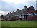
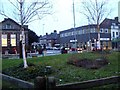
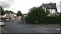
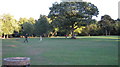
Photos of B23 6SB
Area Information
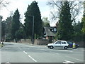
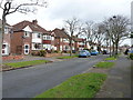
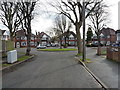
Living in B23 6SB means being part of a small, residential postcode area in Birmingham’s Erdington district, a suburb with historical roots as a village near the River Tame. The area’s population of 1820 reflects a tight-knit community, with homes clustered around Erdington High Street, a key retail hub. Daily life here is shaped by its proximity to Birmingham’s urban infrastructure, yet retains a village-like character. The area’s origins trace back to the 9th century, with development accelerating in the Victorian era as a Birmingham suburb. Today, B23 6SB offers a mix of older housing stock and modern amenities, with access to schools, transport links, and green spaces. While it sits within a larger urban context, the postcode’s small size means residents often know their neighbours. The area’s blend of history and practicality makes it appealing to those seeking a balance between suburban calm and city connectivity.
- Area Type
- Postcode
- Area Size
- Not available
- Population
- 1820
- Population Density
- 4444 people/km²
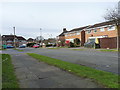
The property market in B23 6SB is characterised by a low home ownership rate of 25%, indicating that the majority of properties are rented rather than owned. This suggests a rental-focused market, which may be influenced by the area’s small size and the prevalence of houses as the primary accommodation type. The presence of houses rather than flats or apartments implies a mix of older, larger properties, possibly with gardens, which could appeal to families or those seeking more space. However, the low ownership rate may also reflect affordability challenges or a transient population. For buyers, the limited number of owner-occupied homes could mean competition for available properties, particularly if the area is seen as a desirable location for its amenities and transport links. The small postcode area means that proximity to key services and schools is a significant factor in property value.
House Prices in B23 6SB
No properties found in this postcode.
Energy Efficiency in B23 6SB
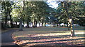
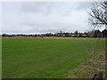
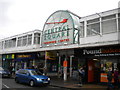
Residents of B23 6SB have access to a range of amenities within practical reach, including retail outlets like Co-op High, Heron Erdington, and Iceland Erdington, which cater to everyday shopping needs. The area’s transport links also provide access to local parks and green spaces, such as Rookery Park, a former district office turned public space. The historical Erdington High Street remains a focal point for retail and community activity, offering a third of Birmingham’s retail space. Nearby, Brookvale Park Lake and Pype Hayes provide recreational opportunities, while the Birmingham Fazeley Canal adds to the area’s charm. The mix of shops, transport, and open spaces creates a convenient, well-connected lifestyle, blending suburban comfort with urban accessibility.
Amenities
Schools
Residents of B23 6SB have access to a range of educational institutions, including Osborne Nursery School and Osborne Primary School, both of which serve younger children. Osborne Primary School has a ‘good’ Ofsted rating, indicating a satisfactory standard of education. For older students, Highclare School and Imedia School offer independent education, with Imedia School holding an ‘outstanding’ Ofsted rating. This mix of state and independent schools provides families with options, whether they prioritise affordability or specialist provision. The presence of a high-performing independent school may attract families seeking premium education, while the state schools offer accessible alternatives. The diversity of school types reflects the area’s broader demographic and economic profile, ensuring that educational needs are met across different family circumstances.
| Rank | School | Type | Entry gender | Ages |
|---|
Explore more schools in this area
Go to Schools tabDemographics
The community in B23 6SB has a median age of 47, with the majority of residents aged 30–64. This suggests a population skewed towards middle-aged adults, likely including families and professionals. Home ownership is low at 25%, indicating that most households are renters rather than property owners. The predominant accommodation type is houses, which is unusual for a small postcode area, suggesting a mix of detached and semi-detached properties. The predominant ethnic group is White, reflecting the broader demographic trends in Birmingham’s outer suburbs. While no specific data on deprivation is provided, the low home ownership rate may imply a reliance on rental markets, which could influence local economic dynamics. The age profile suggests a stable, mature population, potentially with established careers and family ties to the area.
Household Size
Accommodation Type
Tenure
Ethnic Group
Religion
Household Composition
Age
Household Deprivation
NS-SEC
Explore more demographic insights in this area
Go to Demographics tabPlanning
Planning Constraints
- Flood RiskPremium
- Ramsar Wetland SitesPremium
- Area of Outstanding Natural BeautyPremium
- Protected Nature ReservePremium
- Protected WoodlandPremium