Area Overview for B23 6RW
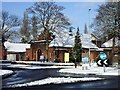
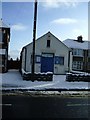
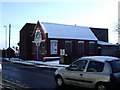
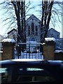
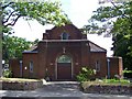
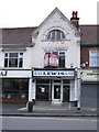
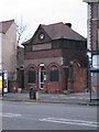
Photos of B23 6RW
Area Information
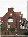
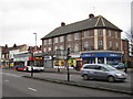
Living in B23 6RW means being part of a small, tightly knit residential cluster within the broader Erdington area of Birmingham. With a population of 1,820, this postcode reflects a suburban character shaped by its historical roots as a village near the River Tame. The area’s development as a Birmingham suburb in the Victorian era is evident in its mix of older housing stock and modern amenities. Residents benefit from proximity to Erdington High Street, one of Birmingham’s largest retail districts, and a network of rail and metro stations that connect to the city’s core. The community is defined by its accessibility to schools, including both state and independent options, and a quiet residential atmosphere balanced with urban convenience. While the area lacks large-scale commercial hubs, its charm lies in its compact size and integration with nearby green spaces like Rookery Park and Brookvale Park Lake. For those seeking a blend of suburban calm and city connectivity, B23 6RW offers a distinct slice of Birmingham’s evolving landscape.
- Area Type
- Postcode
- Area Size
- Not available
- Population
- 1820
- Population Density
- 4444 people/km²
The property market in B23 6RW is characterised by a low home ownership rate of 25%, suggesting that most properties are rented rather than bought. The accommodation type is predominantly houses, which is uncommon in modern Birmingham’s high-density areas. This mix of older, single-family homes may appeal to families seeking space but also limits availability for buyers, given the area’s small size. The low ownership rate implies a rental market dominated by private landlords, which could affect long-term investment potential. For buyers, the scarcity of owner-occupied properties means competition for available homes, particularly in a small postcode like B23 6RW. Proximity to Birmingham’s transport networks and retail corridors may offset the area’s lack of large-scale development, but the limited housing stock means buyers must consider nearby suburbs for more options.
House Prices in B23 6RW
No properties found in this postcode.
Energy Efficiency in B23 6RW
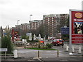
The lifestyle in B23 6RW is defined by its proximity to both retail and green spaces. Within practical reach are shops like Co-op High and Lidl, offering everyday essentials, while the area’s historic retail corridor at Erdington High Street provides a broader range of services. Parks such as Rookery Park, once the district’s administrative heart, and Brookvale Park Lake, a former reservoir, offer recreational opportunities. The nearby Salford Bridge and Pype Hayes area, with modern homes like Sorrel House, add a contemporary edge. Residents can enjoy a mix of suburban tranquillity and urban accessibility, with easy access to Birmingham’s cultural and commercial centres. The presence of both independent and state schools, along with transport links, ensures a balanced lifestyle for families and professionals alike.
Amenities
Schools
Residents of B23 6RW have access to a range of educational institutions, including Osborne Nursery School and Osborne Primary School, both of which serve younger children. Osborne Primary School holds a ‘good’ Ofsted rating, while independent schools like Highclare School and Imedia School, which has an ‘outstanding’ rating, offer alternative options for families. The presence of both state and independent schools reflects a diverse educational landscape, allowing parents to choose between public and private education. Imedia School’s high rating is particularly notable, as it suggests strong academic performance and resources. For families prioritising school quality, the proximity to these institutions is a key advantage. However, the area’s small size means that school catchment areas are limited, requiring careful consideration of location when selecting a home.
| Rank | School | Type | Entry gender | Ages |
|---|
Explore more schools in this area
Go to Schools tabDemographics
The demographic profile of B23 6RW is shaped by a median age of 47, with the majority of residents aged between 30 and 64. This suggests a community skewed towards middle-aged adults, likely including families and professionals. Home ownership stands at 25%, indicating that the area is predominantly occupied by renters rather than owner-occupiers. The accommodation type is primarily houses, which contrasts with the higher-density housing typical of central Birmingham. The predominant ethnic group is White, reflecting broader trends in the West Midlands. While specific data on deprivation is not provided, the low home ownership rate and age distribution imply a mix of long-term residents and those in transient employment sectors. The absence of detailed diversity metrics means the community’s full demographic range remains less defined, but the presence of both state and independent schools suggests a range of household needs and priorities.
Household Size
Accommodation Type
Tenure
Ethnic Group
Religion
Household Composition
Age
Household Deprivation
NS-SEC
Explore more demographic insights in this area
Go to Demographics tabPlanning
Planning Constraints
- Flood RiskPremium
- Ramsar Wetland SitesPremium
- Area of Outstanding Natural BeautyPremium
- Protected Nature ReservePremium
- Protected WoodlandPremium