Area Overview for B23 6QN
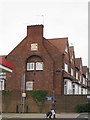
Photos of B23 6QN
Area Information
Living in B23 6QN means being part of a small, tightly knit residential cluster in Erdington, a historic suburb of Birmingham. With a population of 1820, the area retains a village-like character despite its proximity to the city. Centred around the River Tame and Chester Road, it evolved from a medieval settlement into a bustling suburb with a main retail strip at Erdington High Street. The area’s compact size fosters a sense of familiarity, with amenities and services within practical reach. Residents benefit from proximity to Birmingham’s transport networks, including rail and metro links, while historical sites like Rookery Park and Brookvale Park Lake offer green spaces. The community is predominantly composed of adults aged 30–64, reflecting a mature demographic. While the area lacks the density of larger urban centres, its blend of heritage and modern convenience makes it appealing to those seeking a quieter, connected lifestyle.
- Area Type
- Postcode
- Area Size
- Not available
- Population
- 1820
- Population Density
- 4444 people/km²
B23 6QN is a small area with a housing stock dominated by individual homes rather than flats or apartments. With only 25% of residents owning their homes, the market is likely skewed towards rental properties, making owner-occupation less common. This suggests that buyers may find fewer opportunities for purchase in the immediate vicinity, though the area’s compact size means nearby suburbs could offer more options. The predominance of houses reflects a preference for single-family living, which may appeal to families or those seeking space. However, the limited data on property availability means prospective buyers should explore surrounding areas for a broader range of listings.
House Prices in B23 6QN
Showing 1 properties
| Address | Type | Beds | Baths | Last Sale Price | Last Sale Date | |
|---|---|---|---|---|---|---|
| The Abbey, Sutton Road, Birmingham, B23 6QN | shop | - | - | - | - |
Energy Efficiency in B23 6QN
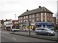
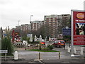
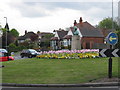
Residents of B23 6QN enjoy a mix of retail, transport, and green spaces. Local shops include Lidl BIR Erdington 2 and Co-op High, providing essentials within walking distance. The area’s rail and metro stations—such as Erdington Railway Station and St Chads—connect to Birmingham’s broader transport network. Parks like Rookery Park, once the district’s administrative hub, and Brookvale Park Lake, a former reservoir, offer recreational space. The historic Erdington High Street remains a focal point for shopping and community activity. This blend of practical amenities and greenery supports a balanced lifestyle, combining urban convenience with outdoor access.
Amenities
Schools
Residents of B23 6QN have access to a range of educational institutions, including Osborne Nursery School and Osborne Primary School, both of which serve younger children. Osborne Primary School holds a ‘good’ Ofsted rating, while Highclare School and Imedia School, both independent institutions, offer alternative options for families seeking private education. Imedia School is rated ‘outstanding’ by Ofsted, highlighting its academic excellence. The presence of both state and independent schools provides flexibility for parents, whether they prioritise affordability or specialist provision. These schools are within walking distance for many residents, reinforcing the area’s suitability for families.
| Rank | School | Type | Entry gender | Ages |
|---|
Explore more schools in this area
Go to Schools tabDemographics
The population of B23 6QN is 1820, with a median age of 47, indicating a community skewed towards middle-aged adults. The most common age range is 30–64 years, suggesting a stable, established population. Home ownership is low at 25%, implying a higher proportion of renters, which may influence the local housing market’s dynamics. The area is predominantly composed of houses, with the White ethnic group forming the majority. This demographic profile suggests a community focused on long-term stability, though the low home ownership rate could indicate limited opportunities for property investment. The absence of specific deprivation data means quality of life is inferred from amenities and infrastructure, which appear adequate for daily living.
Household Size
Accommodation Type
Tenure
Ethnic Group
Religion
Household Composition
Age
Household Deprivation
NS-SEC
Explore more demographic insights in this area
Go to Demographics tabPlanning
Planning Constraints
- Flood RiskPremium
- Ramsar Wetland SitesPremium
- Area of Outstanding Natural BeautyPremium
- Protected Nature ReservePremium
- Protected WoodlandPremium