Area Overview for B23 6LZ
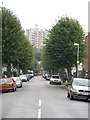
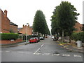
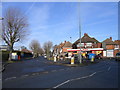
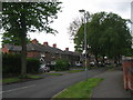
Photos of B23 6LZ
Area Information
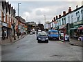
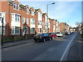
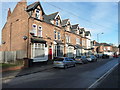
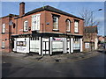
Living in B23 6LZ means being part of a small, tightly knit residential cluster in Erdington, a historic village that evolved into a Birmingham suburb. With a population of 1,556, this area retains a quiet, community-focused character. Centred around the River Tame and Roman roads, Erdington’s origins date back to the 9th century, with its main shopping district at Erdington High Street. The median age of 47 suggests a mature demographic, with adults aged 30–64 forming the majority. This is a place of stability, where 57% of homes are owner-occupied, and the housing stock consists primarily of houses rather than flats. Residents benefit from proximity to multiple railway stations, including Erdington and Chester Road, and a network of retail outlets like Lidl and Co-op. The area’s compact size fosters a sense of familiarity, though its small footprint means amenities are concentrated within a short walk or drive. For those seeking a balance between suburban convenience and historical roots, B23 6LZ offers a distinct blend of tradition and modern practicality.
- Area Type
- Postcode
- Area Size
- Not available
- Population
- 1556
- Population Density
- 8000 people/km²
The property market in B23 6LZ is defined by a 57% home ownership rate, with houses forming the primary accommodation type. This suggests a predominantly owner-occupied area, likely attracting buyers seeking family homes or long-term investments. The small residential cluster means the housing stock is limited in scale, with properties concentrated in a compact footprint. Given the lack of flats or apartments, the market caters more to those preferring single-family dwellings over high-density living. The absence of specific price data means it’s unclear whether this area is more affordable or premium compared to surrounding regions, but the combination of home ownership and house-based housing implies a stable, low-turnover market. Buyers should consider the area’s size when evaluating proximity to amenities, as the small footprint may mean limited options for expansion or alternative properties nearby.
House Prices in B23 6LZ
No properties found in this postcode.
Energy Efficiency in B23 6LZ
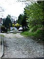
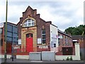
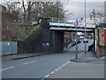
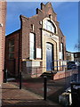
Residents of B23 6LZ have access to a range of amenities within practical reach. Retail options include Lidl BIR Erdington 2, Co-op High, and Heron Erdington, offering everyday shopping needs. The area’s railway stations—Erdington, Chester Road, and Gravelly Hill—provide easy access to Birmingham’s transport network, while metro stops at St Paul’s, St Chads, and Bull Street add to connectivity. For leisure, Rookery Park, once the district’s administrative heart, and Brookvale Park Lake, a former reservoir, offer green spaces for walking or relaxation. The historical backdrop includes Erdington High Street, a major retail corridor, and sites like the former Sir Josiah Mason Orphanage, now Goodison Gardens. This mix of practical retail, transport links, and accessible parks creates a lifestyle that balances convenience with a touch of local heritage.
Amenities
Schools
| Rank | School | Type | Entry gender | Ages |
|---|
Explore more schools in this area
Go to Schools tabDemographics
The population of B23 6LZ is 1,556, with a median age of 47, indicating a community skewed toward middle-aged and older adults. The most common age range is 30–64, reflecting a mature demographic that likely includes families and professionals in their prime working years. Home ownership stands at 57%, suggesting a mix of owner-occupied properties and rental homes, though the exact proportion of renters is not specified. The accommodation type is predominantly houses, which aligns with the area’s suburban character. The predominant ethnic group is White, though no specific diversity statistics are provided. This age profile and housing mix imply a stable, established community with fewer young families compared to other areas. The absence of detailed deprivation data means quality of life factors like access to services or employment opportunities are not quantified here, but the presence of multiple retail and transport hubs suggests reasonable convenience for daily needs.
Household Size
Accommodation Type
Tenure
Ethnic Group
Religion
Household Composition
Age
Household Deprivation
NS-SEC
Explore more demographic insights in this area
Go to Demographics tabPlanning
Planning Constraints
- Flood RiskPremium
- Ramsar Wetland SitesPremium
- Area of Outstanding Natural BeautyPremium
- Protected Nature ReservePremium
- Protected WoodlandPremium