Area Overview for B23 6LY
Photos of B23 6LY
Area Information
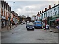
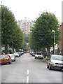
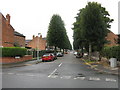
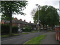
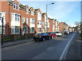
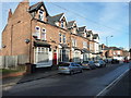
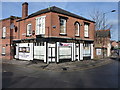
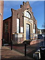
Living in B23 6LY means inhabiting a small, tightly knit residential cluster in Erdington, a suburb of Birmingham with roots tracing back to the 9th century. The area’s population of 1,556 reflects its compact nature, centred around historical landmarks like the River Tame and Chester Road, once a Roman route. Daily life here is shaped by its proximity to Erdington High Street, a thriving retail hub and third-largest shopping district in Birmingham. The community is predominantly middle-aged, with a median age of 47, and many residents are homeowners, owning houses rather than flats. This area is not defined by towering developments but by a mix of traditional housing and pockets of modern development, such as the Sorrel House estate. Its small size means residents are close to amenities, from rail stations to parks, while its history as a village-turned-suburb offers a quiet contrast to Birmingham’s urban sprawl.
- Area Type
- Postcode
- Area Size
- Not available
- Population
- 1556
- Population Density
- 8000 people/km²
The property market in B23 6LY is characterised by a 57% home ownership rate, with houses being the primary accommodation type. This suggests a focus on owner-occupied properties, though the small area size means the housing stock is limited. The presence of houses rather than flats indicates a preference for traditional, family-friendly homes, likely with gardens and more space. For buyers, this means a smaller selection of properties compared to larger urban areas, but proximity to amenities like rail stations and retail hubs may offset this. The area’s compact nature also means that properties are likely to be in close proximity to one another, with limited scope for new developments. Buyers should consider the immediate surroundings, as the small postcode area may not offer the same variety as larger suburbs.
House Prices in B23 6LY
No properties found in this postcode.
Energy Efficiency in B23 6LY
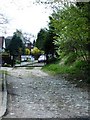
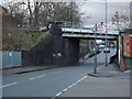
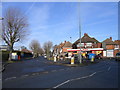
Residents of B23 6LY have access to a range of amenities within practical reach. The area includes five rail stations, such as Erdington Railway Station and Gravelly Hill Railway Station, providing easy access to Birmingham’s transport network. Retail options are plentiful, with five notable stores like Lidl BIR Erdington 2 and Heron Erdington, offering everyday shopping needs. The metro system, with stations like St Paul’s and Bull Street, adds to the connectivity. Parks and green spaces, such as Rookery Park and Brookvale Park Lake, provide recreational opportunities. The historical Erdington High Street remains a focal point for shopping and community activity. This mix of transport, retail, and green spaces creates a balanced lifestyle, blending convenience with a touch of suburban tranquillity.
Amenities
Schools
| Rank | School | Type | Entry gender | Ages |
|---|
Explore more schools in this area
Go to Schools tabDemographics
The population of B23 6LY is 1,556, with a median age of 47, indicating a mature demographic. The most common age group is adults aged 30–64, suggesting a stable, established community. Home ownership here is 57%, with houses being the predominant accommodation type, reflecting a preference for family homes over flats. The predominant ethnic group is White, though no specific data on diversity or deprivation is provided. This age profile implies a focus on long-term residency, with fewer young families or retirees compared to other areas. The 57% home ownership rate suggests a mix of owner-occupied properties and rental stock, though the exact proportion of rentals is not specified. The absence of detailed diversity metrics means the community’s social composition remains partially unexplored in the data.
Household Size
Accommodation Type
Tenure
Ethnic Group
Religion
Household Composition
Age
Household Deprivation
NS-SEC
Explore more demographic insights in this area
Go to Demographics tabPlanning
Planning Constraints
- Flood RiskPremium
- Ramsar Wetland SitesPremium
- Area of Outstanding Natural BeautyPremium
- Protected Nature ReservePremium
- Protected WoodlandPremium