Area Overview for B23 6BZ
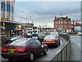
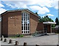
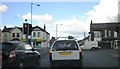
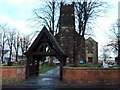
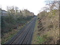
Photos of B23 6BZ


Area Information
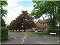
Living in B23 6BZ means inhabiting a compact residential cluster in the Erdington district of Birmingham, part of the Stockland Green ward. With a population of 1,749, it is a small but defined area characterised by suburban living, close to Birmingham’s city centre. The median age of 47 suggests a mature, established community, with the majority of residents falling in the 30-64 age range. Daily life here is shaped by proximity to retail hubs like Tesco Erdington and Farmfoods, as well as accessible rail and metro links. The area is surrounded by open spaces such as Brookvale Park and Witton Lakes, offering recreational opportunities. While the ward’s broader population is higher, B23 6BZ itself reflects a quieter, residential slice of north Birmingham. Its location, just minutes from major roads and transport networks, balances suburban tranquillity with urban connectivity. For those seeking a self-contained, low-maintenance lifestyle with nearby amenities, this postcode offers a blend of practicality and community.
- Area Type
- Postcode
- Area Size
- Not available
- Population
- Not available
- Population Density
- Not available
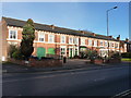
The property market in B23 6BZ is characterised by a 52% home ownership rate, with houses forming the predominant accommodation type. This suggests a mix of owner-occupied homes and rental properties, though the exact proportion of rentals is unspecified. The presence of houses indicates a focus on family-friendly, semi-detached or terraced properties, typical of suburban areas. Given the small postcode area, the housing stock is likely limited in scale, with limited scope for new developments. Buyers should consider the area’s proximity to Birmingham’s city centre, which may influence property values and desirability. The market may appeal to those seeking a low-maintenance, established home with access to transport and amenities, though the relatively low home ownership rate hints at a potential reliance on rental options.
House Prices in B23 6BZ
No properties found in this postcode.
Energy Efficiency in B23 6BZ
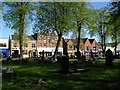
Residents of B23 6BZ have access to a range of amenities within practical reach. Retail options include major supermarkets like Tesco Erdington, Farmfoods Erdington, and Iceland Erdington, ensuring everyday shopping needs are met. The area’s rail and metro stations—Erdington, Gravelly Hill, Chester Road, St Paul’s, St Chads, and Bull Street—provide seamless connectivity to Birmingham’s business districts and cultural hubs. Nearby open spaces such as Brookvale Park, Witton Lakes, and Bleak Hill Park offer recreational opportunities, with active community groups enhancing their appeal. These green spaces, combined with the convenience of retail and transport, create a lifestyle that balances suburban comfort with urban accessibility. The proximity to both nature and infrastructure makes daily life practical and varied.
Amenities
Schools
| Rank | School | Type | Entry gender | Ages |
|---|
Explore more schools in this area
Go to Schools tabDemographics
The community in B23 6BZ is predominantly composed of adults aged 30-64, with a median age of 47. Home ownership stands at 52%, indicating a mix of owner-occupied properties and rental stock. The accommodation type is primarily houses, reflecting a traditional suburban layout. The predominant ethnic group is White, though specific diversity metrics are not provided. The area’s population density—while not explicitly stated—suggests a compact, built-up environment typical of the Erdington district. With no data on deprivation levels, it is unclear how economic factors influence quality of life. However, the presence of retail and transport infrastructure implies accessibility for daily needs. The age profile suggests a stable demographic, potentially with families and professionals seeking a balance between urban proximity and residential comfort.
Household Size
Accommodation Type
Tenure
Ethnic Group
Religion
Household Composition
Age
Household Deprivation
NS-SEC
Explore more demographic insights in this area
Go to Demographics tabPlanning
Planning Constraints
- Flood RiskPremium
- Ramsar Wetland SitesPremium
- Area of Outstanding Natural BeautyPremium
- Protected Nature ReservePremium
- Protected WoodlandPremium