Area Overview for B23 6BL
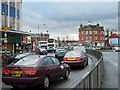
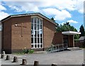
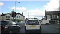
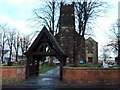
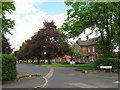
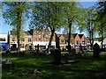
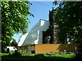
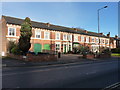
Photos of B23 6BL


Area Information
Living in B23 6BL, a small residential cluster in Gravelly Hill, Birmingham, means being part of an inner-city ward with a distinct character. The postcode area has a population of 1,738, reflecting a compact, tight-knit community. Gravelly Hill lies approximately 4 miles north-east of Birmingham’s city centre, bordered by areas like Erdington and Stockland Green. Historically, it was part of the Erdington constituency and saw development during Birmingham’s industrial expansion. Today, it blends Victorian and pre-war housing with newer apartment blocks, catering to both long-term residents and students drawn by its proximity to Aston University. The area’s transport links to the university and nearby railway stations make it accessible for commuters, while its compact size ensures a mix of urban convenience and local charm. Daily life here balances the practicality of city living with the quietude of a well-defined neighbourhood, though the small population means it remains a niche, less densely populated corner of Birmingham.
- Area Type
- Postcode
- Area Size
- Not available
- Population
- 1738
- Population Density
- 6611 people/km²
The property market in B23 6BL is characterised by a low home ownership rate of 35%, indicating that the majority of housing is rented. The accommodation type is predominantly flats, reflecting a mix of older Victorian and pre-war buildings alongside newer developments. This suggests a rental-focused market with limited owner-occupied properties, which may appeal to students or professionals seeking short-term housing. The small postcode area means the housing stock is concentrated, with limited scope for expansion. For buyers, this could present challenges, as the market is not driven by long-term investment but by transient demand. The presence of flats may also mean that properties are smaller, with fewer options for larger families. However, the area’s proximity to Aston University and transport links could make it attractive to those seeking affordable, convenient housing in a city-centre location.
House Prices in B23 6BL
No properties found in this postcode.
Energy Efficiency in B23 6BL
Residents of B23 6BL have access to a range of nearby amenities, including five retail venues such as Tesco Erdington, Farmfoods Erdington, and Iceland Erdington. These shops provide essential grocery and household goods, supporting daily convenience. The area’s transport links also connect residents to broader city amenities, though local leisure or recreational facilities are not explicitly detailed. The presence of multiple railway and metro stations enhances accessibility to Birmingham’s cultural and commercial hubs. The mix of retail options and transport connectivity contributes to a practical, urban lifestyle, ideal for those prioritising ease of access over expansive green spaces. While the data does not mention parks or leisure centres, the area’s proximity to Aston University may offer additional recreational opportunities. Overall, the lifestyle in B23 6BL balances urban practicality with the compactness of a small postcode area.
Amenities
Schools
The schools nearest to B23 6BL include St Mary and St John Junior and Infant School, a primary school, and St John Earlswood and St John’s Children’s Resource Centre, both categorised as other educational institutions. While no Ofsted ratings are provided, the presence of a primary school suggests the area is suitable for families with young children. The mix of school types indicates a range of educational options, from early years provision to additional support services. However, the absence of secondary schools within the immediate vicinity may require families to travel to nearby areas for comprehensive schooling. The data does not specify the distance to these schools, but their inclusion in the area’s amenities implies a focus on local education provision. For families prioritising proximity to schools, this mix offers some convenience, though further research into specific school performance would be necessary.
| Rank | School | Type | Entry gender | Ages |
|---|
Explore more schools in this area
Go to Schools tabDemographics
The residents of B23 6BL have a median age of 47, with the most common age range being adults aged 30–64. This suggests a mature, stable population, likely including professionals and families. Home ownership in the area is relatively low at 35%, indicating that 65% of households are renters. The accommodation type is predominantly flats, reflecting a mix of older housing stock and modern developments. The predominant ethnic group is White, though the data does not specify the proportion of other ethnicities. The small population of 1,738 means the community is tightly knit, with limited diversity in household composition. The age profile and rental market suggest a balance between long-term residents and transient occupants, such as students or workers commuting to nearby areas. The lack of detailed deprivation data means quality of life factors like access to services or economic hardship are not quantified here.
Household Size
Accommodation Type
Tenure
Ethnic Group
Religion
Household Composition
Age
Household Deprivation
NS-SEC
Explore more demographic insights in this area
Go to Demographics tabPlanning
Planning Constraints
- Flood RiskPremium
- Ramsar Wetland SitesPremium
- Area of Outstanding Natural BeautyPremium
- Protected Nature ReservePremium
- Protected WoodlandPremium