Area Overview for B23 5ZA
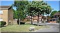
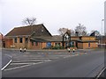
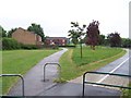
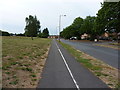
Photos of B23 5ZA


Area Information
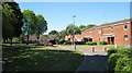
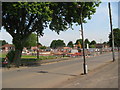
B23 5ZA lies in the suburban heart of north Birmingham, part of Perry Common, a historically significant ward shaped by early 20th-century housing developments. This small postcode area, home to 1,406 residents, sits on land once farmed and later transformed into inter-war council housing. Its character is defined by post-war Boot Houses, which were redeveloped in the 1990s through community-led efforts. The area’s compact size and residential focus create a tight-knit feel, with a population skewed toward adults aged 30–64. Daily life here balances suburban tranquillity with proximity to rail and metro links, enabling easy access to Birmingham’s broader network. The community’s legacy of resident-led housing management, via the Witton Lodge Community Association, underscores a shared commitment to maintaining local identity. While the area lacks large commercial hubs, its modest scale and low crime rates offer a quieter alternative to the city’s busier districts. For those seeking a self-contained, family-friendly environment with a distinct historical footprint, B23 5ZA presents a compelling case.
- Area Type
- Postcode
- Area Size
- Not available
- Population
- 1406
- Population Density
- 3063 people/km²
B23 5ZA is predominantly an owner-occupied area, with 82% of homes owned by residents rather than rented. The housing stock is almost entirely composed of houses, reflecting a suburban layout that contrasts with Birmingham’s more densely populated zones. This makes the area attractive to families seeking space and stability, though the limited number of properties means the market is small and niche. The redevelopment of former council housing in the 1990s has left a legacy of well-maintained, family-friendly homes, many of which are still in private ownership. For buyers, the compact nature of the postcode means competition is concentrated within a tight radius, and proximity to rail and metro stations adds to its appeal for commuters. However, the lack of major commercial or industrial employers nearby may limit opportunities for those seeking work in the area.
House Prices in B23 5ZA
No properties found in this postcode.
Energy Efficiency in B23 5ZA
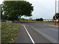
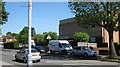
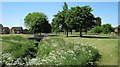
Living in B23 5ZA offers a mix of practical amenities and suburban convenience. Within practical reach are five retail outlets, including Morrisons Daily, Aldi New, and Lidl New, providing everyday shopping needs. The area’s rail and metro connections—Chester Road, Wylde Green, and Erdington stations—offer easy access to Birmingham’s cultural and commercial hubs. While there are no major parks or leisure facilities listed, the area’s historical roots in farmland suggest open spaces may have been repurposed into residential zones. The community’s focus on housing management through the Witton Lodge Community Association implies a strong local network, though the absence of named parks or restaurants means leisure options are limited to nearby Birmingham districts. For those prioritising retail and transport over expansive green spaces, B23 5ZA delivers a functional, low-maintenance lifestyle.
Amenities
Schools
| Rank | School | Type | Entry gender | Ages |
|---|
Explore more schools in this area
Go to Schools tabDemographics
The population of B23 5ZA skews older than Birmingham’s average, with a median age of 47 and 62.5% of residents aged 16–64. The majority of households are owner-occupied (82%), with housing stock predominantly consisting of houses rather than flats. The predominant ethnic group is White, reflecting a lower proportion of Black, Asian, and minority ethnic (BAME) residents compared to the city as a whole (38.2% vs. 50.5%). Child poverty here is notably higher than the city average, with 32.9% of children in low-income households. This statistic highlights socioeconomic challenges, though it also fosters a community-oriented ethos, as seen in the long-standing resident associations managing local housing. The age profile suggests a stable, middle-aged population, potentially appealing to families seeking established, low-maintenance housing.
Household Size
Accommodation Type
Tenure
Ethnic Group
Religion
Household Composition
Age
Household Deprivation
NS-SEC
Explore more demographic insights in this area
Go to Demographics tabPlanning
Planning Constraints
- Flood RiskPremium
- Ramsar Wetland SitesPremium
- Area of Outstanding Natural BeautyPremium
- Protected Nature ReservePremium
- Protected WoodlandPremium