Area Overview for B23 5YE
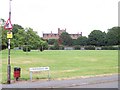
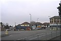
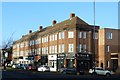
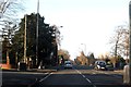
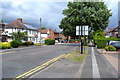
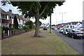
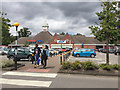
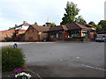
Photos of B23 5YE


Area Information
B23 5YE sits within Perry Common, a suburban ward in north Birmingham rooted in the inter-war council housing estates. The postcode covers a compact residential cluster of 3.5 hectares, housing a population of 1,406 residents. This specific density creates a tight-knit community feel typical of estate developments built on former farmland. You will find yourself in an area defined by Whitton Lodge Farm's legacy, where the land transitioned from open fields to structured housing centuries ago. The ward's broader context involves a history of regeneration, including the rehousing efforts of the Perry Common Residents Association. Living in B23 5YE means adopting a lifestyle centred around established neighbourhood structures rather than new developments. The area falls under the district electoral ward of Birmingham City Council, offering a governance framework familiar to local authorities. Despite its modest footprint, the postcode area supports a functional community with a distinct identity. You are accessing a slice of a larger 12,048-strong ward that balances suburban living with city proximity. The character here is practical, shaped by decades of residents working to maintain their estate after the decline of earlier prefab homes.
- Area Type
- Postcode
- Area Size
- 3.5 hectares
- Population
- 1406
- Population Density
- 3063 people/km²
The property market in B23 5YE is heavily skewed towards owner-occupiers with an 82 per cent home ownership rate. Houses dominate the housing stock in this posture, consistent with the area's development as a council estate. You will not find a significant presence of rental properties or new-build complexes driving the immediate local market. This high ownership level suggests that homes in B23 5YE have passed through multiple private hands over the decades. Buyers looking at this small postcode area should expect established character homes, likely ranging from 2 to 3 bedrooms based on the historical footprint of the estate. The accommodation type is strictly houses, which differentiates it from flats or apartments found in other Birmingham wards. This texture makes sense for the suburban nature of the ward, where spacious 2- or 3-bedroom units were originally built for families leaving the inner city. The market reflects a slow-paced turnover typical of mature estates where residents choose to stay long term. Investing here means joining a community where property values are supported by stability rather than rapid turnover.
House Prices in B23 5YE
Showing 31 properties
| Address | Type | Beds | Baths | Last Sale Price | Last Sale Date | |
|---|---|---|---|---|---|---|
| 33 College Farm Drive, Birmingham, B23 5YE | Semi-detached | 3 | 1 | £245,000 | Aug 2025 | |
| 3 College Farm Drive, Birmingham, B23 5YE | Semi-detached | 3 | 1 | £270,000 | Nov 2024 | |
| 6 College Farm Drive, Birmingham, B23 5YE | Bungalow | 3 | 1 | £275,000 | Sep 2024 | |
| 39 College Farm Drive, Birmingham, B23 5YE | Semi-detached | 3 | 1 | £255,000 | Jul 2024 | |
| 36 College Farm Drive, Birmingham, B23 5YE | house | - | - | £340,000 | Apr 2023 | |
| 17 College Farm Drive, Birmingham, B23 5YE | house | 3 | - | £315,000 | Feb 2023 | |
| 8 College Farm Drive, Birmingham, B23 5YE | Bungalow | 3 | 1 | £285,000 | Aug 2022 | |
| 27 College Farm Drive, Birmingham, B23 5YE | Maisonette | 1 | 1 | £100,000 | Nov 2020 | |
| 16 College Farm Drive, Birmingham, B23 5YE | Bungalow | 3 | - | £234,950 | Sep 2015 | |
| 11 College Farm Drive, Birmingham, B23 5YE | house | 4 | - | £195,000 | Oct 2011 |
Energy Efficiency in B23 5YE
Residents of B23 5YE enjoy practical access to a range of amenities within practical reach of their homes. Local retail options include Aldi New, Lidl New, and Tesco New, ensuring you have choices for groceries and daily essentials nearby. Transport links are well developed with five railway stations in the vicinity, including Wylde Green Railway Station, Chester Road Railway Station, and Erdington Railway Station. These rail connections facilitate easy commutes into Birmingham city centre or other regional hubs. For those using the Metro system, nearby stops include St Paul's, St Chad's, and Soho Benson Road, offering flexible public transport routes. While the area is residential, the presence of these key transport nodes ensures you are not isolated from the wider city economy. The proximity to Wylde Green and Erdington stations is particularly valuable for daily commutes without needing a car. Living in B23 5YE grants you the convenience of major supermarkets and train lines close to your doorstep, blending suburban comfort with urban accessibility.
Amenities
Schools
| Rank | School | Type | Entry gender | Ages |
|---|
Explore more schools in this area
Go to Schools tabDemographics
The community in B23 5YE features a mature demographic profile with a median age of 47 years. Adults between 30 and 64 years represent the most common age range, indicating a settled workforce and family unit presence. Home ownership stands at an impressive 82 per cent for the residents within this postcode. Houses form the predominant accommodation type, aligning with the estate's historical development of 2- or 3-bedroom homes for city families relocating here. The predominant ethnic group is White, reflecting the demographic composition of the wider West Midlands region. Although specific city-wide deprivation statistics for the ward exist in broader data, the local character is shaped by a community-focused atmosphere resulting from successful housing regeneration projects. You are looking at a neighbourhood where long-term residents have prioritised stability. The age distribution suggests a reliance on established housing stock rather than transient rental markets. This demographic stability supports local businesses and community associations that thrive in areas with high owner occupancy. The resident-led nature of the community, evident in groups like the Witton Lodge Community Association, ensures that local issues receive focused attention from people who call this postcode their home.
Household Size
Accommodation Type
Tenure
Ethnic Group
Religion
Household Composition
Age
Household Deprivation
NS-SEC
Explore more demographic insights in this area
Go to Demographics tabPlanning
Planning Constraints
- Flood RiskPremium
- Ramsar Wetland SitesPremium
- Area of Outstanding Natural BeautyPremium
- Protected Nature ReservePremium
- Protected WoodlandPremium