Area Overview for B23 5WD
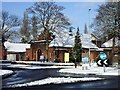
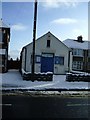
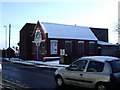
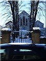
Photos of B23 5WD

Area Information
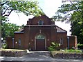
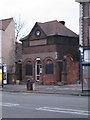
Living in B23 5WD places you in a small, residential cluster within the Erdington area of Birmingham, a historic suburb with roots tracing back to the Domesday Book. The postcode covers around 1,871 residents, forming a tight-knit community centred on Erdington High Street, one of Birmingham’s largest retail districts. This area, once a village near the River Tame, now sits at the edge of the city, blending suburban tranquillity with proximity to Birmingham’s urban core. Daily life here is shaped by its compact size, with a focus on local amenities, historic landmarks like St Barnabas Church, and a mix of modern and traditional housing. The area’s character is defined by its walkable streets, rail links, and a community that reflects its long-standing role as a Birmingham suburb. For buyers, B23 5WD offers a snapshot of suburban living with a distinct historical backdrop, though its small footprint means the surrounding areas are key for broader connectivity and services.
- Area Type
- Postcode
- Area Size
- Not available
- Population
- 1871
- Population Density
- 10412 people/km²
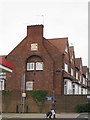
The property market in B23 5WD is shaped by its low home ownership rate of 22%, suggesting that the area is more rental-oriented than owner-occupied. The accommodation type is primarily houses, which are typically family homes, but the limited number of homeowners may mean that rental properties dominate the market. This dynamic could make it challenging for buyers seeking long-term investment, as the area’s small size and focus on rental housing may limit availability. For those considering purchase, the presence of houses implies a potential for larger properties, though the low home ownership rate indicates competition among renters. Buyers should also consider the area’s proximity to Birmingham’s wider infrastructure, as the immediate surroundings may offer more varied housing options. The market’s character reflects a suburban suburb with a mix of traditional housing stock, but its small scale means that the broader Erdington area is crucial for comprehensive property search.
House Prices in B23 5WD
No properties found in this postcode.
Energy Efficiency in B23 5WD
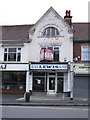
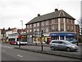
The lifestyle in B23 5WD is enriched by its mix of retail, transport, and historical features. Nearby amenities include Tesco Erdington, Co-op Sutton, and Sainsburys Wylde Green, providing everyday shopping convenience. The area’s proximity to five rail stations and five metro stops, including St Paul’s and St Chads, ensures easy access to Birmingham’s broader network. Historically, Erdington High Street remains a focal point, blending modern retail with the area’s heritage. Parks and green spaces, such as Rookery Park and Brookvale Park Lake, offer recreational opportunities, while landmarks like St Barnabas Church and the former Sir Josiah Mason Orphanage site add character. This blend of practical amenities and historical context creates a balanced lifestyle, though the area’s small size means residents may need to venture further for more extensive leisure options.
Amenities
Schools
The schools nearest to B23 5WD include Abbey Catholic Primary School, a primary school, and Underwood School, a special school. Both institutions are located within practical reach of residents, offering a range of educational options for families. The presence of a primary school caters to the area’s young population, while the special school provides tailored support for students with specific needs. This combination suggests a community that prioritises both general and specialist education, though the lack of secondary schools means families may need to look further afield for comprehensive schooling. The proximity of these schools reinforces the area’s appeal to families, though buyers should verify transport links to nearby secondary institutions. The mix of school types reflects the area’s demographic focus on children and the importance of accessible education.
| Rank | School | Type | Entry gender | Ages |
|---|
Explore more schools in this area
Go to Schools tabDemographics
The population of B23 5WD is heavily skewed towards young families, with a median age of 22 and children under 14 making up the most common age group. This suggests a community focused on raising families, though home ownership is relatively low at 22%, indicating a higher proportion of renters. The accommodation type is predominantly houses, which aligns with the suburban character of the area but contrasts with the higher rental rates. The predominant ethnic group is White, reflecting the area’s historical demographic patterns. While specific deprivation data is not provided, the low home ownership rate may indicate financial pressures on households, potentially affecting access to private services or investment in property. The age profile implies a demand for family-friendly amenities, such as schools and parks, which are present in the vicinity.
Household Size
Accommodation Type
Tenure
Ethnic Group
Religion
Household Composition
Age
Household Deprivation
NS-SEC
Explore more demographic insights in this area
Go to Demographics tabPlanning
Planning Constraints
- Flood RiskPremium
- Ramsar Wetland SitesPremium
- Area of Outstanding Natural BeautyPremium
- Protected Nature ReservePremium
- Protected WoodlandPremium