Area Overview for B23 5TQ
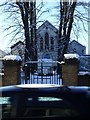
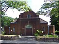
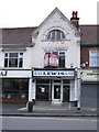
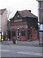
Photos of B23 5TQ
Area Information
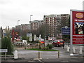
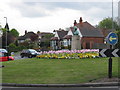
B23 5TQ is a small residential postcode in England, part of the Erdington area within Birmingham’s West Midlands. With a population of 1,765, it reflects a quiet, mature community centred around historical and suburban features. The area originated as a village near the River Tame, evolving into a Birmingham suburb with a main retail corridor at Erdington High Street. Today, it retains a mix of older housing stock and modern developments, such as the Pype Hayes area with homes like Sorrel House. The postcode’s proximity to Chester Road, a former Roman route, and the Birmingham Fazeley Canal adds a layer of historical continuity. Daily life here balances suburban convenience with access to nearby amenities, from retail hubs to rail networks. Its compact size means residents are close to schools, transport links, and green spaces like Rookery Park, making it a practical choice for those seeking a settled, community-focused lifestyle.
- Area Type
- Postcode
- Area Size
- Not available
- Population
- 1765
- Population Density
- 5094 people/km²
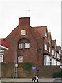
B23 5TQ is primarily an owner-occupied area, with 66% of homes owned by residents rather than rented. The accommodation type is predominantly houses, suggesting a focus on family homes and suburban living. This contrasts with areas where flats or rental properties dominate, indicating a market skewed towards long-term residency rather than transient occupancy. The small postcode area’s housing stock likely includes a mix of older, established homes and newer developments, such as the modern properties in Pype Hayes. For buyers, this means a limited but cohesive housing stock, where properties are likely to be in private hands and less subject to rental market fluctuations. The concentration of houses also implies a preference for larger, more private living spaces, which may appeal to families or those seeking space in a suburban setting.
House Prices in B23 5TQ
No properties found in this postcode.
Energy Efficiency in B23 5TQ
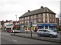
B23 5TQ offers a range of amenities within practical reach. Retail options include Tesco Erdington, Co-op Sutton, and Sainsburys Wylde, providing everyday shopping needs. The area’s rail and metro stations connect residents to broader Birmingham, while nearby parks like Rookery Park and Brookvale Park Lake offer green spaces for leisure. The former Sir Josiah Mason Orphanage site, now Goodison Gardens, and the Birmingham Fazeley Canal add historical and recreational value. The mix of retail, transport, and open spaces supports a convenient, balanced lifestyle. While the area’s compact size limits sprawling commercial districts, its proximity to Erdington High Street and local parks ensures a sense of community and accessibility.
Amenities
Schools
Near B23 5TQ are three schools: St Edmund Campion Catholic School & Sixth Form Centre, a primary school; Inspirations Independent School, a special needs institution; and St Edmund Campion Catholic School, an academy. The presence of a primary school and an academy offers options for early education and secondary schooling, while the special school caters to specific needs. This mix suggests a range of educational provision, though no Ofsted ratings are provided. Families may benefit from the proximity of multiple institutions, though the absence of comprehensive data on school performance means prospective buyers must investigate further. The schools’ types reflect both mainstream and specialist education, aligning with the area’s demographic focus on families.
| Rank | School | Type | Entry gender | Ages |
|---|
Explore more schools in this area
Go to Schools tabDemographics
The population of B23 5TQ has a median age of 47, with the majority of residents aged between 30 and 64. This suggests a community of working-age adults and families, reflecting a stable, mature demographic. Home ownership is high at 66%, with houses being the predominant type of accommodation. The White ethnic group forms the largest proportion of the population, though specific diversity metrics are not detailed. The age profile indicates a balance between established residents and younger families, though the absence of data on younger age groups or rental demographics means the area’s full composition remains partially opaque. The 66% home ownership rate implies a strong local presence, with many residents likely invested in the area’s long-term development.
Household Size
Accommodation Type
Tenure
Ethnic Group
Religion
Household Composition
Age
Household Deprivation
NS-SEC
Explore more demographic insights in this area
Go to Demographics tabPlanning
Planning Constraints
- Flood RiskPremium
- Ramsar Wetland SitesPremium
- Area of Outstanding Natural BeautyPremium
- Protected Nature ReservePremium
- Protected WoodlandPremium