Area Overview for B23 5SG
Photos of B23 5SG
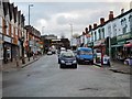

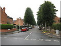
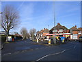
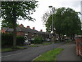
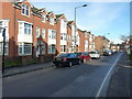
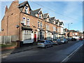
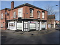
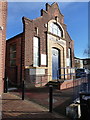
51 photos from this area
Area Information
Key information about the B23 5SG including its size, population, and administrative classification.
- Area Type
- Postcode
- Area Size
- 4996 m²
- Population
- 1556
- Population Density
- 8000 people/km²
House Prices in B23 5SG
19
Properties
£70,874
Average Sold Price
£33,000
Lowest Price
£125,000
Highest Price
Showing 19 properties
| Address | Type | Beds | Baths | Last Sale Price | Last Sale Date | |
|---|---|---|---|---|---|---|
| 201 Gravelly Lane, Erdington, Birmingham, B23 5SG | Maisonette | 2 | 1 | £125,000 | May 2022 | |
| 211 Gravelly Lane, Erdington, Birmingham, B23 5SG | Maisonette | 2 | 1 | £76,500 | Sep 2020 | |
| 215 Gravelly Lane, Erdington, Birmingham, B23 5SG | Maisonette | 2 | 1 | £105,000 | Mar 2020 | |
| 205 Gravelly Lane, Erdington, Birmingham, B23 5SG | Maisonette | 2 | 1 | £79,995 | Mar 2008 | |
| 209 Gravelly Lane, Erdington, Birmingham, B23 5SG | Flat | - | - | £48,000 | Sep 2001 | |
| 189A Gravelly Lane, Erdington, Birmingham, B23 5SG | Flat | - | - | £33,000 | Aug 1998 | |
| Flat, 181 Gravelly Lane, Erdington, Birmingham, B23 5SG | Maisonette | - | - | £57,000 | Jun 1998 | |
| 217 Gravelly Lane, Erdington, Birmingham, B23 5SG | Flat | - | - | £42,500 | Sep 1997 | |
| Flat, 185-187 Gravelly Lane, Erdington, Birmingham, B23 5SG | Semi-detached | 3 | 2 | - | - | |
| Flat, 189 Gravelly Lane, Erdington, Birmingham, B23 5SG | Flat | - | - | - | - |
Page 1 of 2
Energy Efficiency in B23 5SG
Amenities
Schools
| Rank | School | Type | Entry gender | Ages |
|---|
Explore more schools in this area
Go to Schools tabDemographics
Household Size
One person
most common
Accommodation Type
Houses
most common
Tenure
57
majority
Ethnic Group
White
most common
Religion
N/A
most common
Household Composition
N/A
most common
Age
47
median
Adults (30-64 years)
most common
Household Deprivation
N/A
with no deprivation
NS-SEC
30
in Lower managerial occupations
Explore more demographic insights in this area
Go to Demographics tabPlanning
Planning Constraints
- Flood RiskPremium
- Ramsar Wetland SitesPremium
- Area of Outstanding Natural BeautyPremium
- Protected Nature ReservePremium
- Protected WoodlandPremium