Area Overview for B23 5RG
Photos of B23 5RG
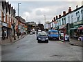
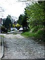

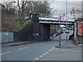
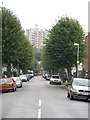
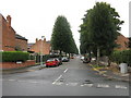
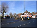
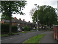
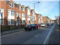
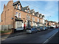
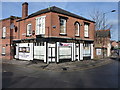
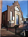
51 photos from this area
Area Information
Key information about the B23 5RG including its size, population, and administrative classification.
- Area Type
- Postcode
- Area Size
- 1.3 hectares
- Population
- 1593
- Population Density
- 7134 people/km²
House Prices in B23 5RG
46
Properties
£153,996
Average Sold Price
£42,950
Lowest Price
£245,000
Highest Price
Showing 46 properties
| Address | Type | Beds | Baths | Last Sale Price | Last Sale Date | |
|---|---|---|---|---|---|---|
| 162 Court Lane, Erdington, Birmingham, B23 5RG | house | 3 | 1 | £220,000 | Aug 2025 | |
| 120 Court Lane, Erdington, Birmingham, B23 5RG | Semi-detached | 3 | - | £245,000 | Mar 2025 | |
| 172 Court Lane, Erdington, Birmingham, B23 5RG | Semi-detached | 3 | 1 | £142,000 | Jul 2023 | |
| 156 Court Lane, Erdington, Birmingham, B23 5RG | Semi-detached | 3 | 1 | £235,000 | Jan 2023 | |
| 152 Court Lane, Erdington, Birmingham, B23 5RG | house | - | - | £180,000 | Feb 2022 | |
| 118 Court Lane, Erdington, Birmingham, B23 5RG | Semi-detached | 3 | - | £210,000 | Jan 2022 | |
| 176 Court Lane, Erdington, Birmingham, B23 5RG | Semi-detached | 2 | 1 | £165,000 | Oct 2020 | |
| 148 Court Lane, Erdington, Birmingham, B23 5RG | Semi-detached | 3 | 1 | £150,500 | Dec 2018 | |
| 144 Court Lane, Erdington, Birmingham, B23 5RG | Semi-detached | 3 | 1 | £147,000 | Feb 2018 | |
| 158 Court Lane, Erdington, Birmingham, B23 5RG | Semi-detached | 3 | 1 | £125,000 | Sep 2016 |
Page 1 of 5
Energy Efficiency in B23 5RG
Amenities
Schools
| Rank | School | Type | Entry gender | Ages |
|---|
Explore more schools in this area
Go to Schools tabDemographics
Household Size
Family (3-5 people)
most common
Accommodation Type
Houses
most common
Tenure
51
majority
Ethnic Group
White
most common
Religion
N/A
most common
Household Composition
N/A
most common
Age
47
median
Adults (30-64 years)
most common
Household Deprivation
N/A
with no deprivation
NS-SEC
17
in Lower managerial occupations
Explore more demographic insights in this area
Go to Demographics tabPlanning
Planning Constraints
- Flood RiskPremium
- Ramsar Wetland SitesPremium
- Area of Outstanding Natural BeautyPremium
- Protected Nature ReservePremium
- Protected WoodlandPremium