Area Overview for B23 5NB
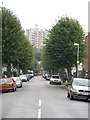
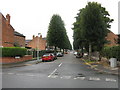
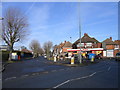
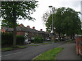
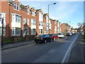
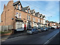
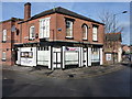
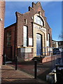
Photos of B23 5NB
Area Information
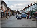
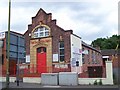
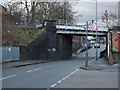
B23 5NB is a small, tightly knit residential postcode in north Birmingham, part of the Perry Common area, known for its inter-war council housing. With a population of 1,487, it reflects a suburban character shaped by mid-20th-century development on former farmland. The area’s demographics suggest a community of mostly middle-aged residents, with 60% owning their homes and the majority living in houses. This contrasts with Birmingham’s broader urban fabric, offering a quieter, more stable environment. Proximity to rail and metro stations, including Erdington and St Paul’s, ensures easy access to the city’s transport network. A nearby primary school, Featherstone Primary, rated ‘good’ by Ofsted, adds to the appeal for families. Digital connectivity is strong, with broadband scoring 100 and mobile coverage at 85. While crime rates are average, the area’s low flood risk and lack of environmental constraints make it practical for long-term living. Its compact size means residents are close to amenities, though the community’s character is defined by its history of resident-led housing regeneration, which continues to influence its social fabric.
- Area Type
- Postcode
- Area Size
- Not available
- Population
- 1487
- Population Density
- 5459 people/km²
B23 5NB is predominantly an owner-occupied area, with 60% of residents owning their homes. The accommodation type is largely houses, reflecting the area’s inter-war housing stock of “Boot Houses” originally built for rehousing city families. This contrasts with newer developments in Birmingham, which often feature apartments or flats. The small postcode area means the housing stock is limited, with most properties concentrated in the original council estate. While redevelopment efforts, such as those managed by the Witton Lodge Community Association, have modernised parts of the area, the overall market remains focused on existing homes rather than new builds. For buyers, this means a stable but constrained market, with opportunities for family homes but limited scope for investment in rental properties. The area’s history of community-led regeneration also suggests a strong sense of local identity, which may influence property values and desirability.
House Prices in B23 5NB
No properties found in this postcode.
Energy Efficiency in B23 5NB
B23 5NB offers a modest but practical lifestyle, with amenities within walking or short driving distance. The area has five retail outlets, including Co-op Marsh, Spar, and Morrisons Daily, providing essential shopping options. Rail and metro stations are within reach, connecting residents to Birmingham’s cultural and commercial hubs. While the area lacks large parks or leisure facilities, its suburban setting offers a quieter alternative to the city’s busier zones. The community’s focus on resident-led initiatives, such as the Witton Lodge Community Association, fosters a sense of cohesion. Daily life here is defined by convenience, with amenities meeting basic needs but not extravagant indulgences. The compact size of the postcode means residents are close to each other, contributing to a familiar, neighbourly atmosphere.
Amenities
Schools
The nearest school to B23 5NB is Featherstone Primary School, a primary institution rated ‘good’ by Ofsted. This provides a solid foundation for young children, though the area lacks secondary schools, meaning families may need to look beyond the immediate vicinity for secondary education. The presence of a well-rated primary school is a key draw for families, aligning with the area’s demographic profile of adults aged 30–64, many of whom may be parents. While the school’s ‘good’ rating indicates satisfactory standards, the absence of a secondary school could be a limitation for households requiring full-cycle education. Parents should consider proximity to other schools in nearby wards, such as Erdington or Nechells, which may offer more comprehensive options.
| Rank | School | Type | Entry gender | Ages |
|---|
Explore more schools in this area
Go to Schools tabDemographics
The population of B23 5NB is 1,487, with a median age of 47, reflecting a community skewed toward adults aged 30–64. Home ownership stands at 60%, with houses being the dominant accommodation type. The predominant ethnic group is White, and the area has a lower proportion of BAME residents compared to Birmingham overall. Child poverty here is 32.9%, affecting 1,095 children in low-income households, which ranks 34th citywide. This statistic highlights challenges in economic stability but also underscores the community’s focus on grassroots initiatives, such as the Witton Lodge Community Association, which manages 200 homes. The older age profile suggests a settled population, with fewer young families than the city average. While the area’s demographics indicate a stable, mature community, the higher child poverty rate may impact local services and opportunities for families.
Household Size
Accommodation Type
Tenure
Ethnic Group
Religion
Household Composition
Age
Household Deprivation
NS-SEC
Explore more demographic insights in this area
Go to Demographics tabPlanning
Planning Constraints
- Flood RiskPremium
- Ramsar Wetland SitesPremium
- Area of Outstanding Natural BeautyPremium
- Protected Nature ReservePremium
- Protected WoodlandPremium