Area Overview for B23 5LU
Photos of B23 5LU


Area Information
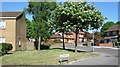
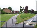
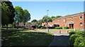
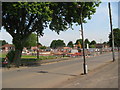
Living in B23 5LU means inhabiting a small, tightly knit residential cluster in north Birmingham, where the population of 1,593 reflects a community shaped by post-war housing developments. This area, part of the Perry Common ward, was originally built on farmland in the 1920s as a council estate of spacious “Boot Houses” intended for rehousing families. While much of the original concrete prefab housing has been redeveloped, the area retains a suburban character with a focus on family-oriented living. The median age of 47 suggests a mature demographic, with many residents in their prime working years. Proximity to rail and metro stations, combined with a mix of retail amenities, ensures practical connectivity. However, the area’s identity is rooted in its history of community-led regeneration, with local groups like the Witton Lodge Community Association playing a key role in shaping its present. For buyers, B23 5LU offers a blend of stability, practicality, and a sense of place that reflects its inter-war origins.
- Area Type
- Postcode
- Area Size
- Not available
- Population
- 1593
- Population Density
- Not available
The property market in B23 5LU is characterised by a 51% home ownership rate, with houses forming the majority of the accommodation stock. This suggests a mix of owner-occupied and rental properties, though the exact proportion of rentals is not specified. The presence of houses, rather than flats, indicates a focus on family homes, likely with larger living spaces. Given the area’s history of council housing redevelopment, many properties may be semi-detached or terraced, reflecting the inter-war “Boot House” design. For buyers, this small postcode area offers a stable market with homes that cater to established families. However, the limited size of the area means that property choices are constrained, requiring buyers to consider nearby suburbs for more options. The housing stock’s age and condition may also influence renovation potential and long-term value.
House Prices in B23 5LU
No properties found in this postcode.
Energy Efficiency in B23 5LU
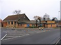
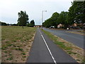
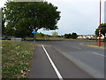
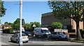
Daily life in B23 5LU is shaped by its proximity to retail, transport, and community hubs. The area’s five retail outlets, including Morrisons Daily and Aldi, provide convenient access to groceries and household goods. For transport, residents can reach five rail stations and three metro stops, facilitating easy travel to Birmingham’s business districts or surrounding suburbs. Parks and open spaces are not explicitly named in the data, but the area’s suburban character suggests nearby green spaces for leisure. The presence of multiple retail and transport nodes fosters a practical, accessible lifestyle, ideal for families and commuters. While the data does not detail dining or leisure venues, the area’s connectivity implies a range of off-site options within a short journey.
Amenities
Schools
The nearest schools to B23 5LU include Court Farm Primary School, which serves the area’s primary education needs. While the data lists this school twice, it is the only named institution provided. As a primary school, it caters to younger children, though secondary education options are not specified. Families relying on this school may need to consider commuting to nearby secondary schools, as no local secondary institutions are mentioned. The absence of data on school Ofsted ratings or performance means buyers must research independently to assess educational quality. However, the presence of a primary school within reach supports families with young children, offering a foundation for local schooling.
| Rank | School | Type | Entry gender | Ages |
|---|
Explore more schools in this area
Go to Schools tabDemographics
The population of B23 5LU is 1,593, with a median age of 47, indicating a community skewed toward middle-aged adults. The most common age range is 30–64 years, suggesting a workforce-centric demographic. Home ownership sits at 51%, with houses being the predominant accommodation type. This aligns with the area’s history of council-built housing, many of which have been redeveloped into family homes. The predominant ethnic group is White, reflecting a lower proportion of BAME residents compared to Birmingham as a whole. While the data does not specify deprivation levels, the area’s child poverty rate of 32.9% (citywide rank 34th) highlights socioeconomic challenges that influence local services and community dynamics. These factors contribute to a community-focused atmosphere, where resident-led initiatives have historically addressed housing and social needs.
Household Size
Accommodation Type
Tenure
Ethnic Group
Religion
Household Composition
Age
Household Deprivation
NS-SEC
Explore more demographic insights in this area
Go to Demographics tabPlanning
Planning Constraints
- Flood RiskPremium
- Ramsar Wetland SitesPremium
- Area of Outstanding Natural BeautyPremium
- Protected Nature ReservePremium
- Protected WoodlandPremium
- Crime RiskPremium