Area Overview for B23 5GR
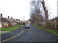
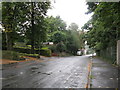
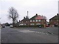
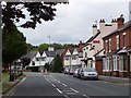
Photos of B23 5GR


Area Information
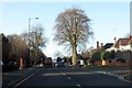
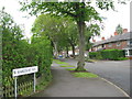
B23 5GR is a specific postcode area within the Erdington Ward, covering a small residential cluster in Birmingham, West Midlands. This location sits within the broader Erdington district, a borough unitary ward that formed the core of the constituency when it separated from Sutton Coldfield in 1974. The area encompasses parts of what were formerly villages near the River Tame and the Roman road now known as Chester Road. While the postcode designation marks a tiny zone, it offers access to Erdington High Street, the third largest retail district in Birmingham. The neighbourhood has deep roots, first appearing in the Domesday Book of 1086 with farms and meadows before expanding into a Victorian suburb with railways and trams. Residents today live in a community that evolved from this agricultural past into a established residential zone. Your daily life here is defined by proximity to major transport nodes like Wylde Green Railway Station and established shopping districts. The area remains a suburban extension of Birmingham, blending historical significance with modern convenience. Living in B23 5GR means residing in a settled community where the backdrop is centuries of local history rather than new development. You are stepping into a part of the city that has weathered the industrial expansion of the 19th century and the challenges of the Second World War.
- Area Type
- Postcode
- Area Size
- Not available
- Population
- 1385
- Population Density
- Not available
The property market in B23 5GR is strictly defined by its housing stock of 100% houses. This area does not feature any flats, terraced blocks, or purpose-built rental complexes. With a home ownership rate of 62%, the market is heavily weighted towards owner-occupied families rather than a private rental scheme. You are looking at a stock of detached or semi-detached homes, characteristic of the suburb's development from the Victorian era onwards. This high level of ownership suggests buyers here prioritize building long-term ties to their address. The accommodation type being exclusively homes indicates a lack of investment buy-to-let properties typical of city centre postcodes. If you are searching for homes in B23 5GR, your options are limited to residential houses suitable for families or individuals seeking privacy. The area attracts buyers who want a standalone dwelling rather than a shared residential block. This concentration of houses aligns with the broader Erdington history of developing along Chester Road and the River Tame. You will find no large estates of student accommodation or shared luxury apartments. The market here values quiet tenure and established neighbourhood boundaries more than off-plan convenience.
House Prices in B23 5GR
No properties found in this postcode.
Energy Efficiency in B23 5GR
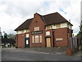
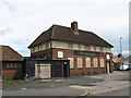
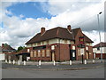
Residents of B23 5GR enjoy immediate access to five notable retail outlets within practical reach. Your daily shopping list is covered by stores like Morrisons Daily, which is close enough for fresh produce, alongside Tesco Boldmere and Aldi New for bulk groceries. For travelling further, you have five railway stations nearby including Wylde Green, Chester Road, and Erdington Railway Station. These links connect you directly to Birmingham city centre and other suburbs without needing a car. The area also sits near major bus routes such as St Paul's and St Chads, offering surface transport alternatives. Leisure options extend outward with metro connections to Bull Street hub. This mix of local shops and major transport nodes means you rarely need to drive for basic needs. The Erdington High Street shopping district acts as a commercial anchor a short distance away. You can walk to your local grocery or drive quickly to Chester Road for larger department stores. The presence of these five stations ensures that commuting into the city works well even if you live in this smaller postcode zone. Your lifestyle balances the quiet of a house in B23 5GR with the convenience of city-wide transport.
Amenities
Schools
| Rank | School | Type | Entry gender | Ages |
|---|
Explore more schools in this area
Go to Schools tabDemographics
The community within this postcode reflects a mature population with a median age of 47 years. Most residents fall into the adult bracket between 30 and 64 years of age, indicating a neighbourhood without a significant young adult or elderly skew. This age profile suggests a stable, established living environment rather than a dynamic, transient student zone. House ownership stands at 62%, meaning the majority of people in this small cluster own their homes outright or with a mortgage. The remaining 38% likely rent their properties. All recorded residents live in houses, confirming that this specific postcode area does not contain any flats or apartments. The predominant ethnic group is White, which characterises the cultural makeup of this particular section of Erdington. You are looking at a traditional, owner-occupied street layout where neighbours have likely lived there for decades. The low population density of 1,385 people spreads across this strong home ownership rate creates a quiet, family-focused atmosphere. There are no large housing blocks or high-density blocks in this specific designation. You find yourself in an area typical for Erdington households who value space and stability.
Household Size
Accommodation Type
Tenure
Ethnic Group
Religion
Household Composition
Age
Household Deprivation
NS-SEC
Explore more demographic insights in this area
Go to Demographics tabPlanning
Planning Constraints
- Flood RiskPremium
- Ramsar Wetland SitesPremium
- Area of Outstanding Natural BeautyPremium
- Protected Nature ReservePremium
- Protected WoodlandPremium
- Crime RiskPremium