Area Overview for B23 3DS
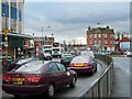
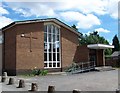
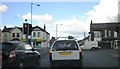
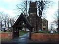
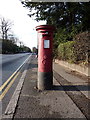
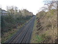
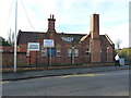
Photos of B23 3DS

Area Information
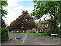
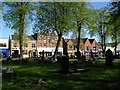
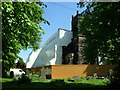
Living in B23 3DS means being part of a small, tightly knit residential cluster in Erdington, a suburb of Birmingham. With a population of 1820, the area retains a village-like character despite its proximity to the city. Historically rooted near the River Tame, Erdington evolved from a medieval settlement into a bustling Birmingham suburb, marked by its High Street retail district and historic landmarks such as St Barnabas Church. The postcode area is defined by its compact size and mix of traditional and modern housing, with a median age of 47 reflecting a community of established residents. Daily life here balances suburban tranquillity with easy access to Birmingham’s infrastructure, including rail and metro links. The area’s appeal lies in its blend of historical depth, practical amenities, and a sense of continuity, making it a viable option for those seeking a quieter alternative to the city’s core.
- Area Type
- Postcode
- Area Size
- Not available
- Population
- 1820
- Population Density
- 4444 people/km²
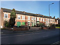
The property market in B23 3DS is characterised by a low home ownership rate of 25%, indicating that the majority of residents rent rather than own their homes. This suggests a rental market dominated by landlords or private tenants, with limited opportunities for first-time buyers in a small area. The accommodation type is primarily houses, which is atypical for a postcode of this scale, potentially reflecting older, larger properties or suburban-style housing. For buyers, this means competition for a limited stock of homes, with fewer new developments likely to arise. The small cluster of properties also implies that the immediate surroundings may offer more options, though proximity to Birmingham’s urban sprawl could influence property values. Buyers should consider the area’s compact size and the potential for higher demand among renters, which may affect long-term investment viability.
House Prices in B23 3DS
No properties found in this postcode.
Energy Efficiency in B23 3DS
Residents of B23 3DS enjoy a mix of retail, transport, and green spaces within easy reach. The area’s five retail outlets, including Heron Erdington and Co-op High, provide access to groceries, clothing, and general goods. Nearby parks and open spaces, such as Rookery Park (former district offices) and Brookvale Park Lake (a former reservoir), offer recreational opportunities, though specific details on park amenities are limited. The presence of rail and metro stations, including Erdington Railway Station and St Chads, ensures convenient access to Birmingham’s transport network. While the area lacks detailed information on dining or leisure venues, the proximity to Birmingham’s urban core suggests that residents can easily access a wider range of services. The blend of practical amenities and historical landmarks contributes to a lifestyle that balances convenience with a sense of place.
Amenities
Schools
Residents of B23 3DS have access to a range of educational institutions, including Osborne Nursery School and Osborne Primary School, both of which serve younger children. Osborne Primary School holds a ‘good’ Ofsted rating, while the nearby independent schools Highclare School and Imedia School offer alternative options. Imedia School, in particular, is rated ‘outstanding’ by Ofsted, making it a strong choice for families seeking high-quality independent education. The mix of state and independent schools provides flexibility, whether parents prioritise affordability or academic excellence. For nursery education, Osborne Nursery School caters to the youngest residents. However, the absence of secondary schools within the postcode means families may need to look further afield, though the proximity to Birmingham’s broader network of schools could mitigate this.
| Rank | School | Type | Entry gender | Ages |
|---|
Explore more schools in this area
Go to Schools tabDemographics
The population of B23 3DS is predominantly adults aged 30–64, with a median age of 47. This suggests a mature, stable community with fewer young families or retirees compared to other areas. Home ownership is relatively low at 25%, indicating a higher proportion of renters, possibly due to the area’s small size and limited housing stock. The accommodation type is primarily houses, which is unusual for urban areas, hinting at a mix of older properties and suburban layouts. The predominant ethnic group is White, with no data provided on other demographics. While specific deprivation metrics are absent, the low home ownership rate may imply economic diversity, with some residents relying on rental income or other financial structures. The age profile and housing stock suggest a community focused on long-term stability rather than rapid growth or change.
Household Size
Accommodation Type
Tenure
Ethnic Group
Religion
Household Composition
Age
Household Deprivation
NS-SEC
Explore more demographic insights in this area
Go to Demographics tabPlanning
Planning Constraints
- Flood RiskPremium
- Ramsar Wetland SitesPremium
- Area of Outstanding Natural BeautyPremium
- Protected Nature ReservePremium
- Protected WoodlandPremium