Area Overview for B22 1AB
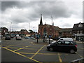
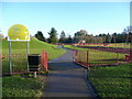
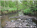
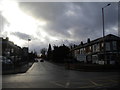
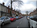
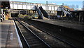
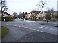
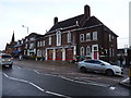
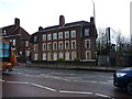
Photos of B22 1AB


Area Information
Living in B22 1AB means being part of a small, tightly knit residential cluster in Birmingham’s southern suburbs. With a population of 1,432, the area is compact yet strategically positioned near historical and modern transport routes, including the Worcester and Birmingham Canal and 19th-century railway lines. The community is predominantly composed of adults aged 30–64, reflecting a mature demographic with a strong focus on home ownership—69% of residents live in their own homes. This area, once part of Worcestershire, now sits within Birmingham’s urban fabric, blending historical roots with suburban convenience. Daily life is shaped by proximity to schools, rail stations, and retail hubs, while the absence of major environmental constraints like protected woodlands or AONBs ensures development flexibility. For those seeking a balance between residential tranquillity and urban accessibility, B22 1AB offers a distinct blend of local character and practical connectivity.
- Area Type
- Postcode
- Area Size
- Not available
- Population
- 1432
- Population Density
- 1434 people/km²
The property market in B22 1AB is characterised by a strong emphasis on owner-occupation, with 69% of homes owned by residents. The area is predominantly composed of houses, which contrasts with regions where flats or apartments dominate. This suggests a market suited to families or individuals seeking more space and privacy. Given the small size of the postcode area, the housing stock is likely limited, making properties in B22 1AB potentially scarce. Buyers should consider the proximity to amenities such as schools, rail stations, and retail hubs, which enhance the area’s appeal. The absence of major planning constraints like protected woodlands or AONBs also means development is less restricted, though the high crime risk—despite the otherwise low environmental risks—may influence property values and desirability.
House Prices in B22 1AB
No properties found in this postcode.
Energy Efficiency in B22 1AB
The lifestyle in B22 1AB is shaped by its proximity to a variety of amenities. Retail options include multiple Co-op stores and Heron Bournville, providing access to groceries and daily necessities. The area’s rail stations and metro stops—such as Edgbaston Village and Town Hall—offer convenient links to Birmingham’s cultural and commercial centres. While the data does not explicitly mention parks or leisure facilities, the historical presence of the Worcester and Birmingham Canal suggests potential for recreational activities. The combination of retail, transport, and historical infrastructure creates a practical, accessible lifestyle, though the lack of detailed information on green spaces or leisure options means residents may need to look further afield for such amenities.
Amenities
Schools
Residents of B22 1AB have access to a range of educational institutions, including Kings Norton Junior and Infant School, which operates as both a primary school and an academy, and Cadbury Sixth Form College, which specialises in post-16 education. The presence of a primary school and a sixth-form college within close proximity suggests a well-rounded educational ecosystem for families. However, the data does not provide Ofsted ratings or specific performance metrics for these schools. The mix of school types indicates that the area caters to both younger children and students preparing for higher education, though prospective families should conduct further research into individual school performance and catchment areas.
| Rank | School | Type | Entry gender | Ages |
|---|---|---|---|---|
| 1 | Kings Norton Junior and Infant School | primary | N/A | N/A |
| 2 | Cadbury Sixth Form College | sixth-form | N/A | N/A |
| 3 | Kings Norton Junior and Infant School | academy | N/A | N/A |
Explore more schools in this area
Go to Schools tabDemographics
The population of B22 1AB is 1,432, with a median age of 47, indicating a community skewed toward middle-aged adults. The most common age range is 30–64, suggesting a stable, established population. Home ownership is high at 69%, with houses being the predominant accommodation type. The ethnic composition is largely White, reflecting the area’s historical and demographic profile. This demographic profile implies a community focused on long-term residency rather than transient populations. The absence of specific data on deprivation or diversity metrics means the area’s social dynamics are not explicitly detailed, but the high home ownership rate and mature age profile suggest a relatively stable quality of life.
Household Size
Accommodation Type
Tenure
Ethnic Group
Religion
Household Composition
Age
Household Deprivation
NS-SEC
Explore more demographic insights in this area
Go to Demographics tabPlanning
Planning Constraints
- Flood RiskPremium
- Ramsar Wetland SitesPremium
- Area of Outstanding Natural BeautyPremium
- Protected Nature ReservePremium
- Protected WoodlandPremium
- Crime RiskPremium