Area Overview for B21 9SY
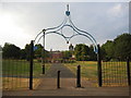
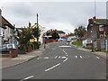
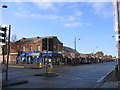
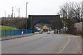
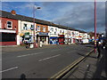
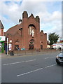
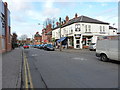
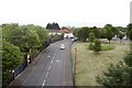
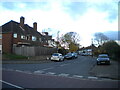
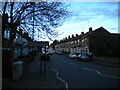
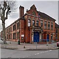
Photos of B21 9SY

Area Information
Living in B21 9SY means being part of a small, tightly knit residential cluster in England, home to 2,067 people. This postcode area sits within the broader historical and economic heart of Birmingham’s Jewellery Quarter, a district renowned for its 18th-century industrial heritage and modern revival as a hub for craftsmanship. The area’s compact size fosters a close-knit community, with residents often connected to the historic streets and landmarks nearby. Daily life here is shaped by proximity to both traditional and contemporary amenities, from local retail to transport links. The postcode’s small footprint means it is well-served by nearby schools, such as Benson Community School and Oasis Academy Benson, which cater to a range of educational needs. While the area is residential, it is also within reach of the Jewellery Quarter’s cultural and economic vibrancy, offering a blend of heritage and modern convenience. For those seeking a quieter, community-focused environment with easy access to urban resources, B21 9SY provides a distinct balance of scale and connectivity.
- Area Type
- Postcode
- Area Size
- Not available
- Population
- 2067
- Population Density
- 7756 people/km²
The property market in B21 9SY is characterised by a 31% home ownership rate, which is notably lower than the national average, suggesting a rental-dominated market. The primary accommodation type is houses, which is uncommon in urban settings and may indicate a mix of older, standalone properties or semi-detached homes. This configuration implies limited availability of flats or apartments, which could be a consideration for buyers seeking more compact or modern housing. The low home ownership rate may also reflect the area’s appeal to renters, possibly due to affordability or the presence of long-term tenants. For buyers, the small size of the postcode and its focus on houses could mean competition for available properties, particularly if demand outstrips supply. The market’s dynamics may also be influenced by the area’s proximity to the Jewellery Quarter, which could offer lifestyle benefits offsetting any limitations in housing stock.
House Prices in B21 9SY
No properties found in this postcode.
Energy Efficiency in B21 9SY
The lifestyle in B21 9SY is shaped by its proximity to a range of amenities, including five retail outlets such as Iceland Handsworth, Lidl Handsworth, and Farmfoods Handsworth, which provide everyday shopping needs. The area’s transport links, including five metro stations and rail services, offer easy access to Birmingham’s cultural and commercial hubs. While the postcode itself is small, its location near the Jewellery Quarter means residents can engage with historic sites like St. Paul’s Church and the Museum of the Jewellery Quarter. The mix of retail, transport, and nearby heritage sites creates a convenient yet characterful environment, blending practicality with the area’s industrial legacy. This balance of accessibility and historical context contributes to a lifestyle that is both functional and rooted in local tradition.
Amenities
Schools
Residents of B21 9SY have access to two schools within practical reach: Benson Community School, a primary school, and Oasis Academy Benson, an academy. These institutions cater to different educational stages, providing families with options from early years through to secondary education. The presence of a primary school ensures immediate access to early education, while the academy offers a broader curriculum and potentially specialist facilities. However, the data does not specify Ofsted ratings or academic performance, so prospective families may need to conduct further research into the quality of education. The mix of school types reflects a balance between traditional and alternative educational models, which could appeal to parents seeking either established or innovative approaches to schooling.
| Rank | School | Type | Entry gender | Ages |
|---|
Explore more schools in this area
Go to Schools tabDemographics
The population of B21 9SY is 2,067, with a median age of 47 and the majority of residents falling within the 30–64 age range. This suggests a mature, established community with a focus on stability and family life. Home ownership in the area stands at 31%, indicating a significant proportion of residents rent their homes. The primary accommodation type is houses, which is unusual for urban areas and may reflect the postcode’s suburban or semi-rural character. The predominant ethnic group is Asian, highlighting the area’s cultural diversity. While specific deprivation data is not provided, the demographic profile implies a population that may value community ties and long-term residency. The age range and home ownership rate suggest a mix of middle-aged professionals and families, with limited data on younger or older residents.
Household Size
Accommodation Type
Tenure
Ethnic Group
Religion
Household Composition
Age
Household Deprivation
NS-SEC
Explore more demographic insights in this area
Go to Demographics tabPlanning
Planning Constraints
- Flood RiskPremium
- Ramsar Wetland SitesPremium
- Area of Outstanding Natural BeautyPremium
- Protected Nature ReservePremium
- Protected WoodlandPremium