Area Overview for B21 9RB
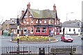
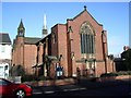
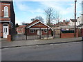
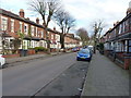
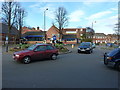
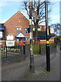
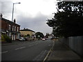
Photos of B21 9RB
Area Information
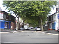
Living in B21 9RB means inhabiting a small, defined postcode area within Handsworth, a historically industrial suburb of Birmingham. With a population of 2,009, this area reflects a blend of rural heritage and urban development. Originally part of Staffordshire, Handsworth was absorbed into Birmingham in 1911, evolving from a farming village into a hub of industry during the 18th century. Today, it is a residential cluster with a median age of 47, suggesting a community of middle-aged and older residents. The area’s character is shaped by its industrial past, including the Soho Manufactory founded by Matthew Boulton, and its post-war demographic shifts, which established it as a centre for the Afro-Caribbean community. Despite its compact size, B21 9RB offers proximity to Birmingham’s city centre, just 2 kilometres south, and is served by multiple transport links. Its mix of historic landmarks, like Handsworth Park and St Mary’s Church, alongside modern amenities, creates a distinct identity for those seeking a balance between heritage and convenience.
- Area Type
- Postcode
- Area Size
- Not available
- Population
- 2009
- Population Density
- 8893 people/km²
B21 9RB’s property market is characterised by a 41% home ownership rate, indicating that more than half of properties are rented rather than owned. The predominant accommodation type is houses, which is unusual for a small postcode area but may reflect the presence of larger, older homes from the region’s industrial era. This suggests a market skewed towards rental properties, potentially appealing to investors or tenants seeking family homes. The limited size of the area means housing stock is constrained, and buyers should consider proximity to surrounding districts for more options. The focus on houses rather than flats may cater to those prioritising space, though the lower home ownership rate implies competition for available properties. For buyers, this area offers a niche opportunity within Birmingham’s broader housing landscape, though its small scale means demand could outstrip supply.
House Prices in B21 9RB
No properties found in this postcode.
Energy Efficiency in B21 9RB
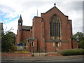
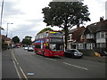
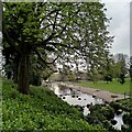
The lifestyle in B21 9RB is shaped by its proximity to retail, transport, and green spaces. Within practical reach are five retail venues, including Tesco Handsworth and Iceland Handsworth, offering everyday shopping needs. The area’s transport network includes five metro stops, such as Winson Green Outer Circle, and five rail stations, including Perry Barr, facilitating easy travel. Nearby, Handsworth Park—once Victoria Park—provides a significant green space for recreation, with historical features like a cricket ground and former estate gardens. The presence of St Mary’s Church and Soho House, now a museum, adds cultural and historical depth. While the area lacks detailed information on dining or leisure venues, the availability of shops, transport, and parks suggests a functional, community-oriented lifestyle. The blend of greenery and practical amenities supports both relaxation and daily convenience.
Amenities
Schools
Residents of B21 9RB have access to two primary schools: Wilkes Green Infant School (NC) and William Murdoch Primary School, the latter of which holds an Ofsted rating of ‘good’. These institutions provide early education options for families, with William Murdoch’s rating indicating a satisfactory standard of teaching and facilities. The presence of two primary schools within the area suggests a focus on local education, though no secondary schools are listed in the data. For families prioritising primary education, the availability of these schools reduces the need for long commutes. The absence of further educational institutions, however, may necessitate travel for secondary schooling. The mix of schools reflects a basic but functional provision for young children, aligning with the area’s role as a residential rather than academic hub.
| Rank | School | Type | Entry gender | Ages |
|---|
Explore more schools in this area
Go to Schools tabDemographics
The population of B21 9RB is 2,009, with a median age of 47 and the majority of residents falling within the 30–64 age range. Home ownership stands at 41%, indicating a rental-dominated market where fewer than half of properties are owner-occupied. The primary accommodation type is houses, which is notable given the area’s compact size. The predominant ethnic group is the Asian community, reflecting broader demographic trends in Handsworth. This age profile suggests a stable, mature population with established ties to the area. The lower home ownership rate may imply a higher proportion of younger residents or those in rental properties, though specific data on household types is not provided. The absence of detailed deprivation metrics means quality of life factors such as access to services and employment opportunities remain unquantified, but the presence of schools, transport links, and amenities suggests a functional community.
Household Size
Accommodation Type
Tenure
Ethnic Group
Religion
Household Composition
Age
Household Deprivation
NS-SEC
Explore more demographic insights in this area
Go to Demographics tabPlanning
Planning Constraints
- Flood RiskPremium
- Ramsar Wetland SitesPremium
- Area of Outstanding Natural BeautyPremium
- Protected Nature ReservePremium
- Protected WoodlandPremium
- Crime RiskPremium