Area Overview for B21 9PJ
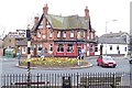
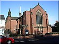
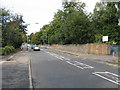
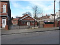
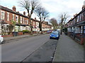
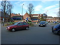
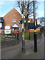
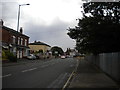
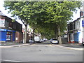
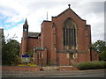
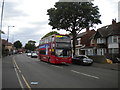
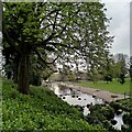
Photos of B21 9PJ
Area Information
Living in B21 9PJ means inhabiting a small, tightly knit residential cluster within Handsworth, a historically significant suburb of Birmingham. With a population of 1,780, this area is modest in size but rich in layered history, from its Saxon origins to its role in the Industrial Revolution. Situated 2 kilometres north of Birmingham’s city centre, it balances suburban tranquillity with proximity to urban amenities. The community reflects a blend of rural heritage and post-war demographic shifts, notably shaped by Caribbean immigration in the mid-20th century. Daily life here is grounded in local institutions like Rookery School and the historic Handsworth Park, which has hosted events from flower shows to Scout jamborees. The area’s compact nature means residents are close to retail hubs, public transport, and green spaces, though its small size also means the housing stock is limited to a few hundred properties. For those seeking a mix of history, convenience, and community, B21 9PJ offers a distinct slice of West Midlands living.
- Area Type
- Postcode
- Area Size
- Not available
- Population
- 1780
- Population Density
- 9398 people/km²
The property market in B21 9PJ is defined by its small scale and focus on owner-occupied homes. With 44% of properties owned by residents, the area leans more towards private ownership than rental activity, though the limited housing stock means opportunities for buyers are constrained. The predominance of houses over flats indicates a suburban character, with properties likely offering more space than the city centre’s high-density developments. Given the area’s size, buyers should consider the immediate surroundings for additional options. The compact nature of B21 9PJ means properties may be more competitive, with prices influenced by proximity to amenities like Handsworth Park and transport links. For those seeking a home with a balance of space and community, the area’s mix of historical charm and modern convenience could be appealing, though the small footprint means thorough local research is essential.
House Prices in B21 9PJ
No properties found in this postcode.
Energy Efficiency in B21 9PJ
Daily life in B21 9PJ is enriched by nearby amenities that cater to practical needs and leisure. Retail options include major chains like Tesco Handsworth, Farmfoods, and Iceland, ensuring easy access to groceries and everyday essentials. The area’s metro and rail stations, such as Handsworth Booth Street and Perry Barr, connect residents to wider Birmingham, while local parks like Handsworth Park offer green space for recreation. The park’s history as a former Victorian garden and its role in hosting events add cultural value. For dining and shopping, the proximity to retail hubs complements the area’s suburban character. The mix of convenience and historical sites, such as St Mary’s Church and Soho House, creates a lifestyle that balances modern practicality with heritage.
Amenities
Schools
Residents of B21 9PJ have access to a range of primary schools, including Rookery Junior School, Rookery Infant School, and Rookery School & Children’s Centre. These institutions provide early education and support services for local families. A notable addition is Rookery School, an academy with an Ofsted rating of ‘good’, offering a structured educational environment. The presence of multiple primary schools within walking distance ensures options for parents, while the academy’s rating suggests a focus on academic standards. The clustering of schools reflects the area’s emphasis on education, though secondary school options would require commuting to nearby Birmingham districts. For families prioritising school proximity and quality, B21 9PJ’s educational infrastructure is a key consideration.
| Rank | School | Type | Entry gender | Ages |
|---|
Explore more schools in this area
Go to Schools tabDemographics
B21 9PJ’s population of 1,780 is predominantly composed of adults aged 30–64, with a median age of 47. This suggests a mature, established community, likely with strong ties to local institutions and a focus on stability. Home ownership stands at 44%, indicating a mix of owner-occupied and rental properties. The area is characterised by houses rather than flats, reflecting a suburban rather than high-density residential profile. The predominant ethnic group is Asian, a legacy of post-war migration patterns that shaped Handsworth’s cultural landscape. While specific deprivation data is not provided, the age profile and home ownership rate imply a community with a balance of long-term residents and newer arrivals. The presence of schools like Rookery School & Children’s Centre and the proximity to Birmingham’s industrial heritage suggest a blend of practicality and historical continuity in daily life.
Household Size
Accommodation Type
Tenure
Ethnic Group
Religion
Household Composition
Age
Household Deprivation
NS-SEC
Explore more demographic insights in this area
Go to Demographics tabPlanning
Planning Constraints
- Flood RiskPremium
- Ramsar Wetland SitesPremium
- Area of Outstanding Natural BeautyPremium
- Protected Nature ReservePremium
- Protected WoodlandPremium